Stuck In A Cool Pattern

A high-ampltude jet stream is bringing unseasonable weather to much of Canada.

A high amplitude jet stream is bringing unseasonable weather to much of Canada.

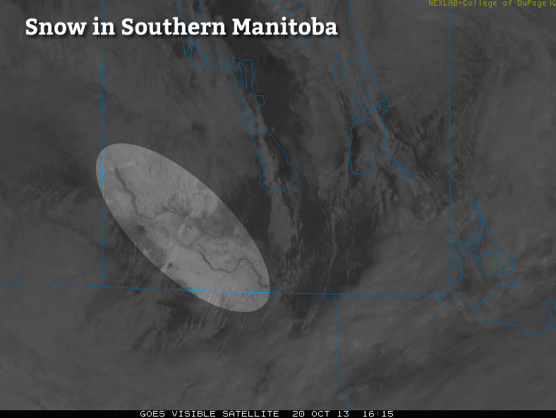
Temperatures will remain fairly cool through the next few days as Southern Manitoba remains entrenched in a pattern that has the jet stream diving through Saskatchewan well to our south, trapping cooler air over the area. In addition, snow will enter the picture as snow squalls batter areas in the lee of the lakes – in particular Lake Winnipeg – and a weak disturbance slides down from the North and brings flurry activity to many regions tonight.

Today

Wednesday

3°C
Mainly cloudy. Chance of flurries in the afternoon.

Through much of the Red River Valley today we’ll see mainly cloudy skies – perhaps with a sunny break or two – with the weather pattern being dominated by snow squalls coming off the lakes. While some squall activity is expected off of Lake Manitoba, with a band of snow extending SSE from the lake positioned between Portage la Prairie and Elie. More vigorous activity is expected off of Lake Winnipeg, where cooler air aloft will combine with favourable winds which will bring air not just over the South Basin, but over the North Basin as well. The cooler air aloft coupled with the air being over water for longer will combine to produce vigorous convection that will push SSE off the lake into areas around Beausejour and east.

The snow has the potential to be very heavy, producing near-whiteout conditions and rapid snowfall accumulation. Fortunately it will be confined to a fairly narrow corridor in the lee of the lake, but if you are expecting to travel east towards the Whiteshell today, you should be prepared for potentially encountering treacherous winter driving conditions.

Wednesday Night

-2°C
Light snow beginning in the evening.

Embedded above these local features will be a weak frontal wave sliding southwards along the baroclinic zone that is dividing the Prairies. This weak wave will bring light snow activity to the Interlake through the daytime today, pushing southwards and entering the northern Red River Valley by late in the afternoon or early evening hours. This light snow will push all the way south to the US border through the evening and persist through much of the night. No significant accumulation is expected from this system, although if it ends up intense enough then its possible some areas may awake to a cm or two on Thursday morning.

High temperatures will be around 2–3°C today throughout the Red River Valley while the ample cloud cover and light snow will limit our overnight lows to just around –2°C.

Thursday & Friday

Thursday

4°C / -4°C
A mix of sun and cloud; chance of flurries in the morning.
Friday

7°C / 0°C
Sunny becoming a mix of sun and clouds. Chance of showers.

Thursday will bring a mix of sun and cloud as the cloud from the overnight snow clears out but ample low cloud continues to flow off the lakes. There will be a chance of flurries in the morning as the overnight disturbance leaves the province, but little is expected otherwise. Some light snow may fall out of any clouds that wander through Winnipeg in the afternoon, but it would likely be exceptionally light if that were to happen.

Overall it will be a relatively nice, albeit cool, day. We’ll drop down to around –4°C under partly cloudy skies on Thursday night.

Friday will start with relatively clear skies but we’ll see things become more mixed as the day progresses. A significant low pressure system will be pushing through Northern Manitoba into NW Ontario dragging warm air with it across the Prairies; we’ll see southwesterly winds of 20–30km/h bring warmer air into the region as we head to a seasonal high of 7°C. There will be a chance of showers here in Winnipeg, although we look to be on the periphery of the system with the bulk of the precipitation falling through the Interlake into Southeast Manitoba. Friday night will bring partly cloudy skies and a low of about 0°C.

A Chill in the Air

There will be a noticeable chill in the air this week as we begin to see hints of the season to come.

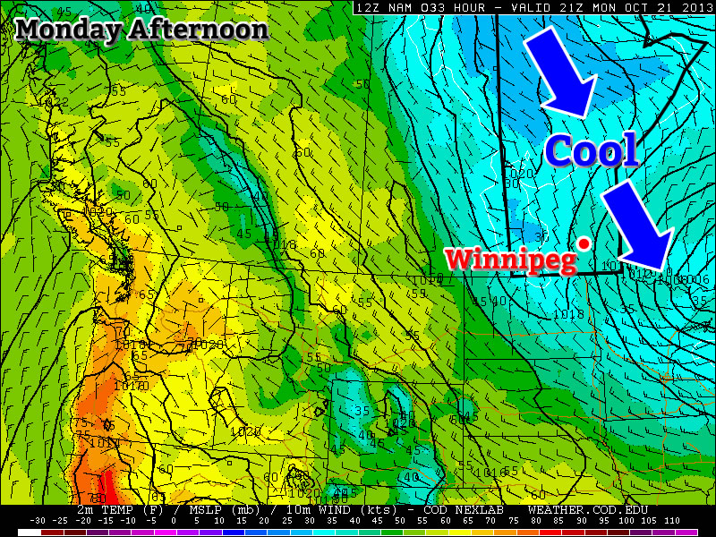
Cool temperatures are expected in Southern Manitoba on Monday

Cool temperatures are expected in Southern Manitoba on Monday.

Monday

Monday

Mainly cloudy. Chance of Flurries.
2°C / -4°C

Today will be one of the coolest days we’ve seen in quite some time. High temperatures will be in the low single digits with a north-westerly wind. We may also see some scattered flurries during the day. These flurries are not expected to amount to anything, but that probably won’t make their presence any more welcome! On the whole it won’t be a very pleasant start to the week.

Tuesday and Wednesday

Tuesday

Mix of Sun and Cloud. Slight Chance of Flurries.
3°C / -4°C
Wednesday

Mainly cloudy. Chance of Flurries.
4°C / -6°C

Tuesday and Wednesday will be very similar days. High temperatures will be in the low to mid single digits with the wind once again being from the north-west. There may also be some scattered showers or flurries, but accumulations will be minimal. Hopefully above-zero temperatures and a lack of additional snow will allow for the weekend’s snowfall over south-western Manitoba to melt.

Snow on the Weekend

Snow fell in Southern Manitoba over the Weekend

Snow fell in Southern Manitoba over the Weekend

A bit of snow fell this past weekend in parts of southern Manitoba. In particular, south-western sections of the province received 2-5cm of snow, with Oak Lake reportedly getting 7.5cm. There was also snow south of the border in parts of North Dakota. Accumulations down there were very similar to those seen in Manitoba, with amounts of 2-5cm noted (1-2 inches). Thankfully, there will be no additional accumulating snow in the short-range.

Long Range

The weather through the late week period looks to remain cool. Models currently suggest that temperatures will remain in the single digits. There may be more chances for snow as we move toward the weekend.

Cooler Weather Pushing In

A cold trough pushing into Manitoba will bring showers today and with cold air building over the province, showers may turn to flurries tonight as temperatures drop. The arrival of cooler air will mark a notable regime change which will leave us in a stagnant pattern with slightly below-normal temperatures.

Friday

7°C / -2°C
Becoming mainly cloudy; showers in the afternoon.
Saturday

5°C / -2°C
A mix of sun and cloud; becoming cloudy in the evening.
Sunday

2°C / -4°C
Mostly cloudy; scattered flurries.

Today will bring increasing cloud this morning which will give way to afternoon showers as a trough slumps through Southern Manitoba. The chance for showers will be very high through Winnipeg & the northern Red River Valley, but through the southern half of the Red River Valley it seems like the showers will be more scattered in nature. Our daytime high of around 7°C will be a couple degrees below our seasonal average of 9°C, and it’s only going to go downhill from there.

Areas that may see lake-effect showers or flurries on Friday night.

Areas that may see lake-effect showers or flurries on Friday night.

We’ll see the showers die off through the evening hours, but it won’t be the end of things; as temperaturs drop in the evening, lake effect showers or flurries will develop in the lee of Lake Winnipeg and Lake Manitoba. Here in Winnipeg it seems like we’ll just see a slight chance of seeing showers or flurries overnight, however to the west and east of the city it looks quite probable.

For the areas that do see precipitation tonight, it may be the first snowfall of the season. While there won’t be much snow and it likely won’t stick, it would not be surprising at all if there were some white flakes falling from the sky tonight. Most areas will see partly cloudy skies tonight save for those underneath the lake-effect cloud and precipitation. Lows will dip to around –2°C with areas under cloud a little bit warmer.

Saturday will be a cool day with a high around 5°C under a mix of sun and cloud. More cloud will push into the Red River Valley late in the afternoon or in the evening as a system diving southwards through Saskatchewan into SW Manitoba spreads some cloud into the Red River Valley. No precipitation is expected at this point for Saturday. Saturday night will be quite cool under partly cloudy skies and lows near –4 or –5°C.

Sunday will bring more cloud into Winnipeg & the Red River Valley as more cool air and instability builds into the Red River Valley. Temperatures will be even cooler than Saturday with highs of only 2–3°C which will make what’s falling out of those clouds more likely to be of the frozen variety than the liquid. Again, not much accumulation is expected, but it may be the first snowfall of the season for many places.

Looking Ahead

We’ll be into a much cooler pattern through the next week with daytime highs sitting near 4 or 5°C through much of the week. It looks like we’ll see a disturbance mid-week bring a chance of showers for most of Southern Manitoba, but nothing in the way of significant (or measurable) accumulations is on the way.

Return to Cooler Conditions

After a beautiful weekend we’ll unfortunately slip back into well below normal weather this week. This cooler weather will be triggered by the passage of a weather system on Monday.

image

A weather system will bring rain to Southern Manitoba on Monday

Today

image
Increasing clouds. Periods of rain in the afternoon-overnight.
12°C / 6°C

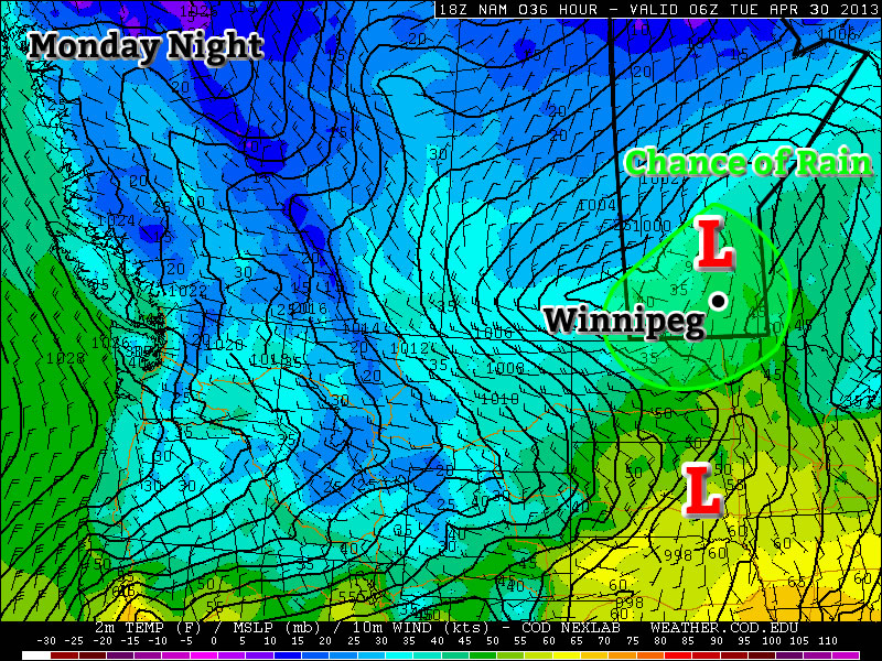
Today will be a fairly normal late April day. Temperatures will be in the low teens with a breezy south wind. Cloud cover will increase during the day, with there being a chance of rain beginning in the afternoon and lasting into the overnight period. This rain will be generated by a fairly strong, complex low pressure system moving through Southern Manitoba and North Dakota today. It is quite difficult to figure out what accumulations might be as the rain may end up quite showery & localized, but my guess would be around 10mm in general with locally higher amounts. The first shot of precipitation will push through in the afternoon as low-level jet over-running a weak warm front slides across the province. This precipitation will be convective in nature, meaning rainfall amounts could be fairly significant (10-20mm) in a short period of time and relatively localized. Those showers will clear out in the evening before a second batch of precipitation arrives with the main low center late overnight. Here in the Red River Valley, that means that we’ll likely see some more shower activity overnight.

Tuesday and Wednesday

Tuesday
image
Chance of Flurries.
6°C / -2°C
Wednesday
image
Mix of sun and cloud
3°C / -3°C

A cold front will swing through tonight, ushering in cooler temperatures for Tuesday. The showers tonight may transition into some flurries on Tuesday morning as this cooler air moves in. Fortunately, these flurries won’t amount to anything, but they will signal a shift back into unpleasant, below-normal conditions. On Tuesday we’ll only see high temperatures in the low single digits with similarly cool values on Wednesday.

Long Range

In the long range there is no sign of a shift towards a more consistently above normal pattern. It looks like we’ll see near normal conditions return around the weekend, with some days being a bit below normal, with others are slightly above normal. There is also no sign of significant precipitation in the long range, which is a good for the flood situation.