Warm Week Ahead For Winnipeg To Bring A Wintery Mix

Early-season winter warmth will continue in Winnipeg, bringing pleasant conditions along with a mid-week wintery mix.

RDPS 2m Temperature Forecast valid 21Z Tuesday November 30, 2021
More early-winter warmth will spread across the southern Prairies this week.

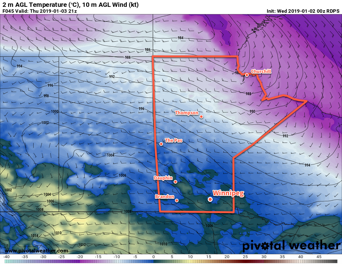
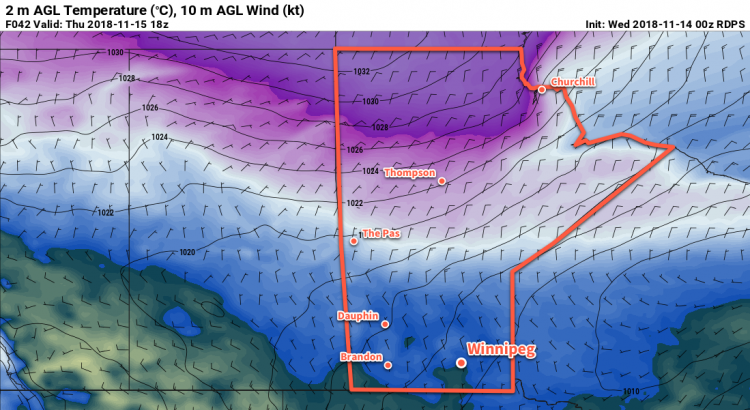
A series of low pressure systems will cross the Prairies this week, spreading more mild air into the region. As a result, Winnipeg will continue to see seasonably warm this week. Daytime highs will sit in the -5 to 0 °C range, but Wednesday will bring temperatures above zero into the low to mid-single digits. Lows will also follow suit, staying several well above the seasonal normals.

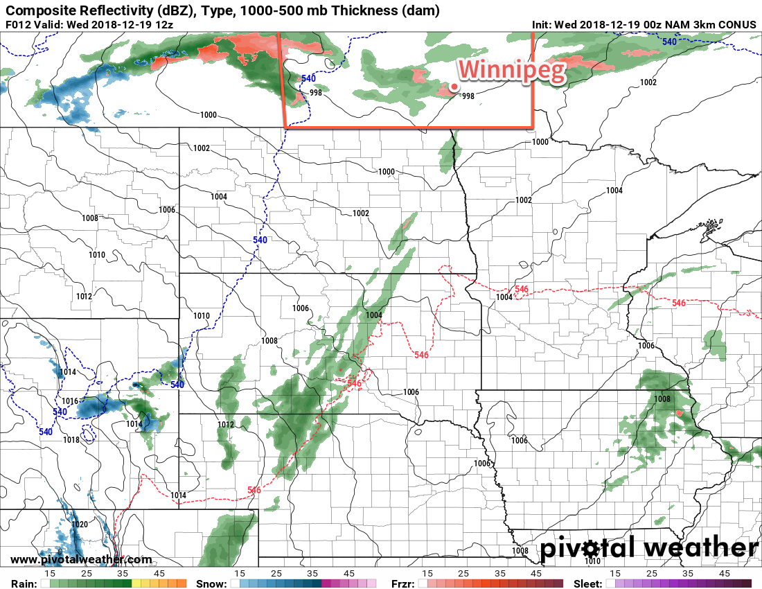
The first low pressure system will begin moving into Alberta later today, pushing a warm front eastwards into southern Manitoba. This will spread an area of light snow into western Manitoba this afternoon that will move into the Red River Valley this evening. This system will produce a couple centimetres of snow as it moves through the region.

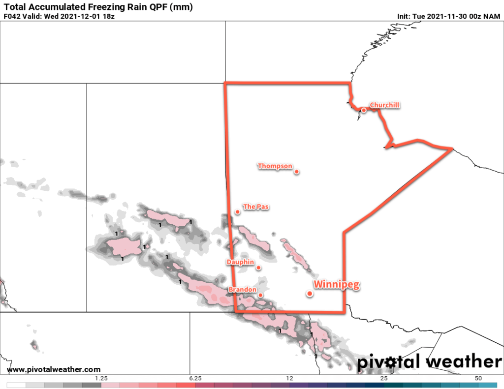
Alongside this, though, will come another risk of freezing rain. The risk will begin Tuesday afternoon in western and southwestern Manitoba. It will then spread into the Red River Valley overnight into Wednesday morning. The greatest threat for ice accumulation is over southwestern Manitoba, but slippery conditions will be possible throughout the risk area.

NAM Total Accumulated Freezing Rain Forecast valid 18Z Wednesday December 1, 2021
Although forecast models are outlining two areas of freezing rain on Tuesday/Wednesday, the risk will extend across much of southern and southwestern Manitoba.

Sunshine will be a relatively rare commodity over the coming week. Today will start off with plenty of sun, but once the cloud arrives later in the day, it’ll stick around through Thursday. A few sunny breaks are possible then, but no widespread clearing trend is likely until the end of the week.

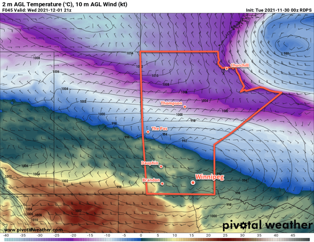
Winds will be variable through the first half of the week, but a cold front passing through the region on Wednesday evening will usher in northwesterly winds near 40 km/h that should ease to light by Thursday morning.

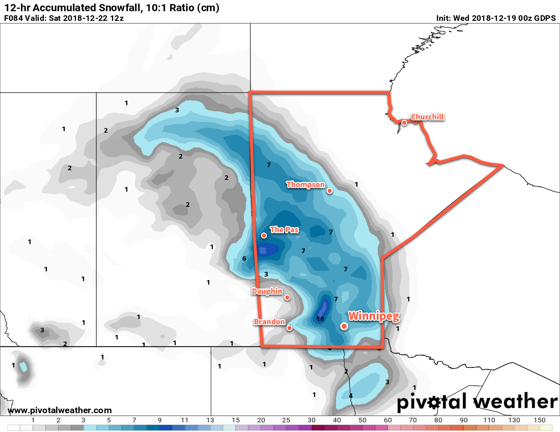
A few more flurries will be possible Thursday night into Friday as another low pressure system crosses the province.

Long Range Outlook

Cooler air will filter into the region this weekend and send daytime highs into the -5 to -10 °C range. This shift in temperatures is forecast to persist into next week with near-seasonal overnight lows. Some more light snow is possible Saturday evening into Sunday, then again on Monday night.

Today’s seasonal daytime high in Winnipeg is -6 °C while the seasonal overnight low is -15 °C.

More Warm Weather On The Way

Temperatures will soar well above seasonal values in Winnipeg as a flood of mild Pacific air washes over the southern Prairies.

A warm front pushing eastwards across the Red River Valley this morning will bring above-seasonal temperatures back to Winnipeg today. To start the day, Winnipeg may see a few flurries as the warm front pushes into the region. Once the front leaves, Winnipeg will see mixed skies with light southerly winds. Temperatures will climb to around -10°C by lunch and then inch towards a high of -8°C in the afternoon. Skies will cloud back over tonight as another warm front pushes into the region. This front will bring a chance of some light snow – and a risk of freezing rain – to the region late overnight into early Thursday morning. Temperatures will continue to rise overnight to around -2°C by morning.

Thursday will bring mainly cloudy skies to Winnipeg and the Red River Valley as a mild Pacific air mass spreads over the region. Temperatures will continue to climb to a high near 0°C with southwesterly winds of 20 to 30 km/h. Thursday night will bring mixed skies with a low near -5°C.

Temperatures will climb to near- or above-freezing across much of southern Manitoba on Thursday

On Friday, the region should see plenty more cloud as temperatures once again climb to around 0°C. A low pressure system moving through the Interlake will bring southwesterly winds of 20 to 30 km/h to the Red River Valley on Friday afternoon. Winds will shift northwesterly on Friday night as temperatures dip to a low near -5°C.

Long Range Outlook

Temperatures will remain mild this weekend with daytime highs in mid-minus single digits. Sunday and Monday may bring a chance for some light snow as a larger low pressure system develops and moves through the region. Slightly above-seasonal temperatures will continue into the middle of next week with variable cloudiness.

Winnipeg’s seasonal daytime high is currently -13°C while the seasonal overnight low is -23°C.

Weather Turning More Unsettled

After a stretch of relatively benign weather, things will be getting slightly more active in Winnipeg through the remainder of the week.

Kicking off the trend towards unsettled weather, Winnipeg will see a mild but potentially messy day today. The culprit for our weather will be a low pressure system tracking through the Interlake today. It brings with it the chance for light precipitation through much of the day, but what exactly falls from the sky will vary as the day moves on. There will be a slight chance of rain or freezing rain showers, [freezing] drizzle, and/or flurries in Winnipeg today. The overall amounts of precipitation will remain low, but it will be a generally damp day. Temperatures will climb to a high near +1°C with winds picking up to northwest 30 gusting 50 km/h this afternoon. Any leftover flurries will clear out this evening. Winds will ease overnight with a few clear patches developing as temperatures head to a low near -11°C.

Freezing rain is possible over the Red River Valley early this morning.

A ridge of high pressure move over the region on Thursday. Winnipeg will see mixed skies, light winds, rand a high near -6°C. Clouds will thicken up on Thursday night as temperatures head to a low near -10°C.

On Friday, the city will see southerly winds of 30 to 40 km/h develop ahead of an Alberta Clipper tracking across Saskatchewan. Skies will stay cloudy through the day as temperatures head to a high near -5°C. Some light snow will likely push into the Red River Valley in the evening with accumulations near 5 cm possible by Saturday morning. Temperatures will keep steady near -4°C on Friday night as winds slowly ease.

A broad area of snow will develop across Manitoba on Friday night.

Long Range Outlook

Winnipeg may see more snow on Saturday as the clipper system slows, blocked to the east by a major winter storm on the east coast. Temperatures will head back towards seasonal for Christmas with variable cloudiness. One thing to keep an eye on will be a second clipper system that is forecast to track through SE Saskatchewan into North Dakota on Christmas Eve. If its track ends up just a tad further north, then it may impact travel conditions in the Red River Valley for Christmas Eve.

Overall, though, the forecast continues to be relatively pleasant for December.

Winnipeg’s seasonal daytime high is currently -11°C while the seasonal overnight low is -21°C.

Seasonal Temperatures Return to Winnipeg for A Couple Days

Cloudy conditions return to Winnipeg as temperatures finally climb back towards seasonal values for a couple days.

Seasonal temperatures will finally return to Winnipeg today as warmer air spreads eastwards across southern Manitoba. The city will see temperatures climb to a high near 0°C with southerly winds near 30 km/h. Some sunshine may appear through the morning hours, but the cloud cover should thicken up this afternoon. Skies will remain mixed to mostly cloudy overnight with temperatures dipping to a low near -4°C.

Thursday will be a slightly more active day as an upper-level disturbance ripples southeastwards through the province. As it moves into the region in the morning, it will spread light snow with a risk of freezing rain across the Red River Valley. Temperatures will be climbing towards a high near 0°C, so if freezing rain materializes there may be a few hours in the morning where untreated surfaces become quite slippery. The risk for freezing rain should end by lunchtime as cooler air begins pushing in from the north. Light snow will continue through much of the afternoon, then taper off in the evening. This band of precipitation will likely leave behind 2 to 4 cm of snow in its wake.

Where exactly this activity moves through is uncertain, though. Forecast models have been varying the position of the band of snow from Winnipeg to as far south as North Dakota. The general consensus at this point is that most of the precipitation will likely pass south of Winnipeg, closer to the American border. This outcome would leave Winnipeg with just mostly cloudy skies for the day.

A narrow band of snow and/or freezing rain will move through Manitoba on Thursday, likely passing south of Winnipeg either through the southern Red River Valley or across northern North Dakota.

Winds will start off calm in the morning and slowly pick up out of the northwest to around 20 km/h. Expect a mostly cloudy night with a continued chance of flurries and a low near -9°C.

Friday will bring much cooler temperatures back to the region as an Arctic air mass plunges southwards behind Thursday’s system. Winnipeg’s temperature will barely recover, reaching just -6°C. Winds will persist out of the northwest at 20 to 30 km/h and skies will remain mostly cloudy. There will be a continued chance for flurries through the day. Temperatures will head to a cold overnight low near -15°C on Friday night with mixed skies.

Long Range Outlook

Generally dry conditions are forecast through the weekend into the first half of next week, but temperatures will remain well below seasonal values. Some indications are that temperatures may moderate in the middle of next week, but the jury is still out on how believable that optimism may be.

Winnipeg’s seasonal daytime high is currently -1°C while the seasonal overnight low is -9°C.