Warmer weather is on the way for the weekend with temperatures soaring close to the freezing mark, however not before a blustery day that will be rather miserable and may impact transportation throughout the Red River Valley.
Windy Weather Developing
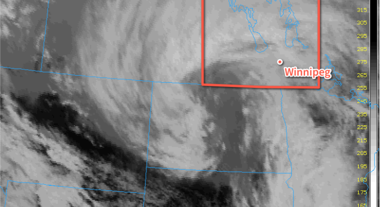
Windy weather is on the way for Winnipeg today courtesy a developing low pressure system pushing eastwards across the Prairies. As this system moves towards Manitoba, a strong pressure gradient will develop over the Red River Valley between the incoming low pressure centre and departing ridge of high pressure. As the gradient strengthens in the afternoon, strong southerly winds will develop throughout the Red River Valley.
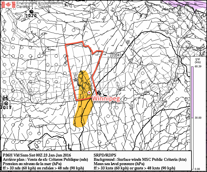
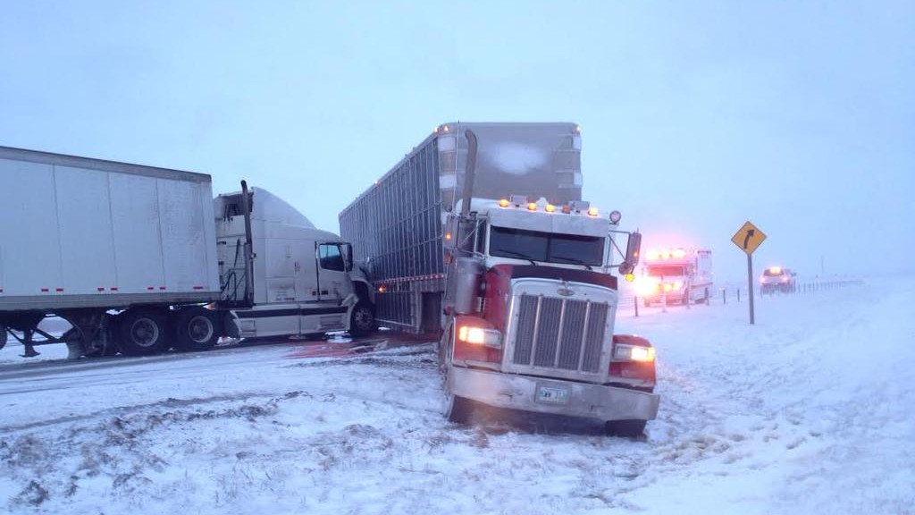
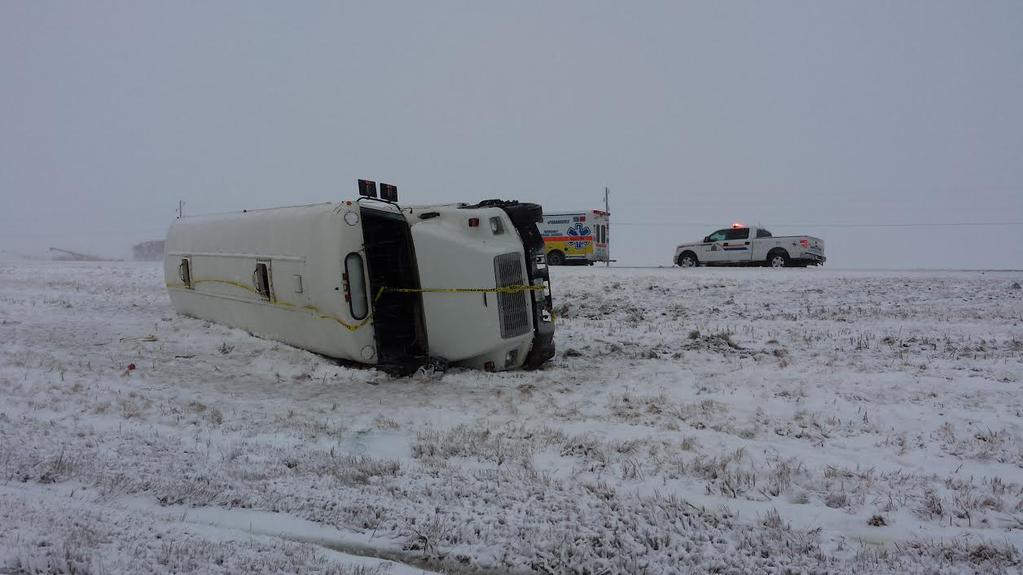
Sustained wind speeds will increase to 40-50 km/h by the early evening. It seems fairly probable given the near-constant light snow and ice crystals that have fallen over the last several days that blowing snow will become a transportation issue for Friday night into Saturday morning. In Winnipeg it shouldn’t be too bad, but in rural areas, particularly along west-east running highways, the potential for near-whiteout conditions exists. Be sure to give yourself extra time and carry a winter survival kit if you will be travelling on area highways.
Warmer Weather Brings Risk for Freezing Rain or Drizzle
Winds will begin tapering off on Saturday morning as the low pressure system arrives, bringing with it a blast of mild Pacific air. Despite the fact that skies will remain cloudy for most of the day, temperatures will soar to a high of -1°C.
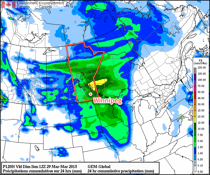
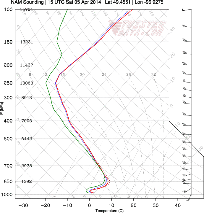
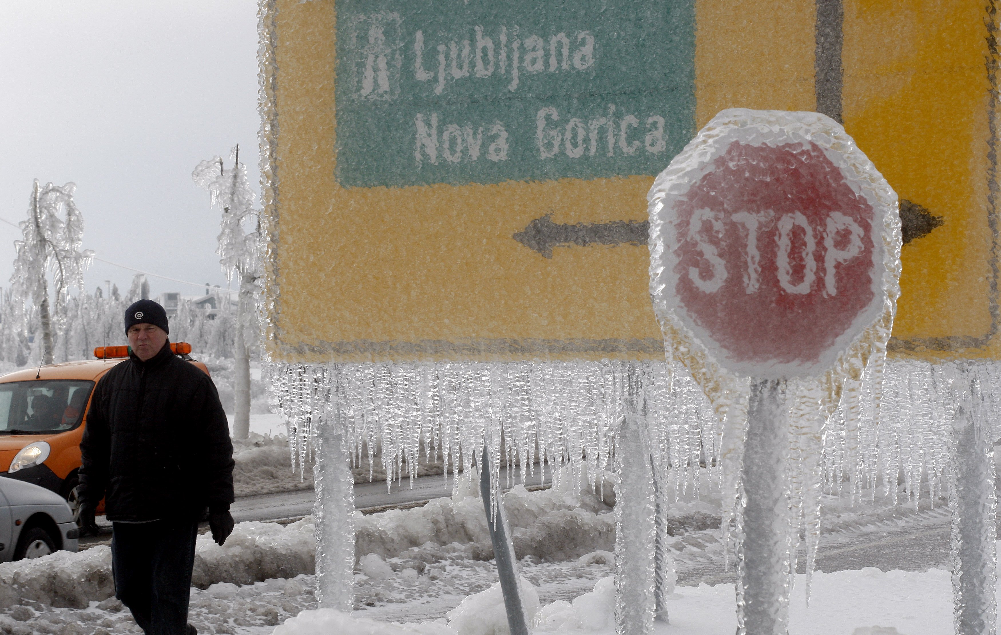
Alongside the surge of warm air will come a risk of some freezing rain. An above-freezing level (AFL) will develop overnight, and by morning an area of precipitation is expected to slide through Parkland Manitoba, the Interlake and northern Red River Valley before sliding eastwards into Northern Ontario.
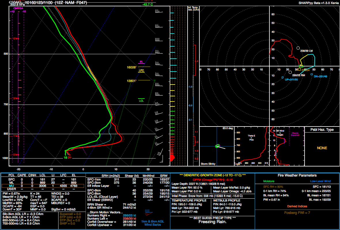
With sustained warm air advection and a wet-bulb temperature above 0°C in the AFL, the potential for organized freezing rain exists. The highest likelihood lies over the Swan River region and then southeastwards through the Interlake. The risk exists over the Red River Valley, but at this point it doesn’t appear that actual amounts will be particularly high. Nonetheless, it doesn’t take much freezing rain to make things slick, so we’ll monitor things and provide an update if the threat for the Red River Valley increases.
Behind the warm front, freezing drizzle will be possible throughout much of the day with saturated low-levels and the lift associated with the incoming low. Winds will be calm through the afternoon.
Winds will shift to the northwest in the evening as a cold front passes through. Skies will remain fairly cloudy and the threat for freezing drizzle will persist well behind the cold front and through much of the night. Temperatures will drop to around -8°C by Sunday morning.
Sunday will bring weak cold air advection through the day, resulting in temperatures rebounding only slightly if at all through the day. The chance for flurries will redevelop as temperature profiles become too cold for freezing drizzle and more favourable for snow. That said, overall moisture supply will be dwindling, so at this point it appears that there will be just a chance for some flurries.
Sunday night will bring cloudy skies and a low near -10°C.