Mid-Week Freeze In Late-Season Arctic Blast

An Arctic ridge will bring a blast cold air to southern Manitoba resulting in a late-spring freeze in many areas. After a cold Wednesday night, temperatures will gradually warm towards seasonal values.

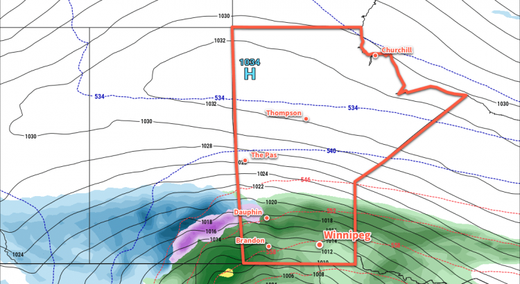
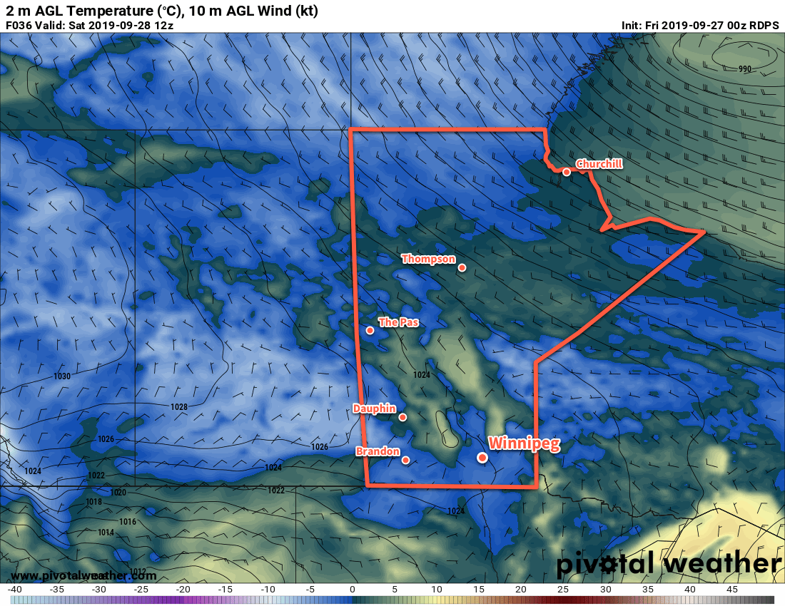
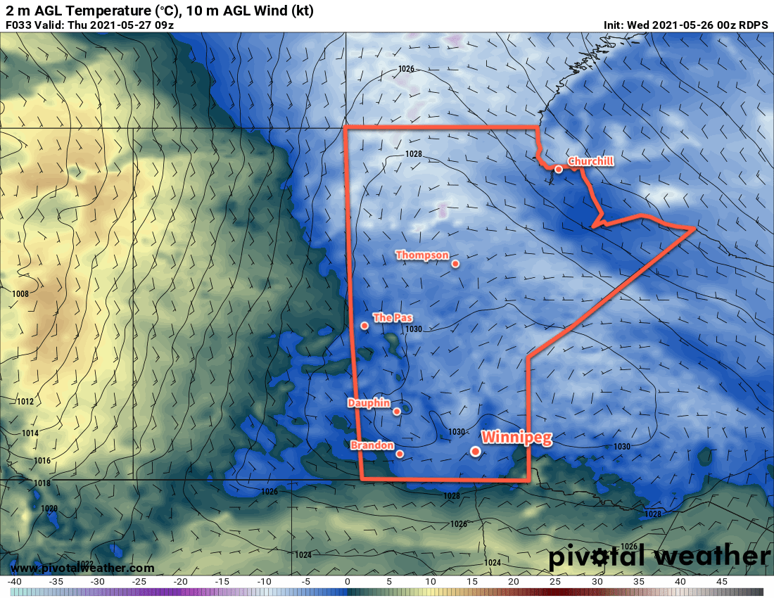
A broad Arctic ridge will lay sprawled across Manitoba today, bringing seasonably cool weather to the region. Winnipeg will see a high of only 11 °C with a north wind easing to around 20 km/h in the afternoon. Skies will clear tonight with easing winds as the main ridge axis moves into southern Manitoba. Temperatures will dip below freezing through the Red River Valley overnight, potentially reaching as cold as -4 or -5 °C. In Winnipeg, there will likely be a larger range of temperatures going from slightly below freezing near the city core to around -3 or -4 °C on the outskirts (particularly on the north side of the city).

If you’ve planted your garden, you’ll definitely want to cover the plants up to help protect them from the cold tonight. More of an issue may be damage to sprouting crops through the Red River Valley.

RDPS 2m Temperature Forecast valid 09Z Thursday May 27, 2021
An Arctic high will bring freezing temperatures to most of southern Manitoba on Wednesday night.

Temperatures will begin to recover on Thursday with a high near 15 °C with light easterly winds. The Arctic high will keep skies sunny as it slowly pushes off to the east. This will be a good thing, as it will likely mean a quick warm-up above freezing on Thursday morning. Temperatures will be warmer on Thursday night with a low near 2 °C.

Skies will stay sunny on Friday as warmer air continues to move into the region ahead of a low over the western Prairies. Winnipeg should see mainly sunny skies with southerly winds picking up into the 30–40 km/h range for the afternoon. Highs will reach around 18 °C through the Red River Valley, followed by lows in the upper single digits. The wind will stay breezy out of the south right through the night with some cloudier conditions building into the region.

Long Range Outlook

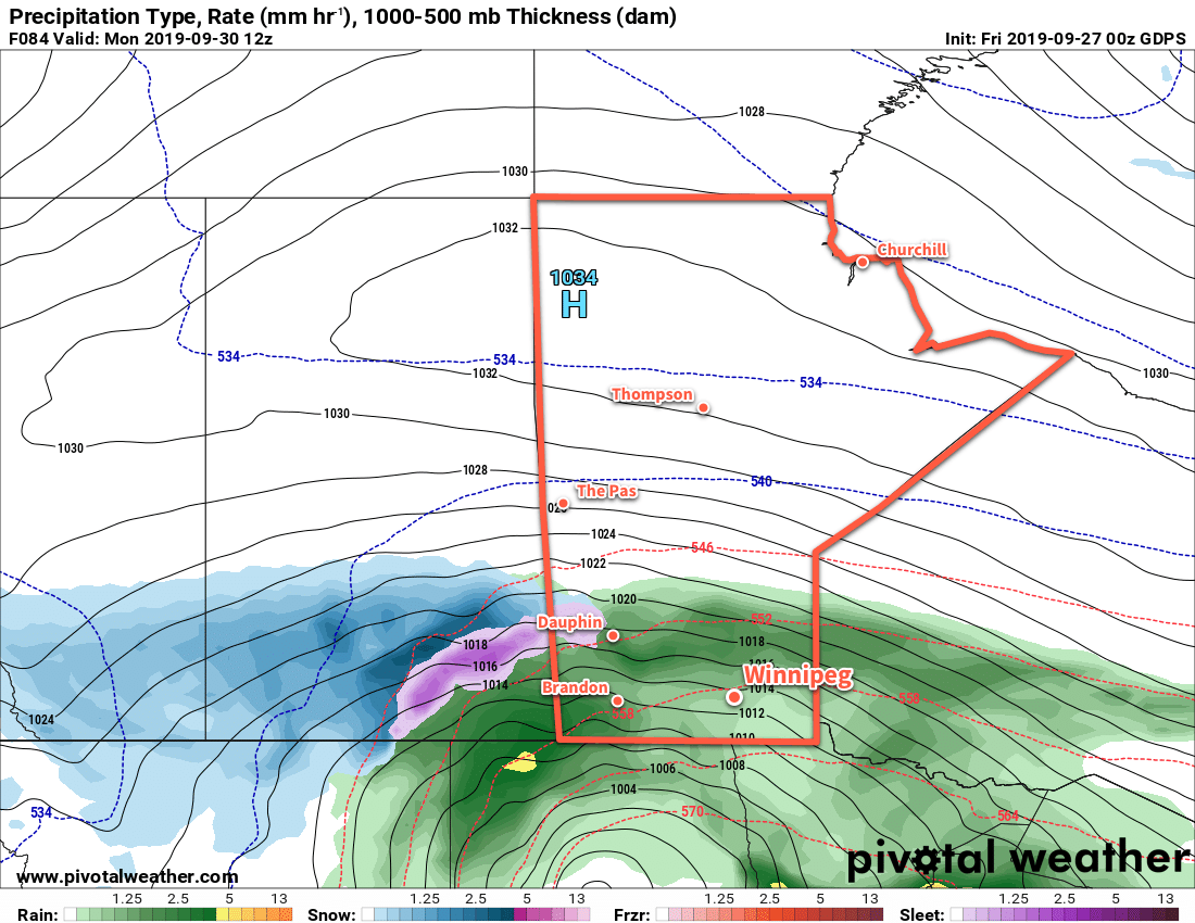
Forecasts show showers likely again on Saturday as a disturbance moves across the region. Sunnier skies should return on Sunday. Temperatures will be near-seasonal through the weekend with highs near 20 °C and lows near 10 °C. Warmer weather will return next week with highs climbing into the mid to upper 20s and lows in the low to mid-teens.

Today’s seasonal daytime high in Winnipeg is 22 °C while the seasonal overnight low is 7 °C.

First A Frost, Then More Rain on the Way This Weekend

The Red River Valley will see a frost on Saturday morning, then more rain is on the way for Sunday and Monday.

The sun returns today after another 10 to 20 mm of rain drenching in the Red River Valley. Winnipeg will see a seasonably cool high near 12°C as an Arctic ridge builds into the province. Winds will be light out of the northwest at 15 to 25 km/h. That Arctic ridge will bring frost to the region tonight with lows dropping to -1 or -2°C through the valley. Winds will be light overnight with a few clouds lingering.

Much of southern Manitoba will see frost tonight as temperatures drop below 0°C early Saturday morning.

That Arctic ridge will remain in place on Saturday, keeping winds light and temperatures cool. Winnipeg will see a high of 10°C with increasing cloud cover. The cloud will be thickening up ahead of a major fall storm that will impact the entirety of the southern Prairies. What will be a major snow storm for the Alberta Foothills will transition to a mix of rain and snow across Saskatchewan and to primarily a rain event for Manitoba. Rain will spread northwards through the Red River Valley on Saturday night with temperatures dipping to a low near +4°C. The wind will pick up overnight as well, increasing out of the northeast to 30 km/h by Sunday morning.

More rain is on the way for Manitoba on Sunday into Monday, but this fall storm will bring significant snow to portions of Saskatchewan and Alberta.

Southern Manitoba will see more wet weather on Sunday with periods of rain moving through the region. Winnipeg will see a cool high near 7°C with moderate northeasterly winds of 30 to 40 km/h through the day. Periods of rain will persist through Sunday night with temperatures remaining steady. Much of the region will likely see 15 to 25 mm of rain through Sunday to Monday morning.

Long Range Outlook

The Red River Valley will see more rain on Monday with another 10 to 20 mm possible. Rain will taper off Tuesday, but cool temperatures and a brisk northwest wind will likely result in some lake-effect precipitation. The rest of the week looks dry with below-normal temperatures.


If you have plans to travel west across the Prairies on Sunday through Tuesday, keep in mind that this system will bring significant snowfall to some areas in Saskatchewan into southern Alberta. Check ECCC’s forecasts for not only your destination but also stops along the way to ensure you don’t hit any unexpected winter driving conditions.

Today’s seasonal daytime high in Winnipeg is 15°C while the seasonal overnight low is 4°C.

Sunny Skies, Cooler Temperatures, Build Into The Red River Valley

After several days of cloudier conditions, Winnipeg and the Red River Valley will see the sun return for the second half of the week.

The low pressure system that brought a few showers to Winnipeg over the past couple days — although more notably a major winter storm to the southwestern Prairies — is finally making its way out of the region. The upper-level support will finish moving out of the province this morning with mostly cloudy skies giving way to afternoon clearing. Temperatures will climb to a high near 13°C this afternoon with winds picking up out of the southwest to around 30 km/h.

Temperatures will be quite cool tonight as a shot of Arctic air moves through the region. Under clear skies and diminishing winds, overnight lows will dip down to around the +1°C mark in Winnipeg, however that’s for most of the urban areas. At the edges of the city, as well as into the Red River Valley, overnight lows may dip down to the 0 to -2°C range. There will be a risk of frost throughout the region, including Winnipeg.

RDPS Forecast 2m Temperature valid 12Z Thursday October 5, 2017
The Red River Valley will see a risk of frost early Thursday morning as temperatures dip near or below the freezing mark.

Thursday will bring mainly sunny skies to Winnipeg with light winds as a ridge of high pressure slumps through the southern Prairies. Temperatures will be near seasonal with highs climbing to around 13°C again in Winnipeg and overnight lows dipping back down to around the +3°C mark.

Friday will also bring sunny skies to the region with a light southerly wind developing in response to a low pressure system building into the far northern Prairies. Daytime highs will climb up to around 16°C as slightly warmer air pushes northwards, and overnight lows will follow suit dropping to only around 6°C.

Long Range

Conditions look fairly dry for the next while, although a more significant pattern change will move in for early next week. Temperatures look to climb into the upper teens on Saturday with breezy southerly winds, with a cold front then passing through on Saturday evening. At this point, the passage of the front looks dry, and will be followed by a second cold front moving through the region on Sunday night.

GDPS Forecast 500mb Height Anomaly valid 12Z Monday October 9, 2017
A large upper-level trough (shown in blues and purples) will develop over the Prairies early next week, bringing below-seasonal temperatures to the Prairies.

That will leave the Prairies underneath a large upper-trough for Thanksgiving Monday. Temperatures will be below normal with highs just in the upper single digits under cloudy skies with a breezy northwesterly wind and a chance of showers. The road to recovery will be slow, with temperatures gradually rebounding towards seasonal through the remainder of the week.

Cooler Weather to Start the Week

Cooler weather is on tap earlier this week as a series of cold front usher in a much cooler air mass. While temperatures will remain only slightly below seasonal averages, some areas will stand a risk of frost.

A cold front will bring cooler weather to southern Manitoba today

This Week

Today will be cool and breezy as a series of cold front brings cooler weather to southern Manitoba. The first cold front passed through late Sunday, with a secondary cold front coming through later today. The initial cold front dropped temperatures into the teens for today, and was followed by fairly extensive cloud cover. The second cold front will bring a chance of showers to most of southern Manitoba today as it passes through and picks up any residual moisture. Parts of western Manitoba that clear out tonight may experience light frost as temperatures drop rapidly after sunset. Winds will be gusty out of the north-west at 30 km/h gusting to 50 km/h.

Following today’s frontal passage, we’ll experience one of the coolest days in awhile on Tuesday. High temperatures will only be in the mid teens. Some cloud cover is expected to develop during the day, but no precipitation is expected, save for perhaps an isolated light shower. There will be a risk of frost again Tuesday night, but it should be more isolated and mainly in traditionally frost-prone low-lying areas. Most parts of southern Manitoba should remain just above freezing due to a weak southerly flow overnight. Daytime winds will be westerly at 20 km/h.

Temperatures will begin to warm on Wednesday as we see a southwesterly flow begin to develop over southern Manitoba. Highs should climb up toward the 20°C mark under mainly sunny skies.

Long Range

The long range forecast suggests that summer weather may not be quite over yet! Weather models hints at more days with temperatures in the mid or perhaps upper twenties before September is over.