Heat Continues

The hot weather will continue into this week, with some of the hottest weather of the season on Monday and Tuesday.

Monday Afternoon Temperatures in Southern Manitoba

Monday

Monday

Mainly Sunny
33°C / 15°C

Monday will be a hot, but decreasingly humid day. The morning and early afternoon may be on the humid side, but a westerly wind and mixing of drier air from aloft should remove a fair amount of moisture from the air by late afternoon into the evening. Highs on Monday will be in the low thirties, with nice sunny skies.

Tuesday

Tuesday

Mainly Sunny
33°C / 12°C

Tuesday will again be hot, but not humid. Another plume of hot air coming off the Rockies will allow temperatures to climb into the low and maybe even mid thirties over Southern Manitoba. Just south of the border there may be the potential for upper thirties temperatures in the Fargo and Grand Forks areas. Depending on how far north this plume of warm air pushes, actual temperatures may be slightly warmer or cooler than suggested above. Again, no rain is expected.

Wednesday

Wednesday

Mainly Sunny
24°C / 10°C

A strong cold front will push through on Tuesday night, setting up significantly cooler conditions for Wednesday. No significant weather is expected with this front, owing to a dry airmass ahead of it, although a stray shower or weak thunderstorm cannot be ruled out. Highs on Wednesday will only be in the low to mid twenties. The wind will be gusty and from the north-west.

Long Range

Beyond Wednesday it looks like warmer weather will return once again, with temperatures in the upper twenties, or maybe low thirties, looking possible from late this week into next weekend. Summer appears to be making a long term stay.

Hottest Weather So Far This Year Ahead

The warmest weather we’ve seen all year is shaping to move in today and persist through the next week as a upper ridge begins to build in over the Prairies. The heat and humidity will be here in full force with daytime highs climbing over 30°C and dew points climbing into the upper teens or even perhaps the low 20’s.

Friday

30°C / 15°C
Mainly Sunny
Saturday

33°C / 17°C
Mainly sunny with a slight risk of a late day thunderstorm.
Sunday

30°C / 17°C
Mainly Sunny

We’ll see beautiful sunny skies today as our temperature climbs to around 30°C. The humidity will become more noticable as the day wears on as the dew point climbs from the low teens to around 17 or 18°C. Temperatures will drop to around 15°C tonight under clear skies.

Tomorrow looks to be a scorcher of a day. The temperature will climb into the low 30’s with high humidity as the dew point climbs over 20°C. It will feel closer to 38–40°C by the afternoon as the Red River Valley bakes in the warmest temperatures of the year. A disturbance will be moving through the Interlake region that will bring a very slight risk of a thunderstorm late in the day, although at this point it looks like most of the activity will stay north of the Red River Valley. Beaches along the South Basin of Lake Winnipeg will have a greater chance of seeing thunderstorm activity than we will here in Winnipeg, so if you’re planning on camping north of the city, that may be something to keep in mind. We’ll have updates below in the comments on the thunderstorm potential tomorrow. We’ll head to an overnight low of aroun 17 or 18°C Saturday night.

Sunday also looks to be a gorgeous day. The hottest weather will be off to our east, but we’ll still see temperatures climb to around 30°C under sunny skies. There will be more of a westerly component to the winds which will help flush out some of the humidity through the day.

Next Week

Next week looks to keep the heat. While the upper ridge flattens thanks to a couple disturbances that move through on the weekend, it’s set to rebound by mid-week, which will keep our daytime highs in the upper 20’s or low 30’s for what looks like the entire week. At this point it looks like we may see some showers or thunderstorms on Monday evening/night, but after that current indications are that it will be hot and dry for the remainder of the week.

After 4 weeks of below-normal temperatures, get out there and enjoy the heat wave! Just be sure to practice some heat safety and wear hats and drink plenty of water. Have a great weekend!

Summer Returns!

After weeks of below-normal temperatures in Winnipeg, we can finally rejoice as summer is set to make a significant return.

Wednesday

25°C / 13°C
Mainly sunny
Thursday

28°C / 14°C
Mainly Sunny
Friday

30°C / 17°C
Mainly Sunny

Describing the next few days will be short and sweet, we’ll see mainly sunny skies, a warm-up returning us to summer-like temperatures and increasing humidity as Gulf moisture is advected northwards in a southerly flow.

The only significant weather to speak of will be a slight chance of a shower or thundershower in the southwest Red River Valley on Thursday morning as a weak area of convection pushes through North Dakota. Other than that slight chance, things should be fairly dry through the rest of the week as well.

The Weekend

This weekend looks exceptinally summer-like as a humid, Gulf-sourced air mass entrenches itself over the Red River Valley. With temperatures in the low 30’s and dew points climbing to nearly 20°C, it’s going to feel more like it’s closer to 36 or 37°C. There will be a slight chance of showers or thunderstorms on Saturday night, but at this point the threat seems marginal at best. It looks to be a dry weekend for the most part with variable cloud cover.

After the weekend we move into a slightly dryer air mass, but the heat sticks around with daytime highs looking to be in the upper 20’s through most of the week.

Hot Weather Building In; Severe Storms to End Week?

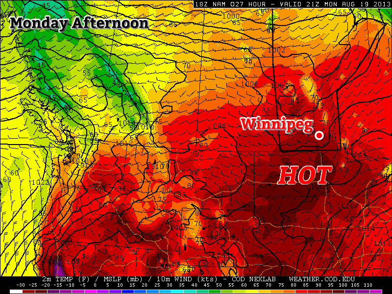
Hot, increasingly humid weather will begin working it’s way back into Southern Manitoba as a southerly flow at the surface, advecting moisture northwards from the US Plains, combines with an upper ridge over the Prairies that will work to crank up the heat.

Model winds at 500mb showing the strong upper-level ridge forecast over the Prairies on Thursday.

Model winds at 500mb showing the strong upper-level ridge forecast over the Prairies on Thursday.

Today

Wednesday

28°C / 15°C
Sunny.

We’ll see a pleasant day today with sunshine dominating the skies and a light northwesterly wind. Temperatures should climb up to around 27°C while the northerly winds keep the humidity down making it a very comfortable summer day. Skies will remain clear overnight as we drop to a low of around 15°C. There will be a very slight chance of a thundershower or two in the Red River Valley through the afternoon hours, but if they do develop they’ll most likely be tied to areas along the western escarpment and northwards towards Riding Mountain park. There would be a very marginal chance of any of these storms becoming severe; if any were to the main threats would be heavy rain and large hail.

Thursday & Friday

Thursday

30°C / 19°C
Sunny & increasingly humid.

The heat will build a little more on Thursday, but the real big difference will be the humidity which will become very noticeable as the winds shift around to the south on Wednesday night and allow the dew point to start climbing. They should reach the mid-to-high teens by Thursday evening which, when combined with our expected daytime high of 30°C will make it feel more like the mid-to-high 30’s. No storms are expected as a strong cap keeps everything in line.

Friday

28°C / 14°C
A mix of sun and cloud; showers or thunderstorms with passage of cold front. Very humid until front passes.

Friday will be the most active day of the week as ample heat and humidity are in place ahead of a moderately strong cold front that will work across Southern Manitoba through the day. It looks likely that storms will initiate on the front fairly early in the day (perhaps even by late morning if nocturnal storms don’t just march out of North Dakota and continue through the day) and pose the risk of becoming severe as they will have ample energy available to them.

High CAPEs combined with ample bulk shear (0–500mb bulk shear values are expected to be in the range of 50–60kt) will allow storms to organize quickly and introduce the threat for large hail and strong winds. Shear values are generally running parallel to the front, which means slow frontal motion could produce training thunderstorms that may produce localized flash flooding. The threat for tornadoes looks fairly low given that winds right near the surface may not be able to move into a favourable direction due to the orientation of the front and tilt of the entire system. While tornadoes can never be ruled out of severe thunderstorms, at this time it doesn’t look like the threat should be considered one of the primary threats for Friday.

The day may be more cloud than sun depending on how convection develops to our south and west on Thursday night, but we should see a high temperatures anywhere from 25°C to 28°C before the front comes through. The passage of the front will bring northerly winds which will flush out a lot of the humidity that will have built up over the prior days which should make things quite a bit more comfortable. Things will clear out overnight as we drop to a low in the mid-teens.

The Weekend

Looking ahead to the weekend, we’ll see plenty of sunshine return with highs climbing in the 27–30°C range with comfortable humidity. It looks great. Keep tuned here and to our team on Twitter (@WeatherInThePeg, @steinbachwx and @lovestormsMB) for updates and thoughts on Friday’s severe weather potential. Until then, enjoy summer!