Early Week Heat Brings Chance of Thunderstorms

A low pressure system crossing the province will bring hot and unsettled conditions to southern Manitoba today. The heat will be short-lived, though, as a cold front ushers seasonal temperatures back into the region for Wednesday.

RDPS 2m Temperature Forecast valid 21Z Tuesday August 2, 2022
A low pressure system moving into Manitoba today will bring hot, humid conditions to the region.

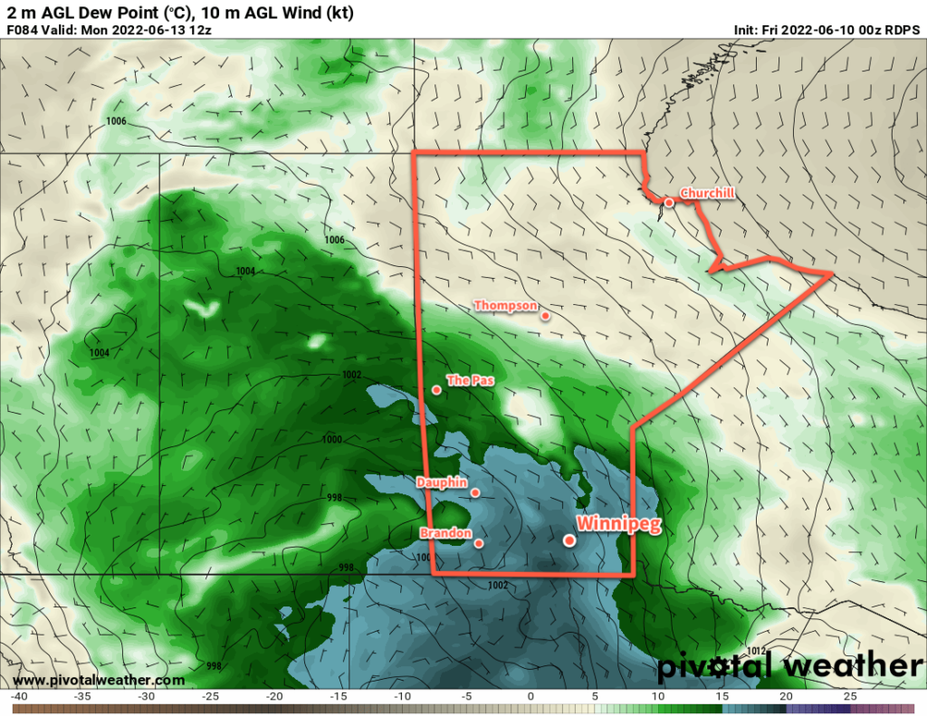
In the wake of a warm front that moved through overnight, temperatures will soar into the upper 20s and low 30s across southern Manitoba today. Alongside the heat, humidity levels will also climb through the day, reaching fairly muggy levels by the evening.

Thunderstorm activity will be the most notable, and challenging, weather of the day. There will be several features moving through the region that that may support thunderstorms today. The first will be an area of showers and thunderstorms — the remnants of overnight convection — that will continue eastwards through the Interlake. This activity will weaken as the morning progresses. While most of it should stay north of the Red River Valley, the southern edge might clip along the Trans-Canada Highway corridor. The second feature will be the warm front itself, which may have some ongoing thunderstorms along it this morning. Any activity along it should shift eastwards into the Whiteshell and then weaken.

Once all the morning activity pushes out, the Red River Valley will see more sun as things heat up. Later in the day, a risk of severe thunderstorms will develop as several features begin pushing across southern Manitoba. Both the low centre, warm-sector trough, and cold front could support thunderstorm development later today. The heat and humidity will combine with favourable winds aloft to pose a notable risk of severe weather.

ECCC Prairie Thunderstorm Outlook valid 1:00PM to 1:00AM CDT
ECCC’s Thunderstorm Outlook issued on Monday afternoon shows a notable severe weather threat for southern Manitoba on Tuesday.

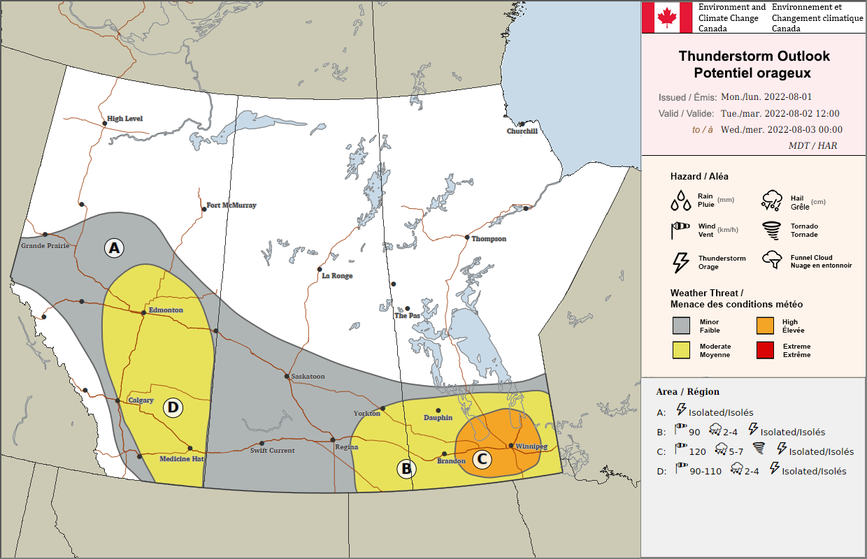
The combination of energy (from the humidity and instability) and shear (from how winds change with height) is highly favourable for severe thunderstorm activity across southern Manitoba today. The biggest uncertainty with storms in the afternoon/evening will be whether or not they actually develop. A layer of warm air aloft will keep storms down until late in the day. It seems likely that the forcing will be strong enough by evening for isolated to scattered thunderstorm development. The activity will likely begin in the southwest and push into the Red River Valley. These thunderstorms would be capable of producing damaging wind gusts, damaging hail, and torrential rain. In addition, an isolated tornado or two may be possible with these thunderstorms as well.

The last unknown related to thunderstorm development will be exactly how warm temperatures end up. Satellite imagery yesterday evening showed a fair amount of high-level smoke moving eastwards from fires over southern British Columbia. If that smoke inhibits temperatures even a couple degrees, that could be enough to thwart thunderstorm development. All those things being taken into account, the weather later today is a bit of an unknown. It will be important to stay up to date on any watches or warnings issued by ECCC later today.

The thunderstorm threat will diminish in the evening as temperatures fall to a low in the mid-teens. Winnipeg will see pleasant conditions on Wednesday with clearing skies, breezy northwest winds, and a high in the low 20s. On Thursday, breezy southerlies will push a warm front northwards and send highs back into the upper 20s. Thursday night might be very warm with southerlies continuing and lows warmer than 20 °C possible.

Long Range Outlook

Friday could bring some morning showers or thunderstorms to the Red River Valley, followed by mixed skies and a high in the upper 20s again. It might also get humid on Friday as well.  A cold front will sweep through by Friday evening, ushering cooler temperatures back into the region for the weekend. Highs will likely sit in the low 20s with lows in the low to mid-teens on Saturday and Sunday. A few showers might be possible on Sunday as well.

Next week is looking like it will start off with near-seasonal temperatures and plenty of sunshine.

Today’s seasonal daytime high in Winnipeg is 26 °C while the seasonal overnight low is 13 °C.

Hot and Humid Summer Weather Comes to Southern Manitoba This Weekend

The heat will gradually amplify across southern Manitoba over the coming days as a hot and humid air mass builds into the province.

NAM 2m Temperature Forecast valid 21Z Sunday June 19, 2022
Very hot and humid conditions will move into Southern Manitoba by Sunday.

After a couple cool, windy, and showery days across the region, summer weather is quickly rebounding back into southern Manitoba. Driven by an intensifying upper ridge, Winnipeg will see near-seasonal conditions today quickly heat up into the weekend.

It will be a beautiful day in Winnipeg today with temperatures climbing to the mid-20s under sunny skies. Winds won’t be much of an issue, swinging around to the east for the afternoon and picking up to around 20 km/h. Humidity will stay comfortable through the day with dew points around 10 °C. Temperatures will drop into the mid-teens tonight with some cloud moving into the area as a warm front approaches.

Saturday will bring a cloudy start to the day with some showers or thunderstorms possible through the morning into midday. Some sunny breaks will develop in the afternoon as temperatures head to a high in the upper 20s. Winds will strengthen out of the southeast to around 40 km/h with gradually increasing humidity. The dew point will climb into the mid- to upper-teens by the end of the day as the warm air continues to push into the region. Temperatures will stay very warm on Saturday night, only dropping into the low 20s with a gradually diminishing wind.

Sunday will bring dangerous heat to southern Manitoba as the mercury soars and very humid conditions develop. With partly cloudy skies, temperatures on Sunday will climb into the low to mid-30s across most of southern Manitoba. As this happens, dew points will rise rapidly as the day warms up, increasing from the mid-teens up into the 20–25 °C range through the morning. This heat and humidity will produce humidex values of 40–45, making for weather that can be dangerous to be exposed to for extended periods.

In preparation for the heat, ensure that if you have air conditioning its in working order. Limit your exposure to the heat on Sunday, drinking plenty of water and ensuring you can find breaks to cool off whether it be indoors, shade, or other cooling opportunities such as city-run splash pads (great for the kids!). If you know anyone at risk for heat-related illnesses such as elderly individuals, those without air conditioning or access to cool spaces, or some with other forms of chronic illnesses, organize a plan to check in with them or provide some way of cooling off. Be sure to check out more information about preparing for and managing heat-related illnesses.

Sunday night will also stay very warm with overnight lows only dipping into the low 20s. Some showers or thunderstorms are likely on Sunday night, but they will likely avoid the Red River Valley. They should develop well to the west-northwest and likely pose a more notable risk to the Parkland and Interlake regions.

Long Range Outlook

Hot weather will continue on Monday, but it won’t be quite as extreme as seen on Sunday; highs in the low 30s will combine with dew points easing into the upper teens. This will produce humidex values of 35–40, which when combined with the second night of very warm lows may still be an issue for some. Conditions will turn more unsettled for the rest of the week as cooler air brings more seasonal conditions back to the region.

Today’s seasonal daytime high in Winnipeg is 24 °C while the seasonal overnight low is 11 °C.

Weather Turning Unsettled This Weekend

Winnipeg will see another day of sunny and mild conditions before cloudier, unsettled weather moves into the region.

RDPS 2m Dew Point Temperature Forecast valid 12Z Monday June 13, 2022
Humid conditions will push into southern Manitoba by the end of the weekend with dew point values climbing into the upper teens.

Today is Winnipeg’s last day under the influence of the upper ridge over the Prairies. After a mostly sunny start to the day, temperatures will climb into the mid-20s for the afternoon. Skies will cloud over through the day as a warm front approaches from the west.

A few showers may be possible this evening, but the activity will weaken though the night. The warm front will stall southwest of the region on Saturday and continue to bring cloud to the region. A few showers may linger across the region early Saturday, but should taper off as the morning progresses.

From Sunday onwards, the upper ridge will slump southwards, allowing multiple disturbances to ride over it across the southern Prairies. While cloud will keep daytime highs in the low to mid-20s, southerly winds will raise dew points into the upper teens. This will give the region the first stretch of humid conditions this summer. Another chance of showers or thunderstorms will develop across the region on Saturday night into Sunday morning. That activity will clear out on Sunday morning, leaving behind mixed to cloudy skies for the rest of the day.

Long Range Outlook

Generally unsettled conditions will persist through the first half of next week as several disturbances roll through the region. A few periods of showers or thunderstorms will again be possible on Monday and Tuesday. Conditions will begin to improve on Wednesday with some sunshine returning the region, but there may be enough lingering instability for a few late-day showers.

Heading into the second half of next week, there’s strong indications that even warmer weather will begin moving into the region. Daytime highs may climb into the upper 20s by the end of next week.

With humid and warmer weather on the horizon, it’s a great time to check to make sure you have some fans in your home and that, if you have it, your air conditioning unit is working correctly. Heat stress is becoming more common in western Canada summers; ensuring that everything works before the warm weather arrives will help protect you. If there are any issues, you’ll likely find what you need easier and cheaper before the heat arrives. If you live alone, think about having someone you might check in with daily this summer during periods of extreme heat, especially if you don’t have access to air conditioning.

It looks like the shift into summer has finally begun; enjoy it! Especially after the winter we just had to endure!

Today’s seasonal daytime high in Winnipeg is 23 °C while the seasonal overnight low is 10 °C.

Turning Unsettled As Warm, Humid Weather Arrives

A warm and increasingly humid air mass will move into Winnipeg this week, bringing chances for showers or thunderstorms to the region.

An upper-level disturbance moving through southern Manitoba will bring cloudy periods to Winnipeg today. There will be a chance of showers, but most of the rain will pass to the north of Winnipeg. The best chance for any rain will be in the morning and midday hours. Temperatures will warm up in the afternoon with some sunshine poking through the clouds to a high near 26 °C. Skies will clear out tonight with a low near 15 °C.

Tuesday will start the move towards a warmer and more humid air mass. A sharp upper-level trough will dig over the western seaboard with an upper ridge over the eastern Prairies developing in response. Skies will stay mainly sunny as a warm front begins lifting towards Canada through the Northern Plains. Winnipeg will see light northeasterly flow ahead of the warm front through the day as temperatures head to a high near 30 °C.

RDPS 12-hr Accumulated Precipitation Forecast valid 12Z Wednesday June 9, 2021
Showers and thunderstorms will develop in the United States on Tuesday night and spread across southern Manitoba by Wednesday morning.

On Tuesday night, a low pressure system lifting out of Montana will support a strengthening flow overrunning the warm front. The combination of lift and destabilization will produce thunderstorms over the northern Plains that will push across southeastern Saskatchewan and southern Manitoba into Wednesday. There will be enough instability and organization in the environment for the risk of severe thunderstorms. The primary threats overnight would be hail and wind. There is also a chance that the thunderstorms may organize into a squall line. If they did so, it could bring damaging winds to portions of southeastern Saskatchewan and/or southern Manitoba overnight.

Temperatures will head to a low near 18 °C on Tuesday night.

RDPS 2m Dew Point Forecast valid 21Z Wednesday June 9, 2021
Humid conditions will spread across southern Manitoba on Wednesday.

On Wednesday, the warm front will lift northwards into southern Manitoba. This will combine with an upper level disturbance moving into the region to support scattered showers and/or thunderstorms. The cloud cover will keep temperatures cooler than Tuesday, but it will become substantially more humid. Although the high will be around 26 °C, dew points will climb into the 18–20 °C range and make it feel closer to the low 30s. The unsettled weather will push off to the northeast for Wednesday night with a low near 17 °C.

Long Range Outlook

The warm and humid weather will stick around for the rest of the work week with highs in the mid-20s and dew points hovering in the upper teens. The sun should return for Thursday afternoon, then another passing low will bring a chance showers and thunderstorms to the region on Friday. A cold front will sweep through after that, ushering in drier conditions for the weekend. Temperatures will stay warm into next week with highs in the 25–30 °C range.

Today’s seasonal daytime high in Winnipeg is 23 °C while the seasonal overnight low is 10 °C.