A low pressure system moving through southern Manitoba will bring snow and mild temperatures to the Red River Valley. In its wake, colder temperatures and strong winds will surge into the region.

Apologies for the late forecast, life has been busy!
Snow spread across much of southern Manitoba this morning as a low pressure system pushed a warm front into the region. A burst of moderate to heavy snow has moved through the region this morning, and now milder temperatures will spread across the region with daytime highs of -5 to 0 °C across southern Manitoba. As the warm air moves in, stiff southerly winds will shift to lighter westerlies.
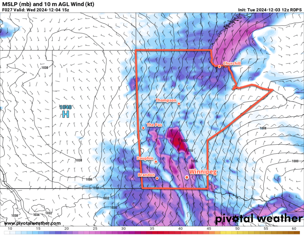
A cold front will sweep through later today, ushering in some light snow and a major shift in the weather. Temperatures will plummet into the minus teens tonight as northwesterly winds strengthen into the 40 to 50 km/h range with gusts of 60 to 80 km/h. It’s likely that lake-effect snow will develop off the lee of Lake Manitoba and Lake Winnipeg, producing a band of flurries that could last well into Wednesday.
The colder temperatures, new snow, and strong winds will likely produce widespread blowing snow across the region, though limited snowpack inside of Winnipeg could reduce the overall amount of blowing snow within city limits. Of particular concern will be the Trans-Canada Highway corridor between Winnipeg and Portage la Prairie where strong winds, existing snow, and lake-effect snow could combine to produce white out conditions and potential highway closures heading through Wednesday.
With those strong northwest winds, temperatures will only recover a couple degrees on Wednesday before dropping down to a low in the -20 to -25 °C range on Wednesday night. Wind chilled values will likely hover in the -25 to -30 range all day then closer to -30 overnight as the wind dies off.
A ridge of high pressure over the province on Thursday should bring partly cloudy skies to the region, light winds, and highs in the mid-minus teens.
Long Range Outlook
Another notable pattern shift will occur late this week as a strong low pressure system is forecast to track across the southern Arctic. This system will send warmer air sweeping across the Prairies, sending daytime highs back towards the 0 °C mark on the Weekend. More snow looks possible eon Sunday as a cold front pushes through the region, then it looks like a return to near-seasonal conditions for much of next week.
Today’s seasonal daytime high in Winnipeg is -7 °C while the seasonal overnight low is -16 °C.
