Cool Friday Replaced by Weekend Warmth

The work week will end on a cold note as cloudy skies bring a chance of flurries to Winnipeg, but temperatures will quickly rebound to beautiful spring warmth.

RDPS 2m Temperature Forecast valid 00Z Sunday April 20, 2025
Pleasant spring weather will be in place for the Winnipeg Whiteout Street Party with temperatures near 10 °C by 6 PM on Saturday.

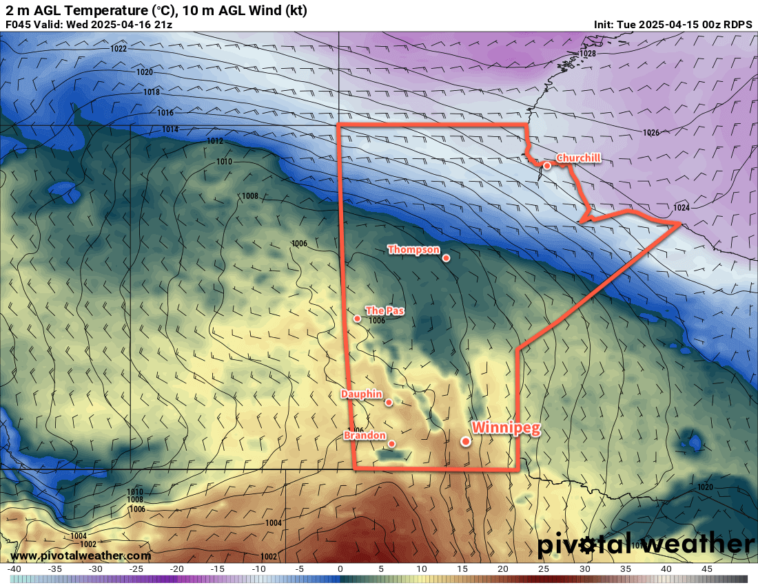
The cooler weather has arrived back in Winnipeg today with temperatures that will struggle back into the low single digits this afternoon. The decaying remnants of a low pressure system will slump through the area, bringing cloudy skies and a chance of snow. The main area of snow will slump through southeast Manitoba while areas further west in the Red River Valley, including Winnipeg, will see a chance of flurries that diminishes towards evening.

Winds will continue out of the north near 30 gusting 50 km/h and then ease overnight. Winnipeg should see an overnight low that dips below freezing into the -5 to 0 °C range.

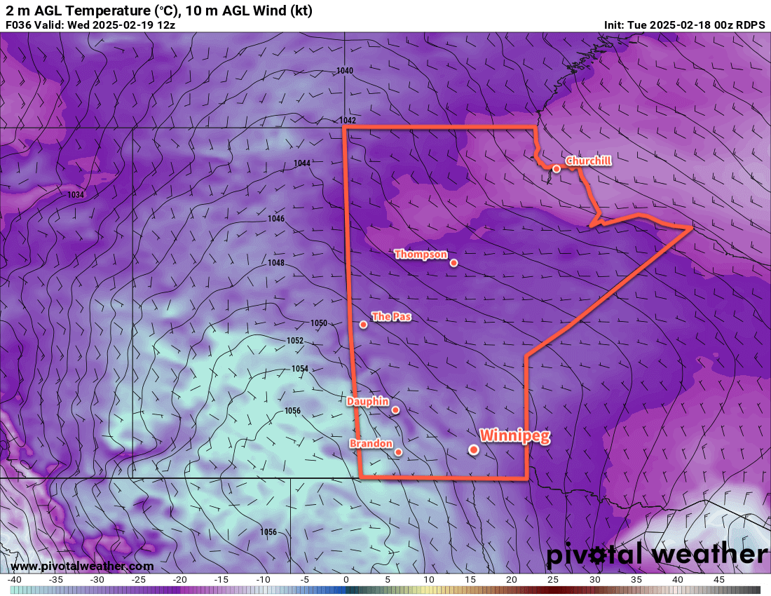
On Saturday, a ridge of high pressure will move across the region bringing mainly sunny skies and light winds. Temperatures will bounce back to seasonal values with a high in the low teens and an overnight low in the 0 to +5 °C range.

Conditions on Saturday won’t be too bad for the Winnipeg Jets’ home opener against the Blues. Those of you who managed to grab tickets for the Whiteout will have temperatures near 9 or 10 °C at game start dipping down to near 5 °C by the end of the game.

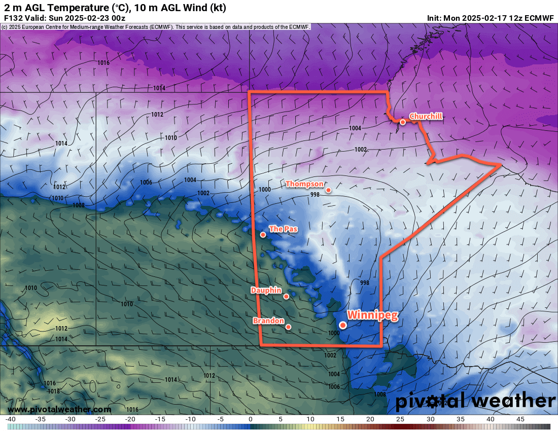
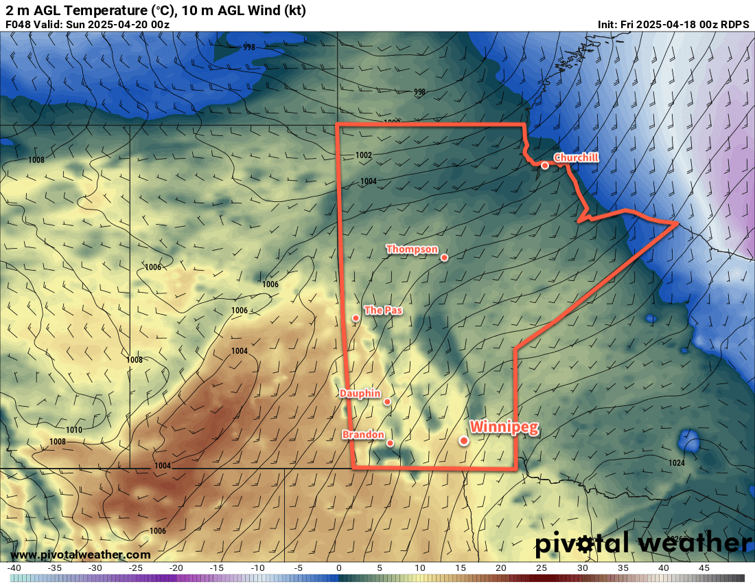
By Sunday, a low pressure system crossing the southern Arctic will push a warmer air mass into the region. Under sunny skies, breezy southerly winds up to around 30 km/h will push temperatures into the 15 to 20 °C range.

Temperatures will dip down into the mid-single digits on Sunday night with partly cloudy skies.

Long Range Outlook

It looks like Monday will bring more beautiful spring weather to the region with highs in the upper teens and mixed skies.

After that, the weather may turn unsettled for Tuesday with temperatures returning to seasonal values as rain pushes through the region. After a cool day or two behind that, temperatures look to return to near-seasonal values with variable cloudiness.

Today’s seasonal daytime high in Winnipeg is 11 °C while the seasonal overnight low is -1 °C.

After a Sunny Tuesday, Cloudier and Warmer Weather Moves In

Winnipeg will see sunny skies and seasonably cool temperatures today, but another low crossing the Prairies will bring cloudier and warmer weather to the region mid-week.

RDPS 2m Temperature Forecast valid 21Z Wednesday April 16, 2025
A low pressure system crossing Saskatchewan will bring warmer weather to Winnipeg on Wednesday.

For today, skies will gradually clear as a ridge of high pressure shifts east of the Red River Valley. Winnipeg should see morning sunny breaks give way to mainly sunny skies this afternoon. Winds will be light through the day as temperatures climb into the upper single digits this afternoon. Heading into the evening, a low pressure system moving across Saskatchewan will push a warm front into southern Manitoba tonight. This will build cloud cover back into the region as temperatures head to a low near the freezing mark.

On Wednesday, the region will see mixed skies as the warm front pushes through in the morning and a cold front approaches in the evening. It will be a much warmer day with highs in the mid-teens across the region along with southerly winds of 30–40 km/h. The cold front will push a band of rain showers across the region early Wednesday night. The cloud cover will begin to break up overnight as winds ease and temperatures dip down to the low single digits.

Thursday will bring mixed skies to the region; morning cloud likely giving way to midday sun then a broader area of cloud beginning to build in from the northwest. Temperatures will climb into the 10 to 15 °C range with northwest winds picking up to around 30 km/h.

A colder air mass will settle into the region on Thursday night as temperatures dip below freezing with northwest winds continuing in the 20 to 30 km/h range.

Long Range Outlook

Friday will bring chilly weather to southern Manitoba with highs in the low single digits and cloudy skies. After another cool night on Friday night, seasonal temperatures will build back into the region for Saturday.

Saturday and Sunday should both bring pleasant conditions to Winnipeg with highs in the mid-teens. Conditions for next week are less clear; some weather models suggest a prolonged stretch of mild weather, while others suggest a slow-moving low pressure system lifting north that could bring a few days of cloudier weather with chances for rain.

Today’s seasonal daytime high in Winnipeg is 10 °C while the seasonal overnight low is -2 °C.

Arctic Grip Weakens Over Southern Manitoba

The bitter cold that’s been entrenched in the region for over a week will finally give way with temperatures gradually warming to above-seasonal values.

RDPS 2m Temperature Forecast valid 12Z Wednesday February 19, 2025
Although change is on the way, it will be cold across the southern Prairies on Wednesday morning.

Winnipeg’s weather is in for a change this week as a lobe of the Polar Vortex exits the region. It will weaken substantially over the next couple days, then rapidly shift east out of the country through the second half of the week.

As a result, there will be little change through the first half of the week, and substantial change in the second.

Over the next few days, as the weakened portion of the polar vortex dissipates, temperatures will gradually rise. By Thursday, daytime highs in Winnipeg will increase from near -20 °C to the mid-minus teens. Overnight lows will follow, rising from the -30 to -25 °C range into the minus teens.

A sprawling (and weakening) Arctic high will dominate the surface pattern, bringing sunshine and light west-northwest winds.

Long Range Outlook

While Thursday will mark the beginning of a pattern change, it will become more pronounced to end the week. The remnants of the Polar Vortex will rapidly shunt east, allowing an upper ridge to build into the Prairies from the Pacific. This will push much milder air across the region, sending daytime highs well above seasonal normals.

Daytime highs will climb to near-seasonal values on Friday, then warm closer to 0 °C on the weekend. For areas west of the Red River Valley, above-freezing temperatures are probable; we’ll have to wait to see how much mild air is able to scour into the Red River Valley to see how warm Winnipeg is able to get.

ECMWF 2m Temperature Forecast valid 00Z Sunday February 23, 2025
Much warmer weather will sweep across the Prairies this weekend, with daytime highs climbing to 0 °C or higher for most regions.

The above-seasonal temperatures will continue right through next week.

With this change, the region will shift closer to the storm track. No major systems are expected, but occasional bouts of light snow or even a wintery mix will be possible beginning this weekend and through much of next week.

Today’s seasonal daytime high in Winnipeg is -7 °C while the seasonal overnight low is -18 °C.

#wx_below_seasonal_temperatures #wx_above_seasonal_temperatures
#Winnipeg #MBwx

First Blast of Bitter Winter Cold Incoming

Winnipeg will see its first shot of bitterly cold Arctic air as a ridge of high pressure builds into the region this week.

RDPS 2m Temperature Forecast valid 12Z Thursday December 12, 2024
An Arctic high will bring bitterly cold temperatures with lows in some places falling below -30 °C this week.

With the system that brought 15 to 20 cm of new snow to Winnipeg on its way out, the next system to shape the weather in the region will be an Arctic High building into the province from the north.

Before it gets here, though, a weak disturbance will move through the region today. It will bring a little bit of light snow, perhaps another 2–4 centimetres, today and then sweep a strong cold front southwards.

Temperatures will plummet behind the front as northerly winds of 30–40 km/h drive Arctic air southwards. A seasonable high near -10 °C today will quickly be forgotten as skies clear tonight and temperatures head to a low in the mid-minus 20s.

The Arctic High will be in full force through the rest of the work week. With plenty of sunshine, daytime highs will struggle to climb into the -25 to -20 °C range with overnight lows dipping back into the -25 to -35 °C range. Wind chill values will likely get close to -40 at times on Wednesday night and Thursday night.

Long Range Outlook

Temperatures will begin to moderate on Friday as the high begins to weaken and the core of coldest air moves out of the region. Daytime highs should climb back above -20 °C but breezy southerly winds will have a bite to them and produce wind chills that make it feel much worse.

Temperatures will climb back to seasonal values for Saturday and continue warming on Sunday. The region will likely see mixed skies through the weekend.

A bit of snow is possible later Sunday into Monday ahead of colder temperatures slumping back into the region.

Today’s seasonal daytime high in Winnipeg is -9 °C while the seasonal overnight low is -18 °C.