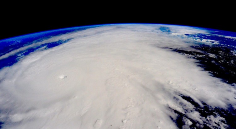
Hurricane Patricia from the ISS. © Scott Kelly (Twitter: @StationCDRKelly)

Patricia Breaks Western Hemisphere Records, Makes Landfall in Mexico

On the 20th of October a tropical depression formed in the Eastern Pacific, well south of Mexico and began drifting slowly northwest into an area of warm sea surface temperatures (SST’s) of about 30°C with low shear.

[map type=”terrain” autofit=”1″ disable_scrollwheel=”1″] [pin]Cuixmala[/pin] [pin tooltip=”La Manzanilla”]Selva de Melaque[/pin] [pin]Puerto Vallarta[/pin] [/map]

Typically hurricanes of this strength are not seen this late in the Eastern Pacific, but very warm SST’s were still present in the area – perhaps influenced by the strong El Niño that is ongoing, provided the fuel necessary for a hurricane of this strength. After drifting northwest without significant intensification early in the week, Thursday is when Patricia began intensifying as it produced a large burst of convection. Patricia intensified to a rate the Western Hemisphere had not seen before – it dropped an incredible 100mb within 24 hours, and at the same time Patricia reached category five status which is the highest category on the Saffir-Simpson scale.
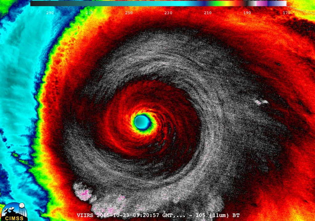
Enhanced IR image of Patricia early Friday morning. (Source: CIMSS)

As it neared its peak early Friday morning, the hurricane hunters flew through the hurricane to sample the environment. The data collected was astonishing; a drop sonde had measured a surface pressure of 883mb with a 45kt surface wind. From this they extrapolated that the central pressure of Patricia was about 879mb at the time of the drop sonde, breaking another Western Hemisphere record for lowest pressure observed. Winds also peaked in Patricia around the same time, where sustained winds were 325km/h, with possible gusts up to 400km/h. Thankfully Patricia’s wind field did not extend very far from its core because it was a fairly compact inner core with pinhole eye – hurricane force winds only extended about 40km from the centre of the storm.
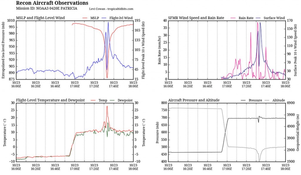
Aircraft data collected Friday morning from the Hurricane Hunters. To note is the top left graph which measured a very low extrapolated MSLP as well as the extremely high winds at aircraft level. In the bottom left graph it's also to note the steep rise in temperature (of about 15C in the eye - the result of subsiding air warming. (Source: @tropicaltidbits)
Aircraft data collected Friday morning from the Hurricane Hunters. To note is the top left graph which measured a very low extrapolated MSLP as well as the extremely high winds at aircraft level. In the bottom left graph it’s also to note the steep rise in temperature (of about 15C in the eye – the result of subsiding air warming. (Source: @tropicaltidbits)

What’s it like flying into one of the strongest ever observed? Here’s a video of the Hurricane Hunters flying in Patricia:

Patricia made landfall as a category five hurricane southeast of Puerto Vallarta, near Cuixmala on Friday evening. Thankfully no deaths had been reported yet out of Mexico as of this morning but significant damage occurred along the coast near La Manzanilla which was both a result of storm surge and the strong winds. After encountering land and terrain Patricia’s inner core quickly collapsed and the system’s biggest threat has now shifted to heavy rainfall. Patricia’s moisture plume is expected to move northeast, helped by an upper level trough, across the Sierra Madres and into southeast Texas. A dangerous flash flooding event is ongoing this weekend in Texas with all the tropical moisture combined with a source of lift present.
Elsewhere in Weather News: July 6th, 2013

Tropical Storm Erick

On Friday a tropical storm – tropical storm Erick, formed off Mexico’s coast, over the Pacific Ocean. Erick has been hugging Mexico’s west but staying over the Pacific. Since it has been staying over warm sea surface temperatures (SST) of about 28-29°C, Erick has had the chance to strengthen and is expected to become a hurricane. It currently has sustained winds around the 80km/h mark. But because of its proximity to land, SSTs gradually decreasing as you head north and a bit shear present, Erick is only expected to intensify into a category one hurricane this weekend. Mexico’s west coast is not in the clear though, cities and resorts such as Manzanillo, Tecomán and Puerto Vallarta are expected to receive heavy, possibly flooding rains from Erick’s outer bands. A hurricane watch has been issued for the region because of Erick.

Erick

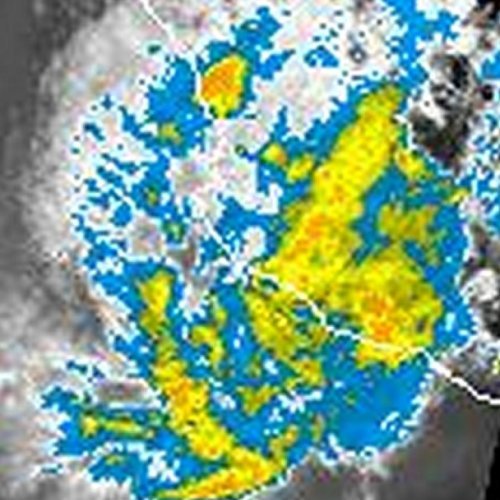
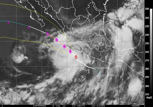
IR picture of tropical storm Erick on Saturday morning. (Source: CIMSS)

After a few days of being close to the coast Erick is expected to take a left turn into the wide open Pacific Ocean and will succumb to its death as SSTs are much cooler and shear will tear the storm apart.

More Flooding in China

In other weather news, China has yet again faced severe flooding because of torrential rains that inundated eastern China and southwestern China. In the southwest it was not uncommon to see 24 hour rainfall accumulations of 200mm from the monsoonal rains. In the east, Shenyang was the hardest hit city where streets were flooded out and houses inundated. The flooding is blamed for 39 deaths this past week in China.

A few sunny days this weekend should let things dry out before the chance of rain will increase again early next week in Shenyang.

Elsewhere in Weather News: May 26th, 2012

Already an Active 2012 Hurricane Season

The first major hurricane of the year for the Eastern Pacific Ocean spun up on May 22 to the south-west of Mexico and will likely make landfall on the west coast. As of Friday afternoon, Hurricane Bud was cruising along at a northerly trajectory as a category one hurricane, packing winds of 120km/h in its core and releasing very heavy rains within its spiral banding.

Hurricane Bud Friday afternoon

Infrared satellite picture of Bud near Mexico’s coast on Friday afternoon. (Source: NOAA)

Bud is forecast to decrease slightly in intensity as it hits the mountainous regions of Mexico’s west coast and interacts with the dry air to its north. However, Bud is still predicted to bring winds from 90km/h to 110km/h, as it makes landfall just to the south-west of Puerto Vallarta, between a weak category one hurricane and strong tropical storm status.

Bud's track

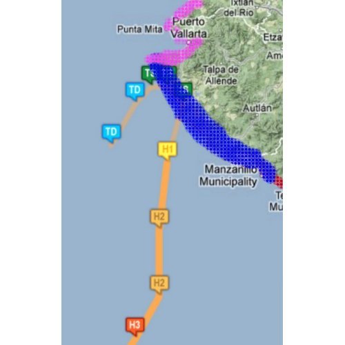
Bud’s track and coastal warnings; in blue a hurricane warning, in red a tropical storm warning, in pink a tropical storm watch. (Source: HEWS/NHC)

The worrisome part of this storm, however, is not the winds that accompany Bud, but the rainfall associated with it. From 150mm to 200mm are expected to fall with even higher amounts locally along the coast. As it makes landfall on the hilly coast, mudslides are a big threat to towns in the vicinity. A hurricane warning has been issued for a small part of the Mexican coast that is sparsely populated in the area where Bud’s centre will make landfall.

Interesting facts on Bud:

  • Bud is the strongest hurricane ever recorded in the Eastern Pacific this early in the year; it reached category three (185km/h) late Thursday night.
  • Only 12 hurricanes have been recorded in the Eastern Pacific in May since 1949, Bud is one of them.
  • Two meter high waves were already experienced on the Mexican coast Friday afternoon ahead of Bud.

Mexico officials say they are ready for Bud; they have cancelled schools in 11 municipalities for Friday and have 15,000 spots ready in rescue shelters if evacuations are needed. Bud will reach land on Friday night and slowly curve back out to the Pacific as a tropical depression by the end of the weekend.

The hurricane season in the Eastern Pacific officially started May 15th and it has already been very eventful at its outset with two named storms. In the Atlantic, where the season officially kicks off on June 1st, an area of low pressure is already forming off the coast of Georgia and has a very good shot of becoming a subtropical/tropical storm by this weekend. So, lots to keep an eye on during this active start to this year’s hurricane season as there will certainly be more to come!

Low off the east coast

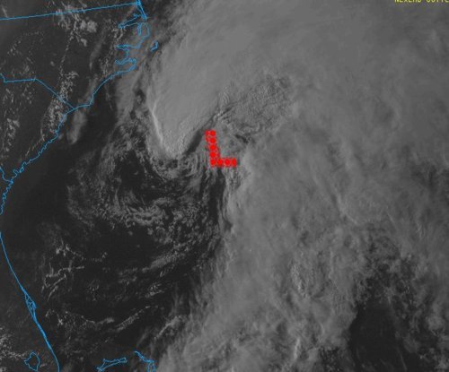
Possible tropical storm forming off the east coast in infrared satellite. (Source: NOAA)