Snowstorm Sweeps across Northeast US, Cold Temperatures Follow
A powerful low off the Atlantic coast impacted the Northeast US this past Thursday/Friday bringing heavy snow to the region and blizzard-like conditions. Blizzard warnings were issued for Cape Cod and surrounding regions as winds howled around 70km/h and heavy snow fell. Conditions did improve snow-wise late Friday, but very cold Arctic air ushered in behind the low was of concern. In total, about 4,500 flights were cancelled out of New York alone, causing problems for holiday travelers. Schools and most government offices were closed in Washington DC on Friday due to the adverse weather conditions. Boxford, Mass appeared to be hardest hit with snowfall totals around 60cm, however, Boston was not far behind with 45cm followed by New York’s 25cm. On Friday night 16 deaths had been reported to be associated with the storm.
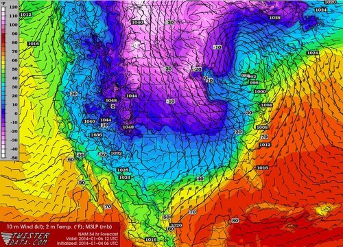
Temperatures are expected to rebound and warm up for the Northeast as another low pressure system approaches, from the west. It will draw in some warm air; highs Sunday (overnight) are even expected to rise in the (positive) double digits making for a 30°C temperature swing in less than 48 hours for parts of the Northeast.

Some potentially record-breaking low temperatures are expected on the horizon for the Midwest behind this system though, as the polar vortex pivots all the way down to the Midwest. On Friday the Governor of Minnesota had already cancelled schools state-wide on Monday in preparation for this next potent blast of Arctic air that will make its way east.
