Cool and Wet Fall Weather Continues, Warmth Returns Next Week…Briefly

Winnipeg will see a few more days of seasonably cool weather and a bit more rain. Relief is on the way to start next week as some sun and warmth return to the region.

Outflow from a departing arctic high will result in a rather breezy day today in the Red River Valley. Winds will pick up out of the south to 30 gusting 50 km/h this morning and will make this afternoon’s high of 11°C feel rather cool. Skies will stay mostly cloudy through the day as well. Tonight, a low pressure system will approach the region from the southwest. The cloud cover will thicken up with some rain spreading into the region for the second half of the night. Temperatures will dip to a low near 6°C.

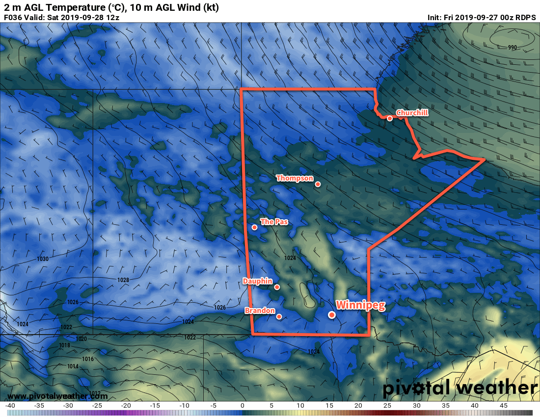
Winnipeg will see periods of rain on Saturday as the low moves through the province. The wet weather will keep things cool with a high near 9°C, but winds will be light much of the day. Later in the afternoon winds will pick up out of the northwest into the 20 to 30 km/h range behind the low, then shift westerly at around 20 km/h for the night. The rain will taper off on Saturday evening; this system looks likely to produce another 10 to 20 mm of rain through the region. Temperatures will nudge down overnight to 8°C.
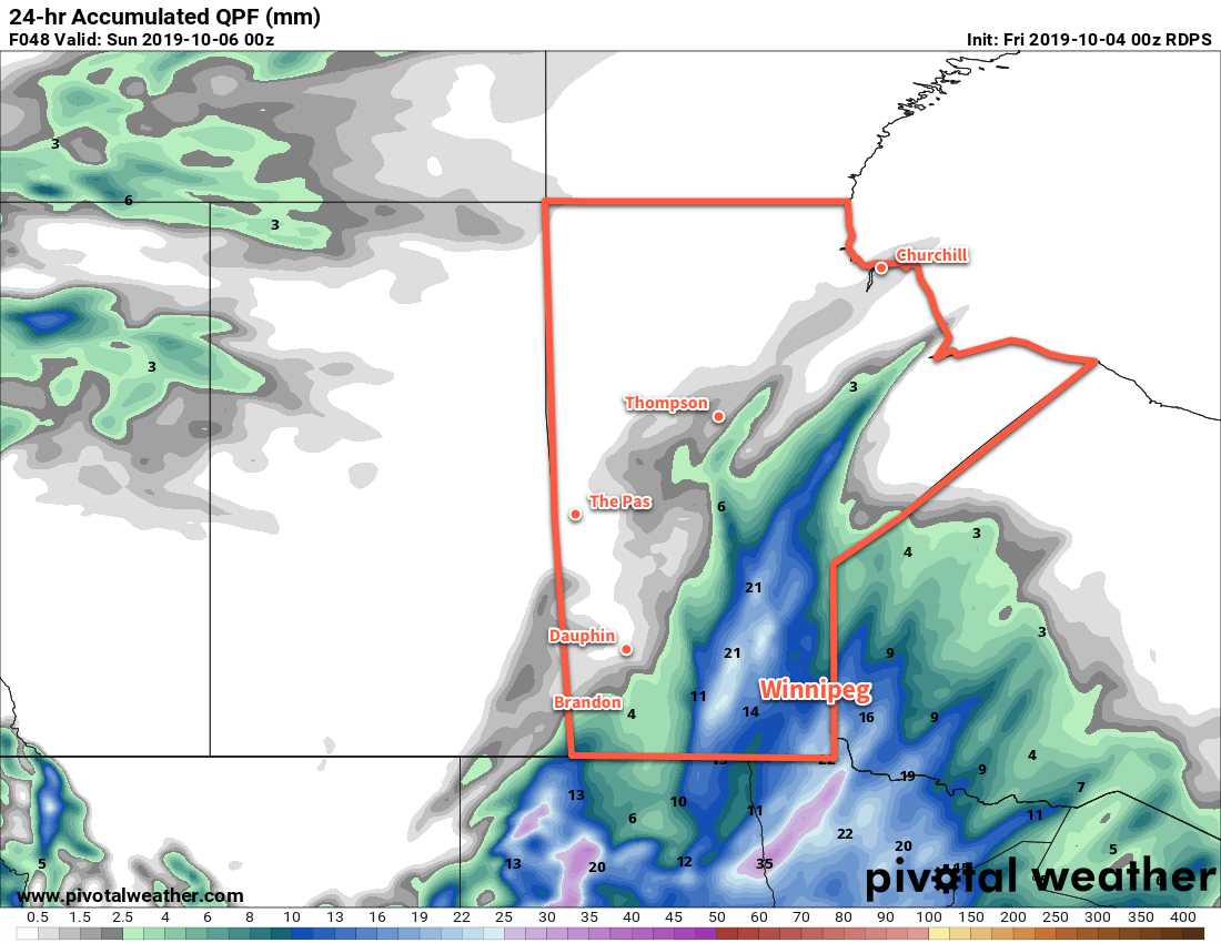
Another batch of rain will spread across the province on Saturday.

On Sunday morning, a few showers will be possible in Winnipeg as precipitation streams off of Lake Manitoba. The best chance looks through the morning hours, then the lake-effect precipitation will likely weaken. The city will see mostly cloudy skies through the day with those westerly winds continuing near 20 km/h. Skies are forecast to clear Sunday night as a ridge moves into the region. Temperatures will plunge as a result to a low near 0°C.

Long Range Outlook

A push of warm air continues to look likely to start next week. Should it arrive as expected, Winnipeg will see temperatures climb into the upper teens for both Monday and Tuesday. Another low is forecast to impact the region mid-week followed by a major surge of Arctic air southwards, plunging the region into a stretch of below-seasonal temperatures.

Today’s seasonal daytime high in Winnipeg is 14°C while the seasonal overnight low is +2°C.
Cold, Wet Weather Continues

Cold and wet weather will stick around in Winnipeg for another few days.

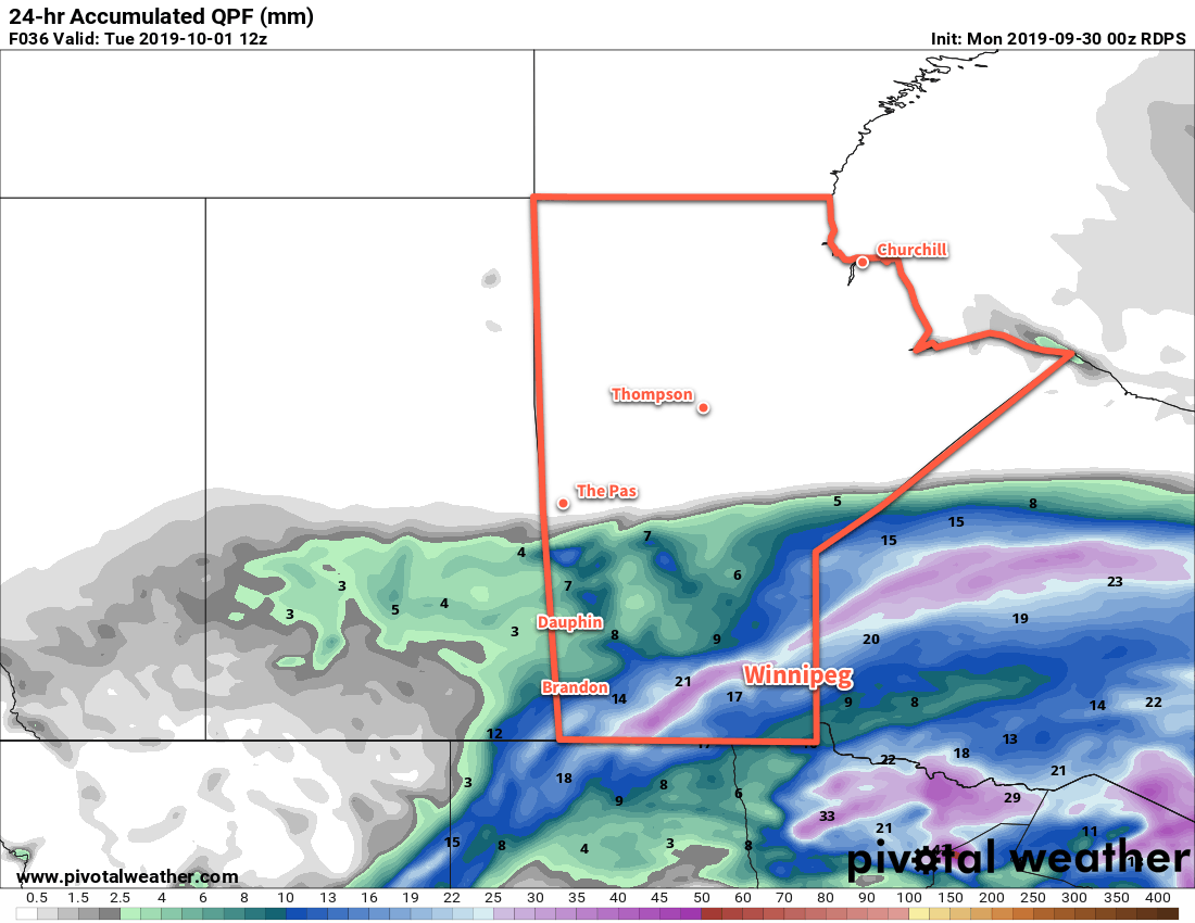
Winnipeg will get another soaking today as more rain moves through the region. The rain will intensify early this morning as the low responsible for all this wet weather moves through the Dakotas. Much of the Red River Valley, including Winnipeg, will see another 15 to 30 mm of rain before it tapers off through the afternoon. Northerly winds near 30 km/h will keep things cool with a high of just 8°C. Temperatures will dip down to a low near +2°C tonight with north-northwest winds of 10 to 20 km/h. Some lake effect snow or rain showers are possible in the lee of Lake Manitoba and Lake Winnipeg tonight.

Another moderate rainfall will occur across southern Manitoba today.

The region will see a brief break from the rain on Tuesday as an arctic ridge moves across the province. It won’t bring much sun, though, with mainly cloudy skies persisting across southern Manitoba. Temperatures will be cool again with a high near 7°C in Winnipeg with northerly winds of 15 to 20 km/h. The chance for lake-effect rain showers or flurries will continue in the lee of the lakes for much of the day. Winnipeg will see a low near +2°C again with light winds tonight under cloudy skies.

Skies will stay cloudy on Wednesday with light winds through the day. Highs through the region will be cool near 6 or 7°C. Yet more rain looks to be on the way on Wednesday night as another low spreads rain out of the U.S. into the Red River Valley. Another 5 to 10 mm is possible on Wednesday night with temperatures heading to a low near +3°C.

Long Range Outlook

Rain will taper off for the rest of the work week with highs climbing back into the low teens. Some sun will work back into the region for Thursday and Friday as well.

That said, another low looks to move towards the region to start the weekend, with another 5 to 10 mm possible on Saturday. Forecasts show things finally settling heading through the latter half of the weekend into next week. Temperatures are forecast to return to seasonal values early next week.

Today’s seasonal daytime high in Winnipeg is 15°C while the seasonal overnight low is +3°C.

First A Frost, Then More Rain on the Way This Weekend

The Red River Valley will see a frost on Saturday morning, then more rain is on the way for Sunday and Monday.

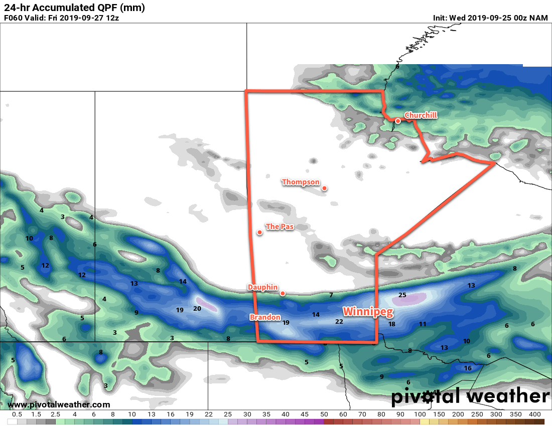
The sun returns today after another 10 to 20 mm of rain drenching in the Red River Valley. Winnipeg will see a seasonably cool high near 12°C as an Arctic ridge builds into the province. Winds will be light out of the northwest at 15 to 25 km/h. That Arctic ridge will bring frost to the region tonight with lows dropping to -1 or -2°C through the valley. Winds will be light overnight with a few clouds lingering.

Much of southern Manitoba will see frost tonight as temperatures drop below 0°C early Saturday morning.

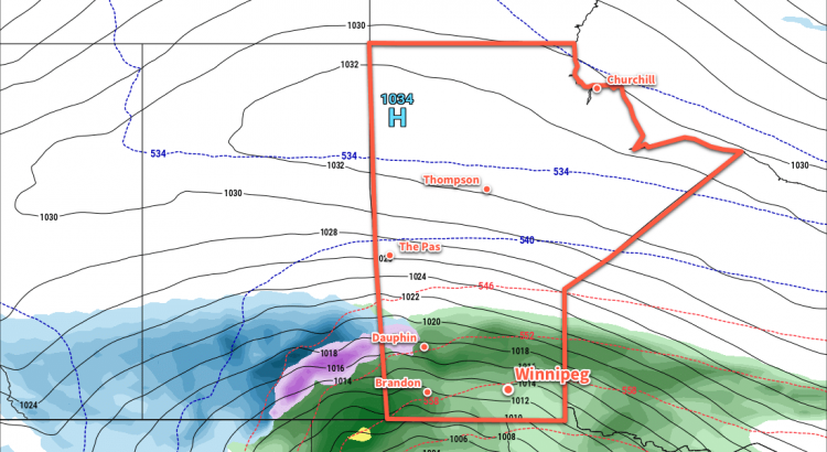
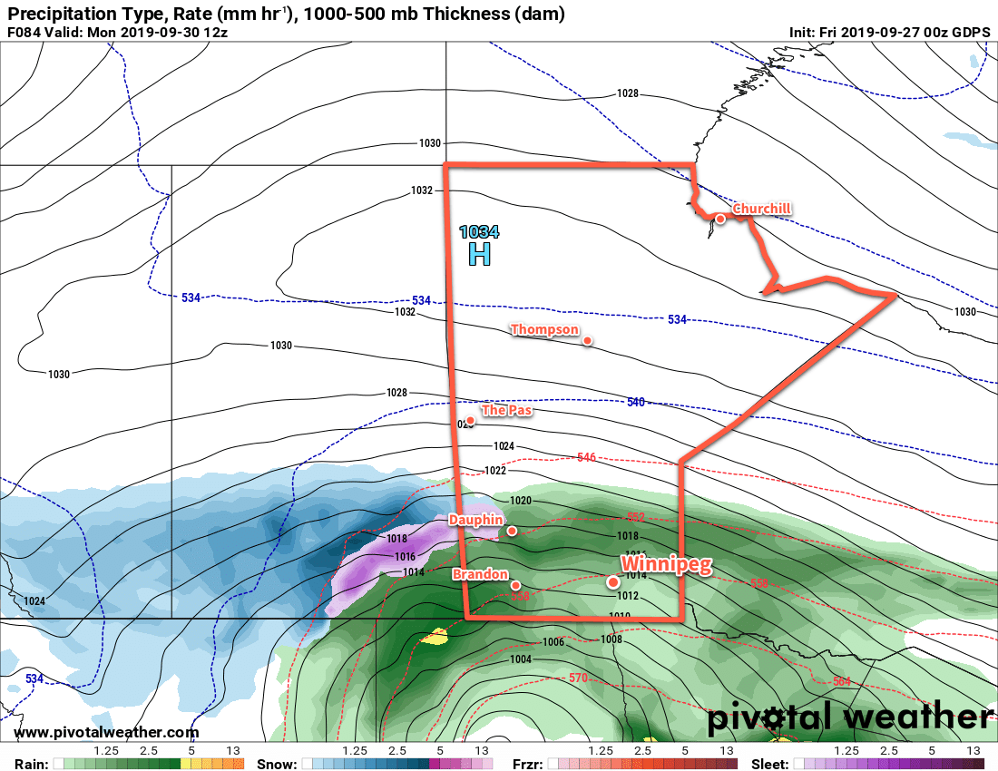
That Arctic ridge will remain in place on Saturday, keeping winds light and temperatures cool. Winnipeg will see a high of 10°C with increasing cloud cover. The cloud will be thickening up ahead of a major fall storm that will impact the entirety of the southern Prairies. What will be a major snow storm for the Alberta Foothills will transition to a mix of rain and snow across Saskatchewan and to primarily a rain event for Manitoba. Rain will spread northwards through the Red River Valley on Saturday night with temperatures dipping to a low near +4°C. The wind will pick up overnight as well, increasing out of the northeast to 30 km/h by Sunday morning.

More rain is on the way for Manitoba on Sunday into Monday, but this fall storm will bring significant snow to portions of Saskatchewan and Alberta.

Southern Manitoba will see more wet weather on Sunday with periods of rain moving through the region. Winnipeg will see a cool high near 7°C with moderate northeasterly winds of 30 to 40 km/h through the day. Periods of rain will persist through Sunday night with temperatures remaining steady. Much of the region will likely see 15 to 25 mm of rain through Sunday to Monday morning.

Long Range Outlook

The Red River Valley will see more rain on Monday with another 10 to 20 mm possible. Rain will taper off Tuesday, but cool temperatures and a brisk northwest wind will likely result in some lake-effect precipitation. The rest of the week looks dry with below-normal temperatures.


If you have plans to travel west across the Prairies on Sunday through Tuesday, keep in mind that this system will bring significant snowfall to some areas in Saskatchewan into southern Alberta. Check ECCC’s forecasts for not only your destination but also stops along the way to ensure you don’t hit any unexpected winter driving conditions.

Today’s seasonal daytime high in Winnipeg is 15°C while the seasonal overnight low is 4°C.

Unsettled Weather Leads Into Extended Cool Stretch

Winnipeg will see a couple more chances of rain before the entire region plunges into an extended period of seasonably cool conditions.

A breezy day lies ahead for Winnipeg as an unstable northwest flow moves over the region. Winds will pick up to 30 gusting 50 km/h today as temperatures head to a near-seasonal high of 15°C. There should be plenty of sun this morning, but skies will become mixed as it warms up. The chance for a few scattered showers will develop for the afternoon. Winds will ease this evening with clearing skies. Temperatures will dip to a low near +4°C with more cloud cover pushing in early Thursday morning.

The next low pressure system to affect the region will approach through on Thursday, spreading more cloud cover in through the day. As a result, Winnipeg will see mostly cloudy skies for much of the day. The day will again see seasonal temperatures with a high near 16°C and west-southwest winds near 20 km/h. Unfortunately, it’s going to be the last day we see seasonal conditions for a while. By late in the day, rain will spread across the Red River Valley. Most regions will see several hours of wet weather that will taper off overnight. Temperatures will head to a low near 5°C with winds shifting to the northwest. Much of the Red River Valley looks to receive close to 10 mm of rain by Friday morning with local amounts up to about 20 mm possible.

Rain will spread across southern Manitoba on Thursday night with most areas seeing 10 to 20 mm by Friday morning.

Brisk northwest winds near 30 km/h will usher in a cooler, drier air mass on Friday. The cloud cover will break up early, leaving behind mixed skies for most of the day. Temperatures will be seasonably cool with a high of just 10°C. The region will see just a few clouds lingering on Friday night as the winds taper off. Temperatures will dip to a low near +1°C with a chance of frost.

Long Range Outlook

Cool weather will persist right through much of next week with daytime highs in the upper single digits for much of that time. Saturday should bring some sun to the area, but with northerly winds and cool temperatures the chance for lake-effect showers will develop.

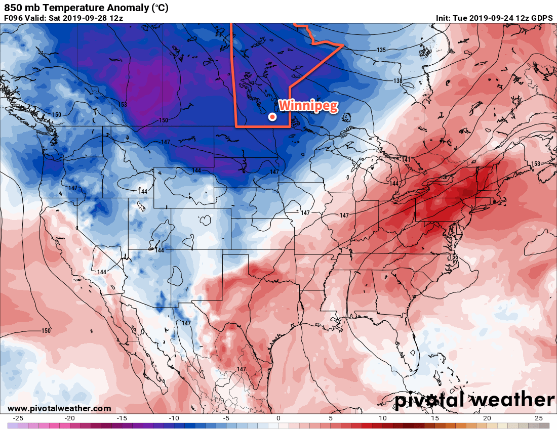
An extensive push of colder than seasonal temperatures will develop this weekend, persisting through next week.

Widespread unsettled conditions look to return with another disturbance lifting out of the United States for Sunday into Monday, potentially lingering into Tuesday. How far north the rain from that system will be able to push is still uncertain, however, and could end up falling just short of the Canadian border.

Today’s seasonal daytime high in Winnipeg is 16°C while the seasonal overnight low is 4°C.