After a few lingering showers clear out today, Winnipeg will see a couple days of drier weather with temperatures returning to seasonal values.
Winnipeg will still see plenty of cloud today as an upper low slowly exits the region. Much of the organized rain has left the region, but lingering showers are possible through much of the day. With all the cloud along and the lingering cold air from the upper low, temperatures will once again be cool with a high near 20°C. The cloud cover will break up this evening, leaving Winnipeg under partly cloudy skies with a low near 11°C.
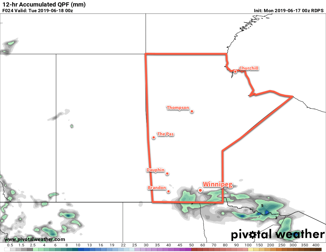
A few more showers are likely today across southern Manitoba.
Tuesday will bring mixed skies to the city with a near-seasonal high of 23°C. A few afternoon showers are possible, but they will likely develop primarily south of the city. Tuesday night will bring mainly clear skies with a low near 12°C.
On Wednesday, morning sunshine will give way to mixed skies in the afternoon. The city should stay dry right through the day and temperatures will climb to a high near 24°C. The city will continue to see mixed skies through Wednesday night as temperatures dip to a low near 14°C.
Long Range Outlook
A major pattern change will occur on Thursday as a series of significant low pressure systems affect the region right through the weekend. These systems will have the potential of bringing moderate to heavy rain across the region. This rain will be convectively driven, though, and may end up being a bit hit and miss as waves of precipitation move through. That said, it likely means that Winnipeg will see mainly cloudy skies through the second half of the week with several chances for showers or thunderstorms.
Today’s seasonal daytime high in Winnipeg is 24°C while the seasonal overnight low is 11°C.
Winnipeg will continue to see pleasant weather through the second half of the week. A few showers are possible Thursday afternoon into Friday morning as a weak low pressure system moves through the region.
A ridge of high pressure over the region today will ensure that Winnipeg sees mainly sunny skies through the day. Temperatures will continue at slightly below-seasonal values with a high near 19°C. The lack of wind and ample sunshine should help it still feel rather nice outside, though. Winds will remain light tonight with temperatures dipping to a low near 8°C under clear skies.
Thursday will start off sunny, but a weak warm front moving into the region in the afternoon will bring more cloud and a chance of showers. Winds will pick up out of the south-south-west into the 20 to 30 km/h range, pushing temperatures temperatures to a seasonal high near 23°C. A low pressure system will move through the region overnight, keeping cloudy skies with a chance of showers around through the night. Temperatures should dip to a low near 11°C with light winds.
Friday should start off with a few showers exiting the region, then a bit more sun returning. Temperatures will climb to a high again near 23°C with a northerly wind near 20 km/h. Winnipeg will likely see partly cloudy skies on Friday night with a low near 10°C.
Long Range Outlook
The weekend should bring Winnipeg near-seasonal temperatures and variable cloudiness. Winnipeg won’t likely see any significant chances of rain until sometime early next week. Forecasts show a more unsettled pattern developing over the region, bringing slightly warmer temperatures alongside plenty of cloud and a chance of precipitation.
Today’s seasonal daytime high in Winnipeg is 23°C while the seasonal overnight low is 10°C.
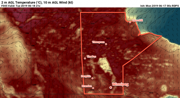
Today will be a scorcher over southern Manitoba as strong southerly wind pump hot and increasingly humid air northwards. With that heat, though, will come a fair amount of instability and one of the first widespread severe thunderstorm threats of the season.
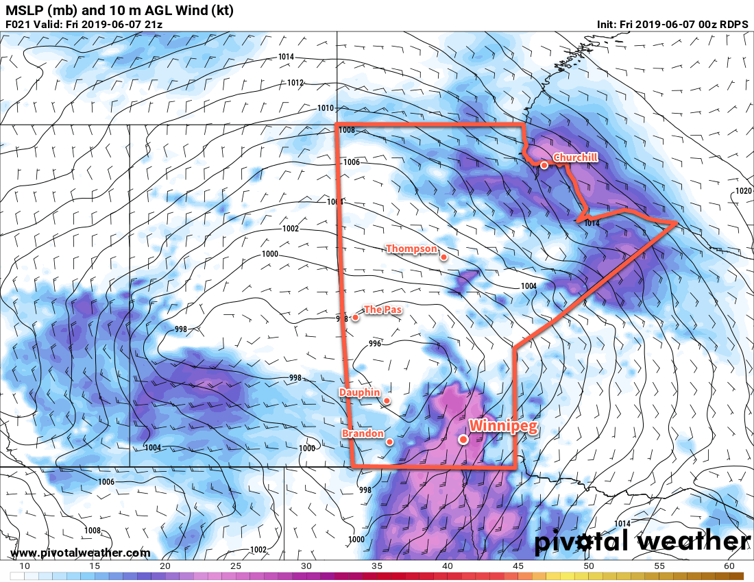
To start the day, some elevated convection will move across the region, most likely through the Interlake. These thunderstorms may be strong to severe, but should remain north of the Red River Valley. Although the storms should pass north of Winnipeg, the city will still see some passing cloud as they move by. These storms and their cloud cover should clear out by midday. As the sun comes out, the wind will pick up. A tight pressure gradient over the region1 will produce southerly winds up to 50 gusting 70 km/h today, helping heat and moisture surge northwards out of the United States. With those strong winds in place, Winnipeg will see temperatures climb to a high near 33°C. It will also get a tad more humid as the day goes on as dew points rise into the mid-teens.
Strong southelry winds will be in place over southern Mantioba this afternoon. To the west, a trough of low pressure extending southwards into the United States may trigger a line of thunderstorms late in the day.
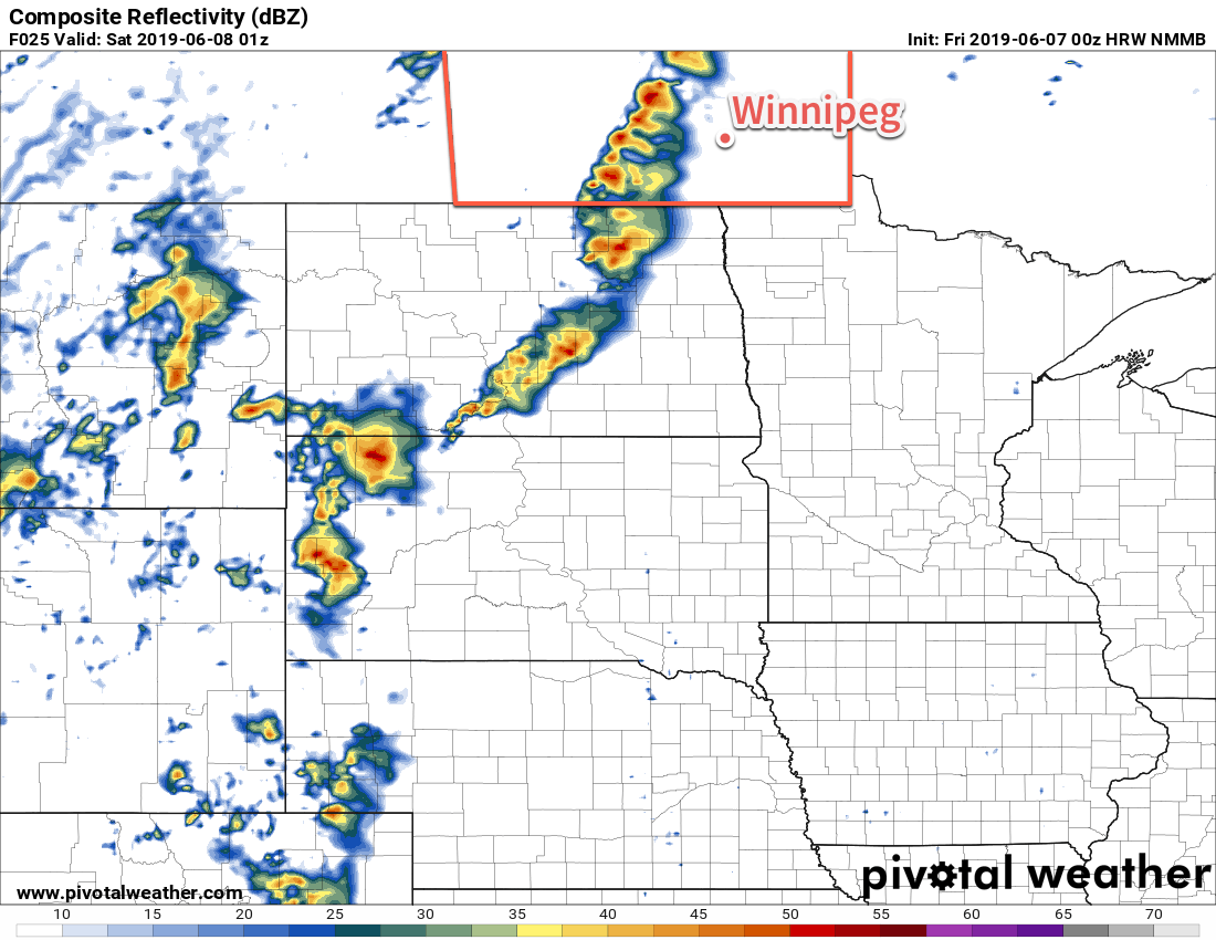
By late in the afternoon, the thunderstorm threat will begin to build. A trough of low pressure over southwestern Manitoba into the Interlake may trigger the development of thunderstorms. If they develop, they’ll likely be strong to severe with primary threats of large hail and strong winds. Any of these thunderstorms that develop will move eastwards towards the Red River Valley through the evening. The focus then turns southwards to the Dakotas. A shortwave lifting northeastwards through the state will trigger convection late in the day. These thunderstorms will grow upscale and expand in coverage overnight. As the evening progresses, this blossoming area of thunderstorms will gradually spread across southern Manitoba. The potential for strong to severe thunderstorms exists tonight, with large hail and damaging wind gusts the primary threats. The thunderstorms should be through the Red River Valley by Saturday morning.
Temperatures will remain mild on Friday night with a low near 19°C. Those strong southerly winds will ease into the 20 to 30 km/h range this evening and then diminish to light overnight.
If thunderstorms are able to develop along the trough, southern Manitoba may see a line of thunderstorms marching towards the Red River Valley early in the evening.
Saturday will bring plenty of cloud to Winnipeg as the low pressure system responsible for all this heat and instability moves through. Temperatures will be much cooler with morning temperatures near 18°C dropping to 14°C through the day. Winds will gradually pick up out of west into the 20 to 30 km/h range. More showers with the risk of thunderstorms are likely to develop later in the morning and persist through much of the afternoon. Conditions will calm down on Saturday night with some clear breaks developing towards Sunday morning. Winnipeg should see a low temperature near 9°C.
Sunday will bring seasonably cool conditions to Winnipeg, but things will get a chance to dry out. The city should see a high near 19°C under partly cloudy skies. Westerly winds near 30 km/h will be in place for much of the afternoon before diminishing in the evening. Winnipeg will see a low near 8°C with just a few clouds on Sunday night.
Long Range Outlook
Next week will bring seasonably cool temperatures with daytime highs around 20°C and overnight lows close to 10°C. The city will see variable cloudiness through the week, and a couple of passing disturbances may bring a chance or two of showers through the week. Temperatures should begin to warm up near the end of the week, but that may bring a return to unsettled conditions.
Today’s seasonal daytime high in Winnipeg is 23°C while the seasonal overnight low is 10°C.
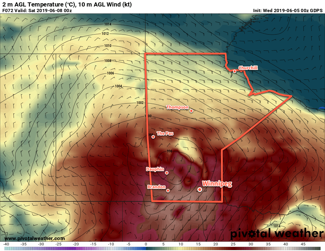
The tight pressure gradient is a result of a 996 mb low over western Manitoba squishing against a ridge of high pressure extending through SE Minnesota into Iowa.
Warm weather continues in Winnipeg for a couple more days, but unsettled conditions will develop on Friday into the weekend.
Winnipeg will see mainly sunny skies today with temperatures climbing to a seasonably mild 26°C. Winds will be light for much of the day, then increase out of the south to around 20 km/h as a low pressure system approaches. The city will see a few clouds through the evening with a marginal chance of a passing shower or thunderstorm. It looks unlikely that Winnipeg will see anything, but the potential is there. Temperatures will head to a low near 12°C overnight with clearing skies.
Thursday will be a gorgeous day across the region as the upper ridge begins building in. Temperatures will climb to a high near 26°C under sunny skies with light easterly winds. The wind will pick up overnight into the 20 to 30 km/h range out of the southeast as a developing low pressure system strengthens over Saskatchewan. These breezy winds will help keep temperatures warm with a low of just 16°C expected. By early Friday morning, some cloud will spread into the region along with a chance of a thunderstorm.
Very warm temperatures will move into southern Manitoba on Friday.
For Friday, a high-amplitude trough-ridge pattern over the Prairies will drive the weather. This upper flow will result in the gradual strengthening of a slow-moving low pressure system near the Saskatchewan/Manitoba border. For Winnipeg, that means a breezy southerly flow tapping into hot air mass over the northern Plains. With winds in the 30 to 40 km/h range, temperatures will climb to a high near 30°C under a mix of sun and cloud. The city may see a chance for a thunderstorm early in the day, then the chance redevelops for Friday night. Temperatures will stay warm on Friday night, dropping only to around 20°C with southerly winds continuing.
Long Range Outlook
Early indications show a rather unsettled weekend for Winnipeg. Friday’s low near the SK/MB border will stall over the province, bringing several chances for rain or thunderstorms to the city through the weekend. The weekend will start warm, but should cool towards seasonal temperatures for Sunday. Next week looks to bring settled conditions with near-seasonal temperatures.
Today’s seasonal daytime high in Winnipeg is 22°C while the seasonal overnight low is 9°C.