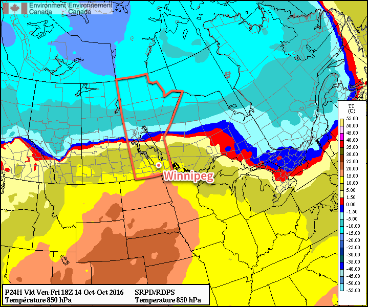
Cooler, more seasonal temperatures will push into Winnipeg & the Red River Valley this weekend behind a low pressure system that will bring rain to portions of Southern Manitoba on Friday.
Today will bring a low pressure system, talked about in Wednesday’s forecast, through the province. In that post, we discussed how there was uncertainty in the track of the low, and that it seemed like much of the rain associated with it would fall across the Interlake. With the system imminent now, it’s become readily apparent that it will indeed primarily affect areas to the north of Winnipeg, at least for much of the day today.
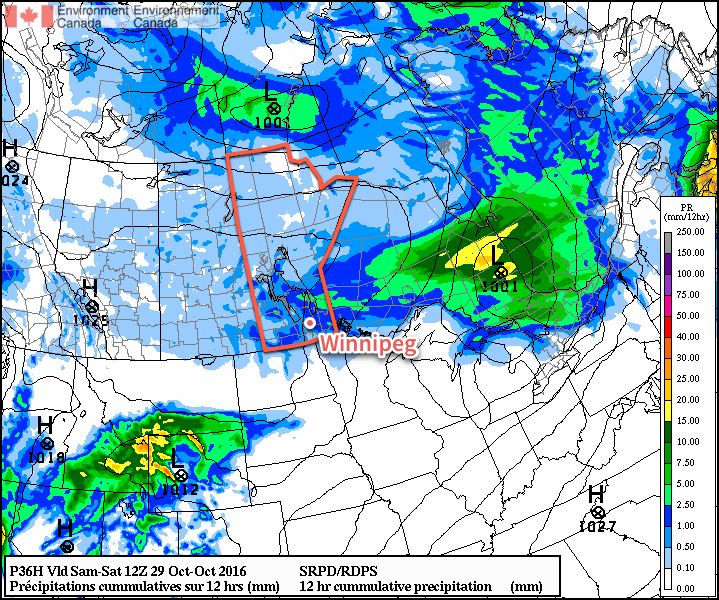
Today will be a cloudy one across Winnipeg & the Red River Valley with light winds and temperatures climbing to a high near 12°C. Late this afternoon, winds will pick up out of the northwest to around 30 km/h, bringing with them a chance of some rain as a cold front sweeps southwards across the province. No significant accumulations are expected in Winnipeg, unlike the further north where 15-25 mm are possible along a west-east line running from Swan River eastwards across the Northern Interlake and Berens River.
With the gusty northerly winds and light showers tonight will come dropping temperatures. Lows should sit near 2°C tonight with winds tapering off towards Saturday morning. With the cooler temperatures and northwesterly winds, there may also be more persistent shower activity in the lee of Lakes Manitoba & Winnipeg as a result of weak lake-effect precipitation.
Saturday will be a mainly cloudy day with light winds and a much cooler, more seasonal high near 6°C. Expect continued cloud cover on Saturday night with lows near 1°C.
Sunday will start off cloudy but will likely bring an occasional sunny break in the afternoon. Temperatures will continue seasonal with a high near 8 or 9°C, but the wind will be more noticeable as it picks up out of the south to around 30 km/h once again. There’s a slight chance that it could end up even slightly windier than that, with sustained winds near 40 km/h, but at this point guidance suggests winds will be closer to the 30 km/h mark.
Expect a low on Sunday night near 5°C under partly cloudy skies.
Long Range
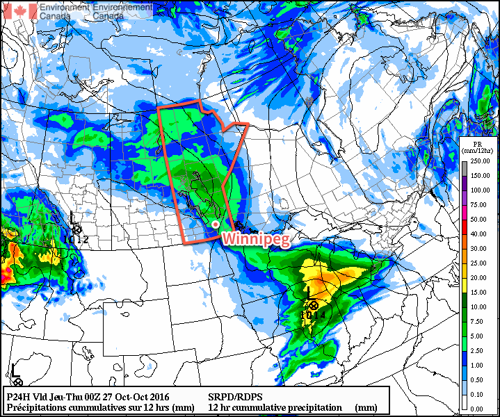
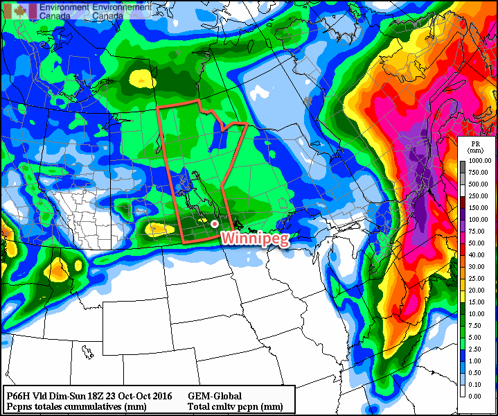
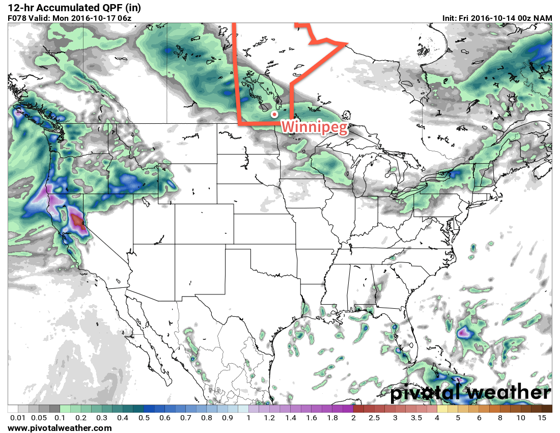
Guidance continues to be fairly consistent in a low pressure system moving through the province on Monday that will bring a soaking rain to much of Southern Manitoba. It’s a bit early for exact numbers, but general amounts 10-25 mm have been consistently produced by guidance over the past several days. After that system moves through, an upper ridge will build into the southern Prairies and…
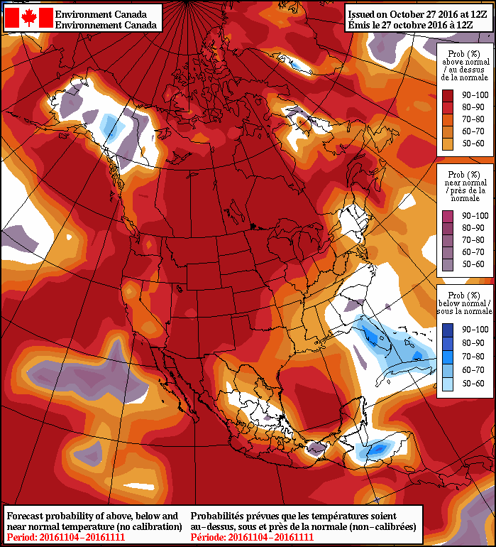
Dry weather with an extremely high likelihood of above-seasonal temperatures will be on the way for Southern Manitoba, alongside much of North America, through the second half of next week. So hang tight, it looks like we have some beautiful November weather ahead!
Winnipeg’s seasonal daytime high is currently 6°C while the seasonal overnight low is -4°C.