Showers and Unsettled Weather

Showers will be the story of the day in Winnipeg as an upper trough swings into the RRV today. A band of showers will push in this morning and entrench itself as a low pressure system pushing northwards out of the United States reinforces the area of rain parked over the Red River Valley.

An upper low has pushed into Alberta, drenching the province in rain and snow, with some areas expecting 30-40mm of rain while some regions in the Foothills are getting 10-20cm of snow. For us here in Manitoba, a band of rain running along a line from Dauphin to Grenta to Grand Forks will push over the entirety of the Red River Valley and stall out. In Winnipeg, we’ll get up to around 10°C today with a blustery southeast wind. Showers will slowly weaken in the afternoon before reintensifying as a low pressure system lifts northwards out of North Dakota in the evening. Precipitation will blossom as the entire system spins up and strengthens with cooler air beginning to slump southwards across the Prairies on the backside of the main surface low.

Accumulated QPF valid Saturday Evening

Total accumulated precipitaiton from the GEM-REG model valid from 00Z today through 00Z Sun 15 April (Saturday evening). This image is what the GEM-REG model believes the 2-day rainfall totals will be.

The showers will clear out from Winnipeg on Saturday morning leaving us with a mix of sun and cloud and a daytime high around 12°C. Things cloud up again on Saturday evening as band of scattered showers pushes southwards along the cold front. We’ll be left with sunny skies on Sunday with a high near 10°C.

Total rainfall through the next few days will vary depending on exactly how much convection ends up embedded within the rain, and we’ll only be able to tell that as things develop. In general, though, the following are the expected amounts:

  • Winnipeg: 10-15mm
  • Altona: 10-20mm
  • Emerson: 10-20mm
  • Morris: 10-15mm
  • Steinbach: 10-15mm
  • Winkler: 15-25mm

Areas in Southwestern Manitoba, including Brandon, Pilot Mound, Melita and Virden will see greater amounts than locations in the RRV, with general accumulations around 1”. As usual, we’ll have updates in the comments below!

Springtime Low to Bring Cooler Weather This Weekend

A low pressure system tracking through western and central Manitoba will bring unsettled weather, cooler temperatures and windy conditions to the Red River Valley this weekend…but not before one more beautiful day.

Forecast surface temperatures

Forecast surface temperatures for mid-afternoon today.

Conditions will be fairly uniform across the Red River Valley today with plenty of sunshine, highs near 20°C and a stiff southerly wind blowing at 40 to 50km/h. It’s a fitting end to another simply beautiful, and above normal with regards to the temperature, week. Tonight, a low pressure system will eject out of southeast Saskatchewan across Parkland Manitoba and into the Interlake. Associated with this low is a very strong 40kt low-level jet (LLJ), however a lack of moisture and unimpressive mid-level lapse rates should erase any concerns (or hopes) of nocturnal convection.

A cold front will sweep across the Red River Valley on Saturday morning, bringing a chance of showers to most regions; indications are that areas east of the Red River will see a greater chance of a shower or two than areas west. After the passage of the cold front, the entire RRV will be left with a fairly strong westerly wind and cloudy skies.

Accumulated Precipitation

Total accumulated precipitation from 00Z Friday to 00Z Monday. This shows the relative lack of precipitation over SW Manitoba and the RRV; a stark contrast to the copious amounts of precipitation that are forecast over Eastern Saskatchewan and Western Manitoba.

The wrap-around precipitation will begin to move into the RRV on Saturday night, coincident with colder air diving southwards on the backside of the low. Current indications are that the precipitation will fall as snow and that the northern half of the RRV has a much greater chance of seeing flurries than the southern half. The low continues to lift NE through the day Sunday, pulling the wrap-around northwards with it and out of the RRV. It will be a struggle between the main area of lift pulling north and remnant moisture and instability in the cooler air left in the RRV. Most areas in the RRV will likely see a little bit of snow on Sunday, however the only areas that might accumulate a cm or two would be north of Morris.

All in all, we’re being spared with this system, as large amounts of precipitation are forecast from the Moose Jaw/Regina, SK region along a line NE to Swan River and The Pas. The GEMGLB is currently painting up to 75mm of precipitation, which if that were to all fall as snow would likely end up as 1-2 feet of the white stuff. We’ll see how much actually falls, though, as the GEMGLB can have problems with convective feedback in situations where embedded elevated convection is a possibility along a warm front. Anyone planning to travel to Saskatchewan today or on the weekend should make sure they check road conditions and weather forecasts for cities/towns along their route before they leave.

After that things clear out for the start of next week and our temperatures rebound back into the low teens by midweek. Things are looking like we’ll have continued sun and warm temperatures into next weekend as well.

Continuing Unsettled Weather

Southern Manitoba will continue to see unsettled weather through the weekend with system after system tracking through our region. Despite this, temperatures will remain above normal, contiuning this month’s summer-like trend.

We’ll start off with clear skies this morning with patchy fog through the Red River Valley which will burn off by mid-to-late morning as that late-March sun gets to work. We’ll see our temperature get up to 12 or 13°C before skies cloud over mid-to-late afternoon. Most areas in the Red River Valley, including Winnipeg, will then have a chance of seeing some showers as a weak warm front pushes eastwards through the area.

GEM-REG Precipitation for Friday Night

GEM-REG Accumulated Precipitation for Friday night.

Overnight, much of the Red River Valley has a decent chance to see rain as the mid-levels destabilize with an injection of cold air at 700mb associated with a shortwave tracking through Central Manitoba. Positioning of the shortwave will be crucial to where the precipitation falls, but current indications are that an area of rain will blossom overnight near Brandon and travel east, with lighter showers south of the Trans-Canada Highway and 4-8mm of rain along and north of the TCH.

That rain will clear out by midday Saturday, and the Red River Valley will be left with just a few clouds and beautiful temperatures around 15°C.

24-Hour Precipitation Accumulation Monday Evening to Tuesday Evening

24-Hour Precipitation Accumulation from Monday evening to Tuesday Evening

It was not mean to last, however, as yet another low begins it’s trek into the Prairies. Winnipeg will get to 11 or 12°C before more clouds push in by mid-afternoon. Light rain will push into the Red River Valley overnight Sunday and then intensify Monday morning, dropping another 5-10mm of rain before it pulls out on Monday evening.

All of these systems are sensitive to exact tracks of subtle features, so we’ll be sure to provide updates in the comments as the weekend progresses. In short, for much of the Red River Valley, the next few days will be unsettled with pleasant temperatures in the low-to-mid teens when the sun manages to poke out and showers/rain every 24-36 hours.

Unsettled March Weather Continues

Southern Manitoba played host to almost all the different kinds of weather out there, with many locations seeing almost any combination of thunderstorms, hail, rain, drizzle, snow and blowing snow. A system that brought heavy snowfall to Western Manitoba and the Interlake region as well as thunderstorms and rain to the Red River Valley and Southeast Manitoba has trundled off into Ontario; we’re not out of the woods yet, though, as another system is set to quickly make it’s way into the province by tomorrow morning.

Hail Accumulation

Photo of accumulated small hail at a downspout exit. Winnipeg was hit with hail from this size up to as large as dimes as a thunderstorm pushed through the city at around 2:30AM on Tuesday morning.

For today, we’ll see cloudy skies with a chance of a few remnant flurries this morning. We’ll see a daytime highs of only 2°C or 3°C through the RRV. Another low pressure system is already on it’s way to Manitoba, however, with the parent upper trough making landfall on the Oregon coast last night. This trough will advect eastwards and rotate northwards into the Central Prairies, bringing with it a warm front that will bisect the Prairies and slowly push eastwards.

This warm front is expected to push through the Winnipeg and the Red River Valley through the day on Thursday. Current indications are that we’ll be far enough south that we won’t have to worry about snow, that should be reserved for areas a bit further north in the Interlake region. We’ll see rain push in tomorrow morning around mid-morning and clear out by early evening. Rainfall totals currently look to be fairly uniform through the Red River Valley with totals around 10-15mm, however it does look like there’s a good chance for some enhanced convective areas which will result in fairly heavy showers interspersed through the general area of rain.We’ll enjoy warmer temperatures through the rest of the week, with the warm air pushing through bringing our daytime highs up to around 10°C.

We’re not out of the woods quite yet, though, as another low is forecast to track through the southern Interlake region bringing rain to areas along and north of the Trans-Canada Highway Friday night and Saturday morning. Current indications are that regions south of the Trans-Canada Highway will only see some scattered showers with this system.

8-14 Day Temperature Anomaly Outlook

NAEFS 8-14 Day Temperature Anomaly Outlook, valid for April 4 – April 11.

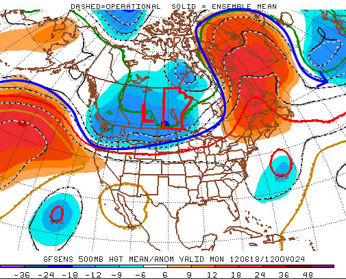
With a the passage of Tuesday’s weather system, North America has transitioned into a much different weather pattern that that which brought us our record-busting heat wave. With the blocking high collapsed over the SE United States, the summer-like heat will be contained further south in the Central and Southern Plains of the United States. Fortunately, the bitterly cold Arctic air that’s still omnipresent north of 60 will remain bottled up. So what does that mean for us? As the image above shows, ensemble forecasts are showing a moderate chance of above normal temperatures, however nothing nearly as certain as what was being predicted a couple weeks ago. The long-wave pattern has shifted to favor more frequent disturbances tracking through the Prairies, which should result in temperatures that may still be slightly above normal, but we’ll likely also see more precipitation than we had through much of March.