Dry Streak Finally Over

In a new post over at Rob’s Blog, Rob describes exactly how dry it has been this summer in Winnipeg. I recommend you head over and read it, but the highlights are:

  • This summer the CYWG airport site recorded 93.0mm of rain from June to August.
    • This value is over 140mm below average
  • This year was the driest summer since 2006, when only 91.5mm of rain was recorded.
  • Southwest Manitoba and the Southern RRV experienced near-normal amounts of rain while the Northern RRV and Eastern MB experienced the dry conditions this summer.
  • This summer was the 5th driest summer on record.

Be sure to head over to Rob’s Blog to see the whole post and some more details on this summer compared to climatology. All in all, if you enjoy the sun, this summer in Winnipeg has been the summer for you!

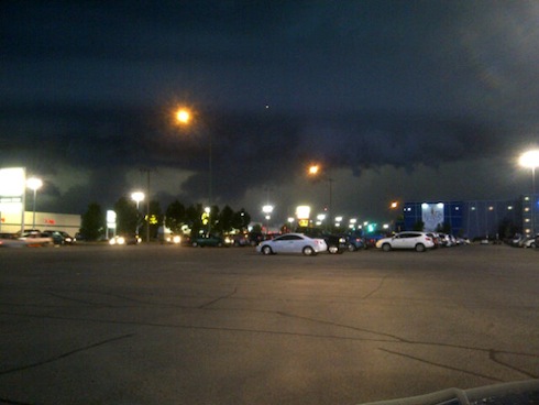
The hot and dry weather came to an abrupt end early Thursday morning when Winnipeg received ~20mm of rain as a large complex of thunderstorms rolled through Southern Manitoba, giving large amounts of rain and winds as high as 110km/h over portions of extreme Southern MB. After a day of sun with much cooler temperatures, Winnipeg is set to likely receive another round of showers tonight. Read on to find out what’s in store!

18:15Z Water Vapor Image
Water Vapor (7µm) Image of Canada from 2:15PM CDT. L – Low; Blue Line – Cold Front; Red Line – Warm Front; Green Arrows – Expected Track of Low

A moderately strong upper low is tracking southeastwards across the Prairies today and will slump to the International Border near Melita by late this evening and then slide east along the border, crossing over the RRV overnight. A frontal wave associated with this system will mirror its parent’s motion and slide along the same track ahead of the system, arriving at the western edge of the RRV by early-to-mid evening.

6 Hour QPF from GEM-REG 12Z Model Run valid at 06Z 03 Sept. 2011
6 Hour QPF from GEM-REG 12Z Model Run valid at 06Z 03 Sept. 2011 (1AM CDT)

Showers and isolated thunderstorms will develop along the warm front early this evening, pushing into the RRV around midnight. The rain will push across the RRV and through Winnipeg overnight. Most of the RRV will see only 2-4mm of rain, and there is no risk of severe thunderstorms. Perhaps a bigger story with this system is rainfall totals in areas north of the the low track.

24 Hour QPF from GEM-REG 12Z Model Run valid at 12Z 03 Sept. 2011
24 Hour Total QPF from GEM-REG 12Z Model Run valid at 12Z 03 Sept. 2011

The above picture shows the total amount of rain that is expected to fall from Friday 7 A.M. CDT to Saturday 7 A.M. CDT. Over 40mm of rain are expected to fall across portions of Eastern Saskatchewan, across the Parkland areas of Manitoba including Dapuhin and Minneodsa, through the Interlake and into Northwestern Ontario.


For Saturday, Winnipeg and the rest of the RRV will see the chance of showers as the cold front pushes through in the morning. By early afternoon things will begin to stabilize with the passage of the front, and most of the RRV will see winds of 30-40km/h behind the cold front with gusts up to 60km/h.


Chart of 500mb Heights and Temperatures valid for the evening of Wed. Sept. 7

Things look calm in the long-term, as after this system the upper ridge begins to redevelop aloft. It will continue to intensify through the next week, bringing sunny skies and the return of warmer weather. We should see relatively light winds most of next week with daytime highs in the mid-20’s. Summer isn’t over yet!

Powerful Thunderstorm Rips Through Winnipeg; What’s Next?

Winnipeg Lightning
Photo by Phil Hossack, The Winnipeg Free Press

A powerful thunderstorm developed rapidly along an advancing cold front last night, pounding the city with heavy rain, strong winds and hail. Things looked like they would pass north of the city until the front reached about 30-40km west of Winnipeg, where rapid southward development of the existing storm line occurred. This storm, a rarity this summer, comes after a month and a half of hot, dry weather where thunderstorms constantly split as they approached the city and passed north of our south of the area. For storm lovers, we couldn’t have asked for more from a late-evening thunderstorm: great structure in the clouds, much-needed rain, some hail, and one of the most impressive light shows I’ve seen in a long, long time. Read on to see pictures and video of this storm in action!

I was able to capture this video from the west-end of town around 9:45 last night, shortly after it had stopped raining. I haven’t seen as much lightning in a single storm as the one last night in a long, long time:

Intense Lightning in Winnipeg (August 18, 2011) from buffaloseven on Vimeo

User submitted photo
Photo submitted by @hubertguiggsy on Twitter

Twitter user @hubertquiggsy sent me this picture of the storm. It’s a beautiful shot that shows the gust front crossing the city (this picture is facing North) with ample amounts of scud being sucked up into the storm.

Lightning + Mammatus
This picture is one of a few great ones at http://www.steinbachweather.ca from the storm as it moved through his area, such as the one above. I highly recommend you visit the site and take a look.

The Weather Network always has plenty of submissions, and last night’s storm was no different; here are some of the highlights:

Clouds
Clouds; submitted by Arienna Paul

This shot (Clouds) shows the impressive structure the leading edge of this storm had, with a well-defined lowering and gust front, complete with beautiful striations running along the main lowering.

Wow!
Wow!; submitted by Christina Unger

Seen from a different angle, Wow! shows us how ominous this storm looked as it approached. Scud getting sucked up into the storm as it advanced on the city, with nothing but ominous behind the gust front. Again, striations can be seen running along the gust front on the upper half of the lowering.

funnel cloud
funnel cloud; submit by Wendy Buleziuk

This shot, taken near East St. Paul, shows another beautiful shelf cloud. The photo is titled “funnel cloud” and I chose not to change that, but it’s important to note that there is no funnel cloud in this picture. The elongated strands of clouds pointing towards the lower left of the picture, protruding from the shelf cloud itself, is known as ‘scud’. This is very low level cloud that is generated by strong lift right ahead of the gust front. These clouds are indicative of a powerful thunderstorm, but do not have a direct connection to the development of funnel clouds or tornadoes.

Thunder Storm Winnipg
Thunder Storm Winnipg (sic); submitted by Greg Pecold

Another beautiful shot of the gust front as it advanced into town.


What’s next for Winnipeg? Cooler weather for today and tomorrow with a mix of sun and clouds. It looks like there’s a chance of showers tomorrow afternoon/evening as a weak disturbance slides through the interlake in the northwest flow, although it looks likely that the showers will stay north of Winnipeg. Sunday may be a little more unsettled as another system moves by and starts to push the cold air out of the province. We’ll see temperatures rebound to close to 30°C Sunday afternoon as the system brings warmer air into the province, and then for the first half of next week we’ll be under the influence of a building upper ridge, which will bring sunshine and temperatures near 30°C for Monday, Tuesday and Wednesday.

Another Warm, Sunny Day with a Chance of Late-Day Showers & Thunderstorms

Another Beautiful Day
A shot of Downtown Winnipeg, August 18, 2011

A low pressure system moving into the Interlake has brought yet another day of sunny skies and daytime highs near 30°C to Winnipeg and the Red River Valley today. However, by late this afternoon, a trough moving through the RRV has the potential to produce a few showers or thunderstorms.

A southerly flow ahead of an incoming trough is pushing warm air up the Red River Valley which will push daytime highs to the 30°C – 33°C range today across the Red River Valley. Along with the warm temperatures, the southery flow will help increase our dew points from their current 11°C levels to 16°C – 18°C by late afternoon. This will make it feel a little muggy, but all in all, a very nice day on tap for everyone in the Red River Valley (which may be a good thing or a bad thing, depending on your occupation).

1500Z Surface Analysis
1500Z (10AM Local Time) Basic Surface Analysis

A trough associated with this low pressure system currently sits along the Manitoba Saskatchewan border (represented by the dashed black line in the image above) will move eastwards through the afternoon. As the trough moves into the area this evening (around 6 or 7 PM), a few scattered showers and thunderstorms should develop along a line running north-south along the trough. Again, as usual, Winnipeg itself has a 50/50 chance of showers splitting around the system as sources of lift begin to move north and south as they move eastwards.

Model Image
3hr. Precipitation Amounts from the 12Z GEM-REG Aug 18 Model Run valid 03Z Aug 19

After this little evening blip, we move into a slightly cooler pattern as a cold trough swings across the province, giving us daytime highs in the low-to-mid 20’s for the next couple days. Saturday and Sunday offer a slight chance of showers as a couple weak impulses slide across the region from the north-west.

Early next week, a significant upper ridge builds over the Southern Prairies which will bring more heat and dry weather to the region. Beginning Monday, temperatures across the RRV will climb into the low 30’s and stay there for much of the week as sunshine and a southerly flow dominate for much of the week.

Chance of Rain Re-Enters the Picture for Winnipeg on Tuesday

Another low pressure system tracking through the Canadian Prairies has brought sunshine and hot weather for Monday, but will one of the thirstiest areas on the Prairies see any rain out of it?  Read on to find out…


Multispectral Satellite Image of the Canadian Prairies valid at 3:45PM in Winnipeg.

A strong low tracking across the northern Prairies has brought temperatures into the low 30’s to Southern Manitoba, with higher humidity creating humidex values of 35°C – 37°C over south-central and southwest portions of the province.  This warm, humid air has been brought in by a southerly wind ahead of a secondary disturbance tracking across the southern Prairies.

Things will change overnight as the entire system moves into our area and exits the province quickly tomorrow.  Thunderstorms should develop ahead of a shortwave disturbance tracking through Southern Saskatchewan this afternoon, then develop into an area of rain with embedded thunderstorms as it moves into southwest Manitoba this evening as the low level jet (LLJ) begins to intensify.  The track of these two distinct features, the shortwave and the LLJ, will be crucial for Winnipeg’s chances of seeing any rain overnight or tomorrow.

Currently, the shortwave is expected to track near Winnipeg, but likely somewhere north of the city, while the LLJ should track eastwards through the Southern Red River Valley.  Should the LLJ pull off into North Dakota, the shortwave track further north into the Interlake, or some combination of the two, Winnipeg will likely see what we’ve seen for over a month now: a solid wall of rain that splits and goes around either side of the city without giving us a drop.

What do current indications show?  Well, so far the actual shortwave seems to be captured very well by most models, which is a good thing.  The GEM-REG model is very precipitation happy, bringing 10-20mm of rain through Winnipeg tomorrow, starting around 6-7 in the morning.


12Z GEMREG Model, 12hr. QPF valid 00Z Wed the 17th (Tuesday Evening in Winnipeg)

There are naysayers in the model world though.  Both the NAM and the GFS models hint at the splitting rain pattern:


12Z GFS Model, 12hr. QPF valid 00Z Wed the 17th (Tuesday Evening in Winnipeg)


12Z NAM Model, 12hr. QPF valid 00Z Wed the 17th (Tuesday Evening in Winnipeg)


Both models show significantly less precipitation than the GEM through the Winnipeg area, with heavier amounts to the North/Northwest and across the Int’l border in ND.  Ensembles paint fairly large amounts of precipitation over Winnipeg for tomorrow as well.

My gut feeling?  I think that this system will lift north quicker than many of the models are seeing, and a gap in the precipitation will develop as the LLJ separates from the shortwave.  However, I do think that the LLJ will be able to sustain enough precip to give us a batch of rain in the morning, but probably only 3-5mm.  Of course, if any thunderstorms survive to Winnipeg, that amount could be significantly higher.  I certainly don’t think it’s going to rain all day, but tomorrow still looks like our best shot for some significant precipitation that we’ve had in a long while.

Expect things to clear up by mid-afternoon as some drier air pushes in with the gusty westerlies that will move in.  The rest of the week looks nice with plenty of sunshine and highs in the mid-20’s.  There might be a slight chance of showers overnight on Thursday into Friday, but we’ll take our battles one at a time.

What do you think?  Will Winnipeg finally see an end to this dry spell?