Pleasant Seasonal Conditions Ahead

Southern Manitoba will finally see a break from the cold with several days of near-seasonal temperatures ahead.

RDPS 2m Temperature Forecast valid 21Z Sunday January 30, 2022
A series of low pressure systems will bring progressively warmer conditions to Winnipeg over the next few days.

A series of weak low pressure systems will move through southern Manitoba over the next few days. They will gradually push warmer air into southern Mantioba, alongside some cloudier conditions and occasional snow.

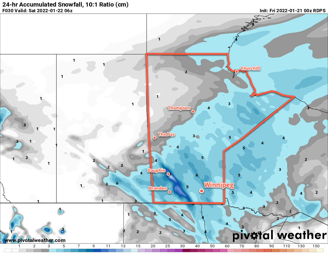
Southern Manitoba will see increasing cloud on Friday night with temperatures warming up close to 10 °C for Saturday. The low moving through the province tomorrow will bring some light snow to the province, but it will mainly move from northern Manitoba to east of Lake Winnipeg. The Red River Valley should just see mainly cloudy skies. Southerly winds tonight will turn northwesterly on Saturday up to around 30 gusting 50 km/h.

Some clearing will move across the region on Saturday night as the low exits the region. This will allow temperatures to head back to a low near the -20 °C mark.

RDPS 24hr. Accumulated Snowfall Forecast (10:1 SLR) valid 00Z February 1, 2022
While snow is possible through the weekend, a stronger low pressure system on Monday will bring the most organized snow to southern Manitoba.

The next low will follow hot on the heels of Saturday’s, spreading more cloud into the region on Sunday morning. This system will a couple centimetres of snow to the region as highs climb into the -5 to -10 °C range. It will be a bit breezy in the Red River Valley with southerly winds near 30 km/h. The snow will clear out for Sunday night, but temperatures will stay steady as a stronger low pressure system moves towards the region from Saskatchewan.

Long Range Outlook

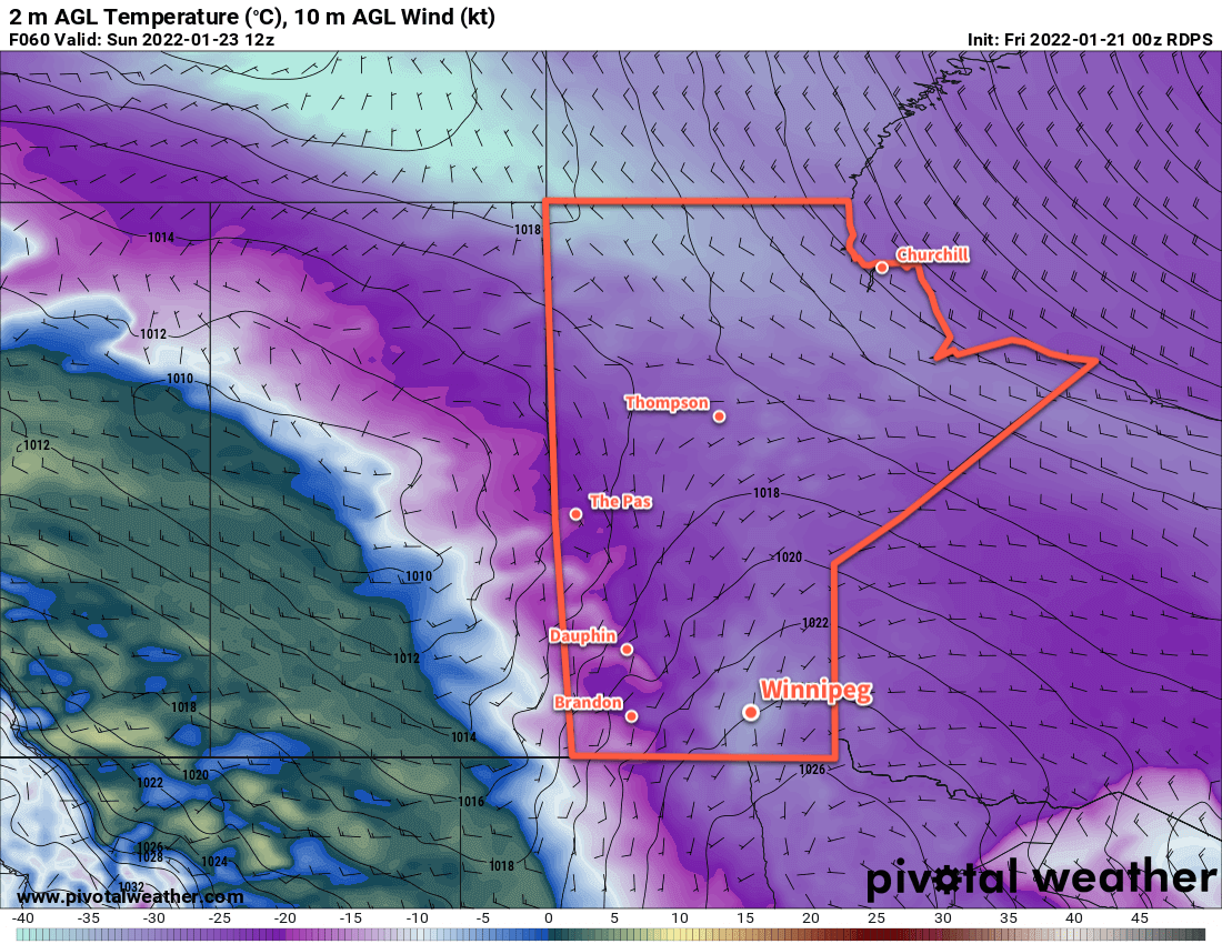
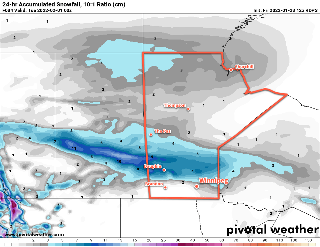
Monday’s low will bring even warmer conditions to Winnipeg on Monday with highs climbing into the 0 to -5 °C range. This system will bring a more intense are of snow to the province on Monday. Beginning over the Parkland region and drifting east-southeast, as much as 10 cm of snow will fall with this system. The Red River Valley will likely sit on the southern flank of the area of snow with 2–5 cm possible.

This system will push a strong cold front through the region on Monday evening, bringing strong northwesterly winds and colder temperatures. Blowing snow could be a concern on Monday night.

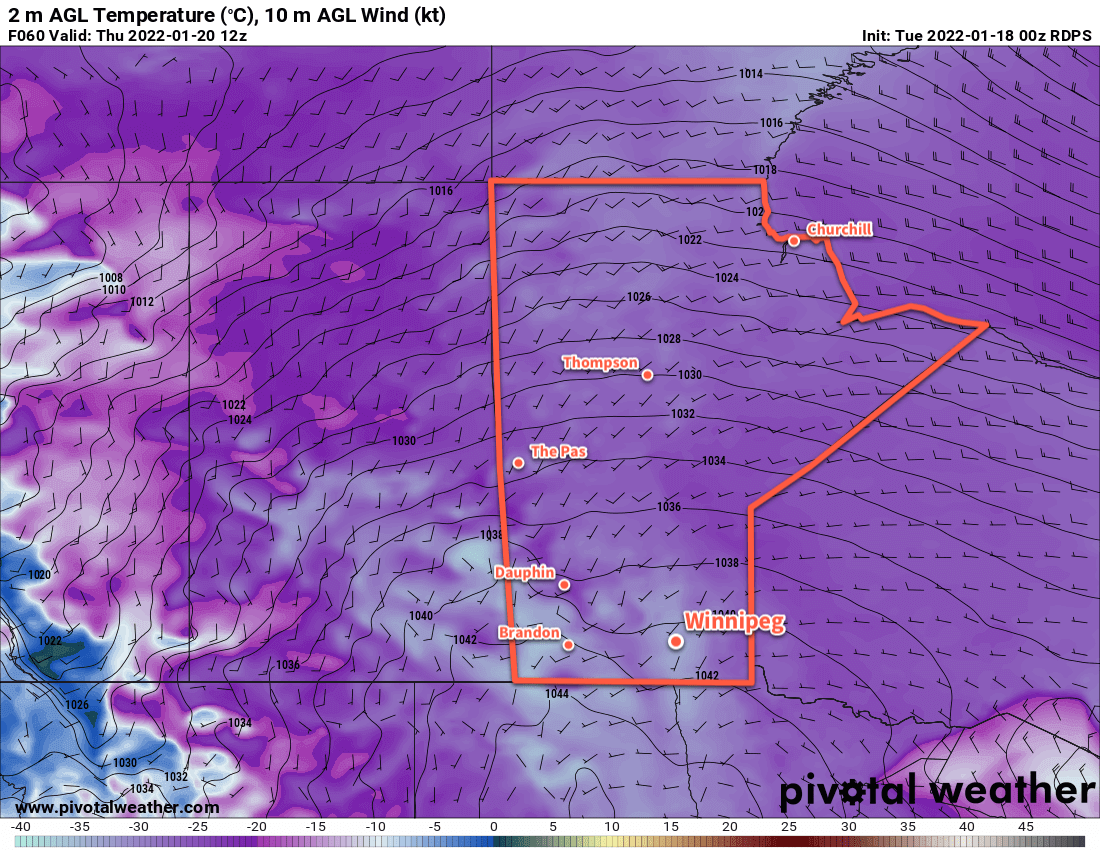
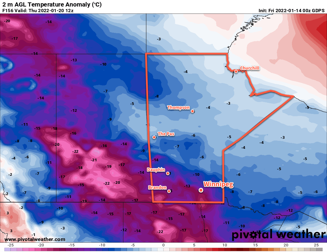
The region will plummet back into a period of seasonably cold conditions with daytime highs falling back into the -20 to -25 °C range and overnight lows dipping back towards the -30 °C mark. Some improvement could be seen by the following weekend.

Today’s seasonal daytime high in Winnipeg is -11 °C while the seasonal overnight low is -22 °C.

Windy Warm-Up Brings More Snow

Winnipeg will see a blustery return to warmer weather today as more snow moves into the region.

A low pressure system moving towards the region has brought strong southerly winds to the Red River Valley this morning. Like on Tuesday, the blowing snow will hamper visibilities on area highways this morning. Fortunately, the winds will ease through the morning and bring an end to the blowing snow.

RDPS 24hr. Snowfall Accumulation (10:1 SLR) Forecast valid 06Z Saturday January 22, 2022
Much of southern Manitoba will see close to 5 cm of snow on Sunday, but some higher amounts could fall near the terrain over the Parkland into the western Red River Valley.

A frontal wave slumping through the province this morning will bring more snow to the region as well. Snow should begin early this morning with close to 5 cm of accumulation by the time it tapers off in the afternoon. A strong cold front will sweep through the region in the afternoon ushering in strong northwest winds with a few flurries. These northwesterly winds will bring some more blowing snow to the Red River Valley through Friday evening.

The frontal wave moving through the province today will bring mild temperatures to the Red River Valley. Winnipeg should see a high this afternoon near -5 °C. That warmth will be short-lived, though, as another Arctic air mass slumps in behind the cold front. Temperatures will head down to the -20 to -25 °C range tonight.

RDPS 2m Temperature Forecast valid 12Z Sunday January 23, 2022
Very cold temperatures will be in place over southern Manitoba on Sunday morning. Note the strong warm front over Saskatchewan behind which temperatures rise above the freezing mark.

Behind this system, Winnipeg will see cooler conditions for the weekend, but not quite as bad as some of the other cold snaps lately. Highs this weekend will be in the -15 to -20 °C range both Saturday and Sunday. Saturday night will be quite cold with lows possibly dipping back below -30 °C again.

More cloud will move into the region on Sunday as a warm front pushes in from the west. Some light snow is possible in the afternoon, but it won’t be much more than a dusting. With the cloud cover and the nearby warm front, temperatures will be a bit warmer on Sunday night with a low in the -20 to -25 °C range.

Long Range Outlook

Next week will start off with colder temperatures again as another Arctic high slumps through the Prairies. Monday and Tuesday will bring daytime highs of -20 to -25 °C and and lows in the again dipping close to -30 °C.

The good news, though, is that the Polar Vortex is forecast to collapse northwards from the Baffin Island region. Its movement back toward the pole will bring a broader pattern change to Prairies. The Arctic air will be locked up further north, allowing Pacific air to spread over the region. Winnipeg will see temperatures climb to seasonably mild values for the second half of next week. The city will see highs generally in the -5 to -10 °C range.

There will likely be a fair amount of cloud around and frequent chances for some light snow, but perhaps that’s a small price to pay for some more prolonged relief from the cold.

Today’s seasonal daytime high in Winnipeg is -13 °C while the seasonal overnight low is -23 °C.

Alberta Clipper Brings Winter Storm And Bitter Cold

An Alberta clipper is bringing heavy snow to the province, but the worst conditions will arrive upon its exit. Blizzard conditions will develop Tuesday afternoon, followed by bitterly cold temperatures mid-week.

RDPS 24hr. Snow Accumulation Forecast (10:1 SLR) valid 00Z Wednesday January 19, 2022
Heavy snow will taper off over the Red RIver Valley this morning with a widespread 10–15 cm storm-total accumulation.

The heavy snow has arrived in the Red River Valley and will continue until around midday. The heaviest snow will exit to the east with the clipper itself, but a few flurries will continue through the day. Conditions will continue to deteriorate behind the low as northerly winds increasing to 50 gusting 70 km/h.

Widespread blowing snow will develop on Tuesday afternoon from the Parkland region into the Red River Valley. The worst visibilities will occur in the Red River Valley Tuesday evening through the night. Ample quantities of fresh snow combined with howling northwesterly winds and falling temperatures will produce [near-]blizzard conditions. It will be a unpleasant and dangerous night out in the open.

RDPS 10m Wind Forecast valid 21Z Tuesday January 18, 2022
Strong northwest winds will likely produce blizzard conditions through the Red River Valley beginning on Tuesday afternoon.

Temperatures will reach a high in the -5 to -10 °C range early Tuesday, then fall through the rest of the day. The region will see lows into the -20 to -25 °C range by Wednesday morning.

The winds will begin to ease Wednesday morning, bringing an end to the blowing snow. It will be cold on Wednesday with temperatures barely recovering a few degrees from the overnight low as skies clear. Temperatures will plummet down below -30 °C on Wednesday night. Extreme cold warnings are likely across much of southern Manitoba on Wednesday night as wind chill values of -40 to -45 will be widespread.

RDPS 2m Temperature Forecast valid 12Z Thursday January 20, 2022
Bitterly cold temperatures will return to southern Manitoba on Wednesday night with lows dipping below the -30 °C mark.

Thursday will also be cold with highs in the -20 to -25 °C range and light southerly winds. A warm front pushing across the Prairies will bring cloud to the region on Thursday night with temperatures rising close to -10 °C by Friday morning. That warmer weather won’t come without a cost, though. As it moves into the region on Thursday night, southerly winds will strengthen into the 40–50 km/h range.

Long Range Outlook

The winds will ease on Friday with a high in the -5 to -10 °C range. Some snow will move through southern Manitoba — perhaps close to 5 cm — followed by a cold front later in the day. Northwest winds near 30 gusting 50 km/h will move in behind the front, sending lows back into the -20 to -25 °C range overnight.

The weekend will bring seasonably cool conditions with highs in the -15 to 20 °C range and overnight lows near the -20 to -25 °C range. Saturday should bring sunshine, but some flurries may be possible on Sunday as another disturbance brushes by the region.

Today’s seasonal daytime high in Winnipeg is -13 °C while the seasonal overnight low is -23 °C.

Warmer Weekend Ahead for Winnipeg, Then Cold Air Returns

Above seasonal temperatures will return to Winnipeg this weekend, but then the Polar Vortex will bring another blast of Arctic air to the Prairies.

Winnipeg will see a seasonably cool conditions today as an Arctic ridge slumps southwards through the day. Temperatures will climb into the mid-teens with mixed morning skies giving way to more consistent sunshine in the afternoon. There’s a small chance of a few flurries with the morning cloud, but any amounts would be very limited.

The next “big” weather system will begin moving into the area on Saturday. Southerly winds will strengthen tonight as a swell of warmer air begins pushing across the Prairies from the northwest. This will bring cloudier conditions back to the region this weekend, but much warmer weather. Temperatures will climb into the -10 to -5 °C range Saturday afternoon, then further to near freezing by Sunday morning. The region will see moderate southerlies up to 40 gusting 60 km/h on Saturday that will ease on Saturday night. The winds will shift northwesterly on Sunday morning.

RPDS 2m Temperature Forecast valid 12Z Sunday January 16, 2022
Temperatures will climb close to the freezing mark by Sunday morning across much of southern Manitoba.

A bit of light snow is possible as the warm front pushes through on Saturday night, then again as a cold front slumps southwards later Sunday morning. Accumulations will be quite low with only a couple centimetres possible.

Cooler weather will then begin to slump back southwards into the region beginning Sunday night.

Long Range Outlook

The main feature driving the weather next week will be the return of cold air associated with the polar vortex. Currently, it sits over much of Baffin Island and into the northern portion of Québec. Next week, though, it will shift westwards and then drop south, re-establishing itself over Hudson Bay again. This will set up a pipeline of cold Arctic air over Manitoba and send daytime highs back down into the minus 20s.

GDPS 2m Temperature Anomaly Forecast valid 12Z Thursday January 20, 2022
The polar vortex will bring temperatures well below seasonal values to the Prairies next week.

There’s a little uncertainty on when exactly it will set back up over the region. Some forecasts show it establishing its influence here by Monday, some others have it’s arrival delayed until mid-week with a bit of cloud and snow moving through in advance. Either way, temperatures will be heading back into the -20s next week for at least 4–6 days.

There is good agreement though that it will not remain locked over the region for a prolonged period. Forecasts show the Polar Vortex once again shifting back towards Baffin Island then northwards again sometime near the end of next week. This will allow warmer temperatures (and cloud, and the renewed chance for snow) back into the region.

Today’s seasonal daytime high in Winnipeg is -13 °C while the seasonal overnight low is -24 °C.