Arctic Chill Moves In This Weekend

Much colder weather will arrive in southern Manitoba this weekend as a blast of Arctic air moves into the Prairies.

Before the cold, though, Winnipeg will see a couple days of near-seasonal conditions. A couple of weak systems crossing the region will bring partly cloudy skies and highs on the milder side of the minus single digits. Today will start off a bit breezy with southeast winds near 30 gusting 50 km/h, but the wind will ease through the day.

Saturday should be a pleasant day with light winds as a ridge of high pressure moves over the region.

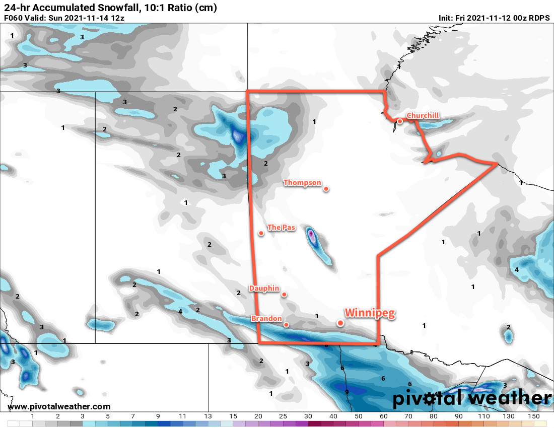
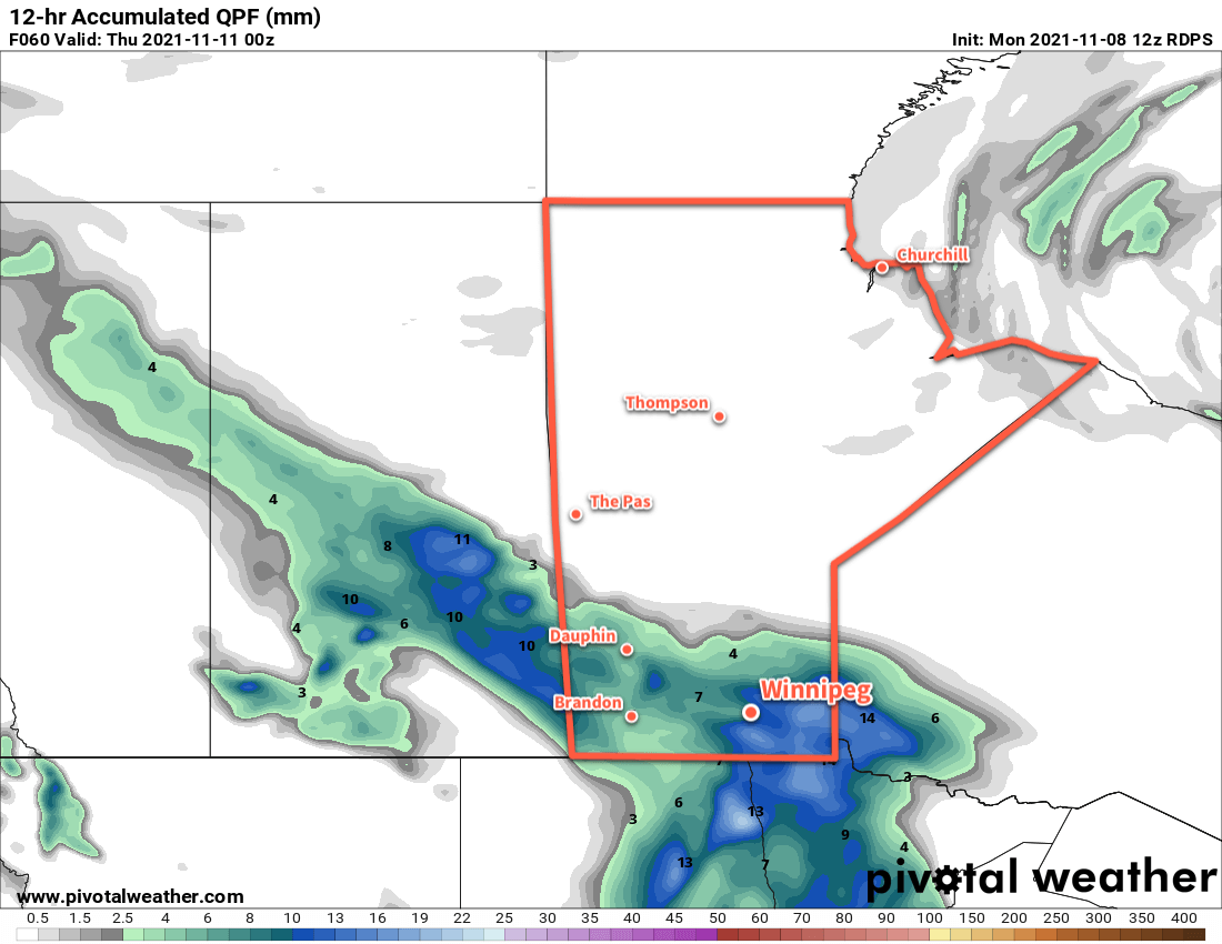
The real change in the weather will begin on Saturday night. An Alberta Clipper will cross the Prairies Saturday and Sunday while a potent low pressure system strengthens over Hudson Bay. This system will bring some light snow to southern Manitoba on Saturday night as a cold front surges through the province. Behind this front, the clipper and Hudson Bay system will work together to funnel the coldest surge of Arctic air Winnipeg has seen so far this season.

Temperatures will fall to around -7 °C by Sunday morning, then continue to drop to around -10 °C through the day. Winds will stay out of the northwest at 30–40 km/h through the day as Arctic air pushes into the region. Winnipeg may see a few more flurries through the day with morning cloud cover replaced by streamers from Lake Manitoba.

RDPS 2m Temperature Forecast valid 12Z Monday November 22, 2021
Winnipeg’s first taste of bitter winter cold will come on Monday morning with temperatures dipping to -20 °C or colder.

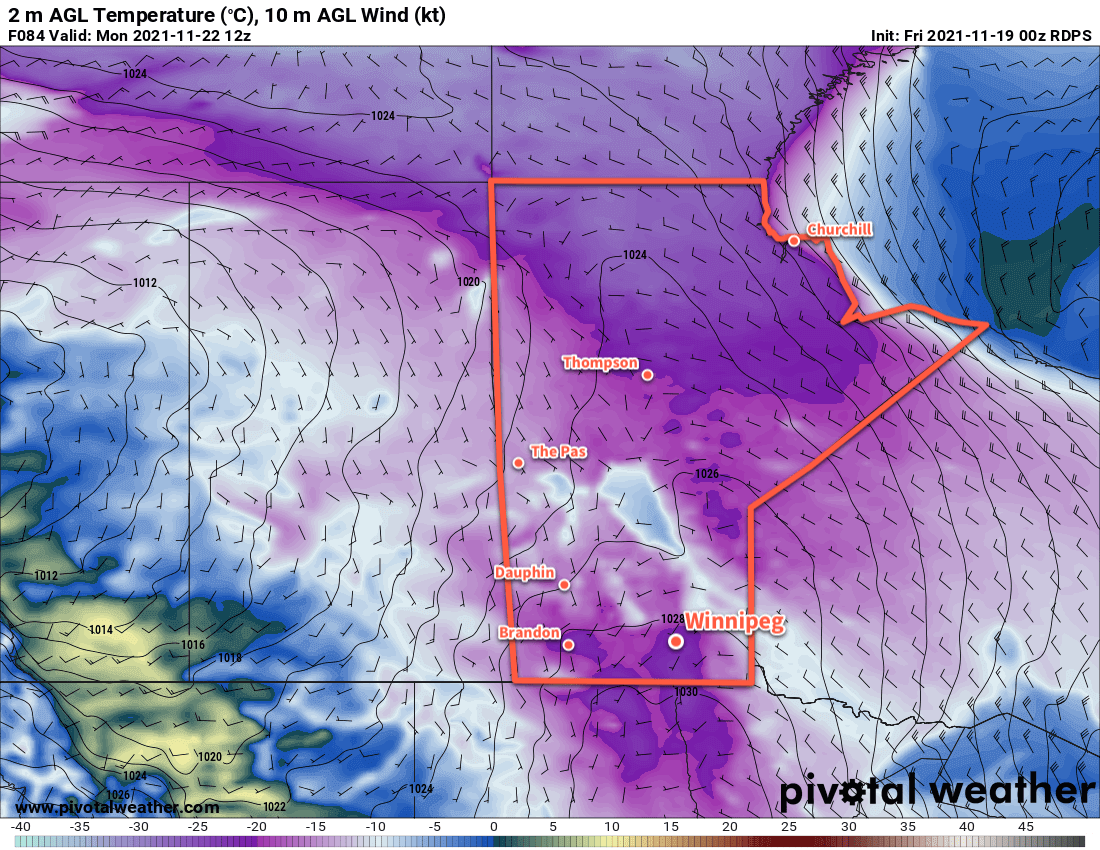
The wind will ease on Sunday evening as a ridge of high pressure moves into the province. Temperatures will dip to a low near -20 °C on Sunday night with mainly clear skies.

Long Range Outlook

Cooler weather looks to stick around next week as winter settles into Manitoba. The region will likely see variable cloudiness through the week, but more snow looks largely limited to Wednesday when another disturbance moves through the province. While no bitterly cold temperatures are in the forecast, the region will be heading into a pattern of near- to below-seasonal temperatures.

Today’s seasonal daytime high in Winnipeg is -3 °C while the seasonal overnight low is -11 °C.

Winter Begins in Southern Manitoba

Cleanup continues across southern Manitoba as a wintery conditions settle into the region.

Winnipeg will see an unpleasant start to the day with the last bit of snow the region will see being blown about by northerly winds near 40 km/h. The low responsible for this wintery blast will start pushing off to the east today; as a result, snow across the region will come to an end this morning as winds ease to around 20 km/h. Skies will stay mostly cloudy with temperatures reaching a high of only around -2 °C.

Skies will cloud back over overnight as the next low to impact the region approaches. Temperatures will dip to a low near -10 °C with light winds.

Winnipeg will see cloudy skies on Saturday with temperatures rebounding to around -3 °C. More snow will move into the region with a weak low that will clip through the region into the Northern Plains. Snow will begin midday in the city and taper off to flurries in the evening. This system will produce close to 5 cm of snow near the U.S. border, but Winnipeg should only see around 2 cm. Systems like these can often track a bit further south than originally forecast, and if that comes to fruition then most of the snow will miss Winnipeg, lowering amounts down to 0–2 cm.

RDPS 24hr. Accumulated Snowfall Forecast (10:1 SLR) valid 12Z Sunday November 14, 2021
A clipper system will bring more snow to parts of southern Manitoba on Saturday.

A few flurries will be possible Saturday night with temperatures dipping to a low near -10 °C.

A broad ridge of high pressure over the region on Sunday should finally bring a little bit of sunshine back to the region. Winnipeg should see mixed skies with a cool high near -4 °C and light winds. Skies will cloud back over on Sunday night with temperatures dipping down to a low near -8 °C.

Long Range Outlook

A potent clipper system developing early next week will likely bring some more snow and rain to the region through the first half of next week.

Today’s seasonal daytime high in Winnipeg is 0 °C while the seasonal overnight low is -8 °C.

Mid-Week Low Brings Warm Weather To An End

A low pressure system that will move through the region will bring an end to Winnipeg’s stretch of beautiful late-fall weather. Rain, snow, and cooler conditions are on the way.

But first, a couple more pleasant November days lie ahead for the city. Winnipeg will see plenty of sunshine over the next couple days with highs in the 8–10 °C. Winds will be breezy today out of the west at 20–30 km/h, then ease slightly for Tuesday. Overnight lows will dip to around the freezing mark.

On Wednesday, a low pressure system will move from Saskatchewan into southern Manitoba, spreading cloud and rain across the province. Most areas in the Red River Valley should see 5–10 mm of rain through the day. Winds will start out at 20–30 km/h out of the southeast, then ease to light as the low moves over the Red River Valley in the evening. Temperatures will be much cooler with a high near 3 °C.

RDPS Forecast 12hr. Precipitation Accumulation valid 00Z Thursday November 11, 2021
Much of southern Manitoba will see rain on Wednesday.

Rain may become mixed with snow late in the day, then will change completely over to snow sometime overnight as temperatures drop below freezing.

Long Range Outlook

The seasons will change quickly this year as the region will look a lot more like winter by the end of Thursday. Moderate northerly winds of 30–40 km/h will develop behind the low and continue to usher cooler air into the region. Snow will continue through much of the day on Thursday with 5–10 cm accumulation likely by Thursday evening. Some periods of light snow will likely continue through Friday, and a bit of light snow may be possible with a weak low on Saturday.

Temperatures will hover near seasonal values right through the weekend with highs around the freezing mark. Overnight lows will dip into the mid-minus single digits.

Today’s seasonal daytime high in Winnipeg is +1 °C while the seasonal overnight low is -8 °C.

Warming Up In Winnipeg…Briefly

Winnipeg will shake the shackles of Arctic air and return to spring-like weather! But another cold front will sweep through the region on Thursday night, bringing another blast of cooler temperatures to end the week.

With the Arctic ridge finally to the south, temperatures will return to seasonal values today with a light westerly wind. Some morning cloud will clear out as a warm front slides eastwards across the region, then Winnipeg will see a sunny high near 12 °C. Skies will stay clear tonight with a low near +1 °C.

Temperatures will climb on Thursday as a warm-sector trough moves into the region. With sunny skies, southwest winds will pick up to around 30 km/h and bring a high near 17 °C to Winnipeg. The winds will ease in the evening, followed by increasing cloudiness overnight as a cold front moves through overnight. Skies will be cloudy by Friday morning with northerly winds of 30–40 km/h. The city should see a low near -1 °C.

RDPS 2m Temperature Forecast valid 21Z Thursday April 22, 2021
Mild temperatures will spread through southern Manitoba on Thursday.

Friday will start with cloudy skies and a good chance for some light snow The northerly winds will persist through much of the day, but the chance of snow will drop off midday. Temperatures will be much cooler than Thursday with a high near +3 °C in Winnipeg. An area of high pressure will settle over the region on Friday night, bringing clearing skies, light winds, and a low near -6 °C.

Long Range Outlook

Winnipeg will see seasonably cool temperatures this weekend with highs in the upper single digits. A sunny Saturday will give way to cloudier conditions on Sunday that will persist through the first few days of the week. A generally unsettled pattern will develop as an upper trough digs over western North America, and Winnipeg will see a few chances for rain through the first half of next week.

Today’s seasonal daytime high in Winnipeg is 13 °C while the seasonal overnight low is 0 °C.