Mild Start to the Week, But The Deep Freeze Looms

Mild, cloudy weather will stay over Winnipeg through the first half of the work week. The warmth will come to an abrupt end mid-week as bitter cold returns to the region for an extended period.

An upper ridge will support a southerly flow over the next few days, pushing mild temperatures across the province. The downside to the warmth will be fairly persistent cloud cover over much of the coming days. A few sunny breaks are possible in Winnipeg today, but skies should generally stay on the cloudier side. Temperatures will climb to a high near -6 °C today with light southeast winds picking up into the 15–25 km/h range by evening. The wind will increase into the 30–40 km/h range overnight with a low near -9 °C.

Tuesday will bring cloudy skies to the region as temperatures climb to a high near -2 °C. It will be windy with southerlies of 40–50 km/h, making it a relatively unpleasant day out in the Red River Valley. The winds will ease to 20 km/h by Wednesday morning with temperatures dipping to a low near -4 °C.

RDPS 12hr. Snowfall Accumulation (at 10:1 SLR) valid 06Z Thursday February 4, 2021
Much of southern Manitoba will see some snow on Wednesday, but ht heaviest amounts will occur north of the Trans-Canada Highway.

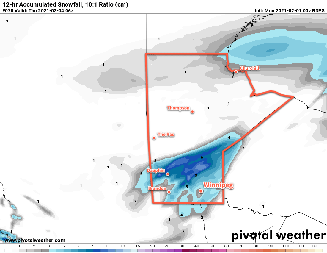
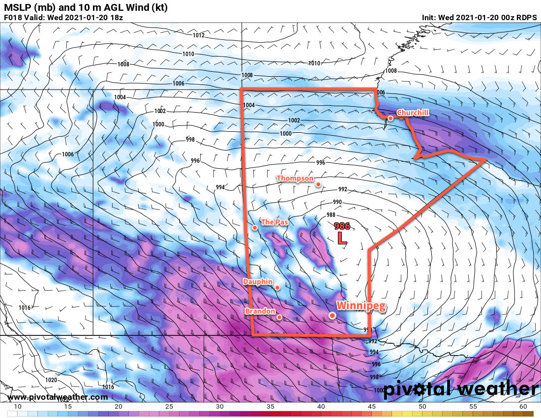
On Tuesday night, a low pressure system will move from eastern Saskatchewan into northern Manitoba. The warm-sector trough of this system will move through the Red River Valley on Wednesday morning, followed by some snow in the afternoon. Closely behind the snow will be an Arctic cold front surging across the Prairies. After 2–5 cm of snow, northwest winds will strengthen up to 40 gusting 60 km/h on Wednesday night. Temperatures will begin to plummet to a low near -17 °C.

Long Range Outlook

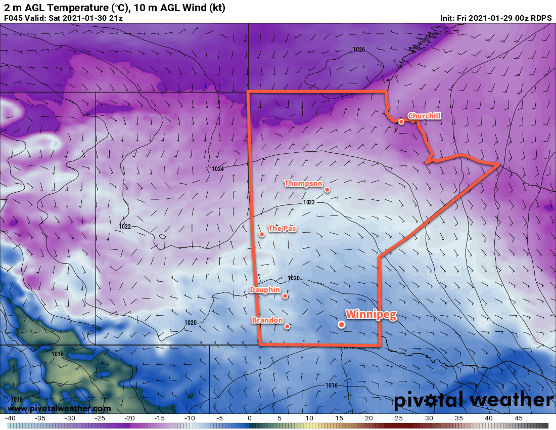
Bitterly cold air will build into the Prairie through the rest of the work week with daytime highs falling below -20 °C by Saturday. This bitterly cold air will likely stick around through next week.

Today’s seasonal daytime high in Winnipeg is -11 °C while the seasonal overnight low is -21 °C.

Milder, Cloudy Weather Ahead

An upper ridge building across the Prairies will bring warm weather and plenty of cloud to Winnipeg this weekend.

Warmer weather arrives in Winnipeg today, thawing the region from the snap of cold air that settled over the region earlier in the week. Clouds moved in overnight and are going to stick around for at least the next three days. As a result, though, temperatures will stay fairly steady. Highs through the weekend will hover near -6 °C.

The wind will pick up out of the southeast into the 20–30 km/h range today. The wind will keep up through most of the night, keeping temperatures mild with a low of just -8 or -9 °C. The winds will ease for Saturday and Sunday, allowing lows to dip into the minus teens.

RDPS 2m Temperature Forecast valid 21Z Saturday January 30, 2021
Temperatures will warm back above seasonal averages across southern Manitoba this weekend.

A weak trough will move across southern Manitoba on Saturday, likely bringing some light snow with it. Nothing more than a dusting is likely with 1–2 cm possible by the end of the day. A few flurries are possible overnight into early Sunday morning, but any remaining snow will taper off by midday Sunday.

Long Range Outlook

The mainly cloudy and mild conditions will continue into mid-week. A low pressure system moving through on Wednesday will bring some more snow to the region and usher in another blast of Arctic air. Temperatures are forecast to plummet back to below-seasonal values for the end of next week.

Today’s seasonal daytime high in Winnipeg is -11 °C while the seasonal overnight low is -22 °C.

Saturday Snow Ushers In Bitter Cold

Temperatures will rebound in Winnipeg on Saturday as a low brings light snow to the region. Things will take a turn for Sunday, though, as bitterly cold Arctic air plunges into the region as the low exits the area.

It will be a pleasant winter day in Winnipeg today with a bit of morning snow followed by mixed skies. Temperatures will sit near seasonal values with a high near -11 °C and light winds as a trough weakens over the region.

A compact low pressure system will head slide through northern Alberta today and across central Saskatchewan tonight. As it approaches Manitoba tonight, it will spread more cloud cover into the region and strengthen southerly winds into the 20–30 km/h range. Temperatures will dip to a low around -15 °C.

The low will cross Manitoba on Saturday, bringing a bit of snow to the region and milder temperatures. Winnipeg will see a high around -7 °C as the southerly winds ease into the 15–25 km/h midday and shift towards the northwest through the afternoon. This will also be the best chance for snow; once the warm-sector trough passes, snow is more likely as colder air starts pushing into the region. There’s a bit of disagreement amongst forecast models on how much snow will fall, but 2–4 cm is most likely with a chance of it ending up a bit outside of that range on either end depending on the exact track of the system.

RDPS 2m Temperature Forecast valid 15Z Sunday January 24, 2021
Bitterly cold Arctic air will pour into the southern Prairies behind a low pressure system. This cold air will reach southern Manitoba by Sunday morning.

On Saturday evening, after this system passes, the wind will strengthen out of the northwest into the 30–40 km/h range. These northwesterly winds will tap into a rather cold Arctic air mass and begin dragging it into southern Manitoba. Temperatures will plummet to a low near -25 °C with clearing skies and gradually easing winds.

An Arctic ridge moving into the region on Sunday will keep things cold and sunny with winds easing to light. Temperatures in Winnipeg will recover only slightly to a high near -21 °C, then head awfully close to (if not below) -30 on Sunday night.

Long Range Outlook

The first half of next week will bring cloudier conditions as the coldest air gradually leaves the region. By mid-week, forecasts show temperatures returning to seasonably mild conditions that persist through next weekend. No major snowfalls are in the forecast.

Today’s seasonal daytime high in Winnipeg is -13 °C while the seasonal overnight low is -23 °C.

Warm And Windy Wednesday, Then Cold Again

A potent low pressure system diving through the eastern Prairies will bring warm and windy weather to Winnipeg today. In its wake, cooler weather will slump back into the region from the north.

Temperatures will rocket back above freezing in Winnipeg today as strong westerly winds usher in a Pacific air mass. Temperatures will climb to a high near +1 °C as southerly winds of 40 gusting 60 km/h shift westerly midday and strengthen to 50 gusting 70 km/h. Stronger winds will move through to the southwest of Winnipeg where gusts in excess of 90 km/h will be possible. A rogue gust closer to 80 km/h can’t be ruled out for Winnipeg today.

Most of the precipitation associated with this system will stay north of the Red River Valley, tracking with the low centre and to its north. Areas along the Trans-Canada Highway will still likely see a bit of light snow or even a rain shower as this system moves through. The best chance for precipitation will be in the morning as the warm front pushes across the region. While skies will be mostly cloudy through the day, a sunny break or two is possible in the afternoon.

RDPS 10m Wind Forecast valid 18Z Wednesday January 20, 2021
Strong westerly winds will move through southern Manitoba today.

The winds will ease to 30 gusting 50 km/h this evening, then shift to the northwest overnight as a cold front slumps through. This will bring more cloud to the region and a chance for some light snow. Temperatures will plummet to a low near -16 °C by Thursday morning.

The cold weather will be back in force on Thursday as a ridge moves through the province. Temperatures will barely recover to a high near -15 °C as northerly winds near 30 km/h continue to funnel Arctic air into the region. Cloud will likely stick around through the morning hours, but some sunny breaks should develop in the afternoon. The clouds will clear out in the evening. Temperatures will drop to a low near -25 °C on Thursday night with light winds. A trough will begin rotating into southern Manitoba overnight, likely bringing cloud back into the region by Friday morning.

RDPS 2m Temperature Forecast valid 21Z Thursday January 21, 2021
Much colder air will surge back into southern Manitoba for Thursday.

Winnipeg will see mixed skies again on Friday as that weak trough rotates across the region. Temperatures will return to seasonal values with a high near -13 °C and there’s a slight chance for some scattered flurries. Skies will stay mainly cloudy on Friday night with a low near -19 °C.

Long Range Outlook

Some more cloud and snow is likely on the way for Winnipeg on Saturday with near-seasonal temperatures. Following that, temperatures will shift to seasonably cool with partly cloudy skies. Temperatures may moderate in the second half of next week.

Today’s seasonal daytime high in Winnipeg is -13 °C while the seasonal overnight low is -23 °C.