Cold Snap Comes With Quick Recovery

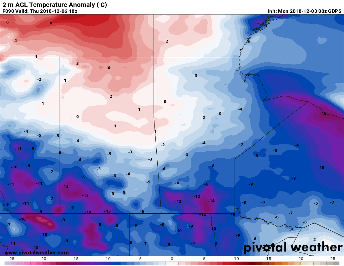
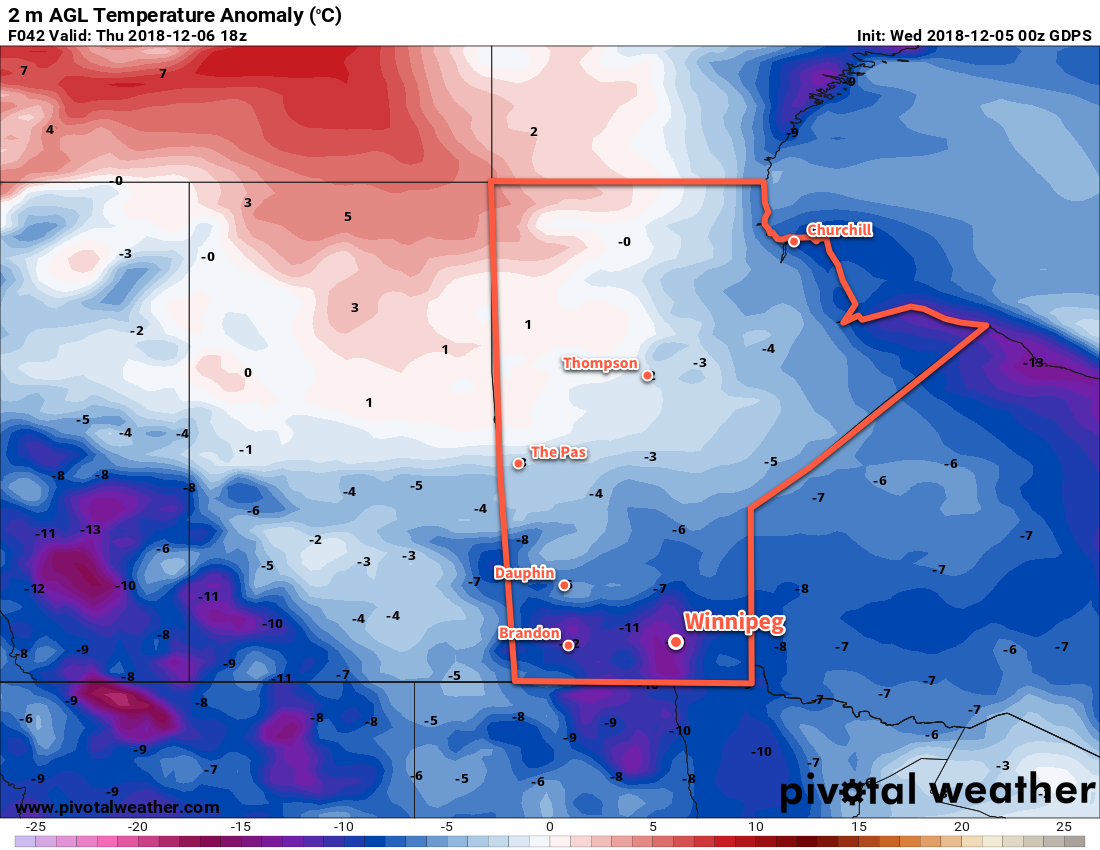
Winnipeg will see temperatures plummet well below seasonal for Thursday, but the cold conditions won’t last long.

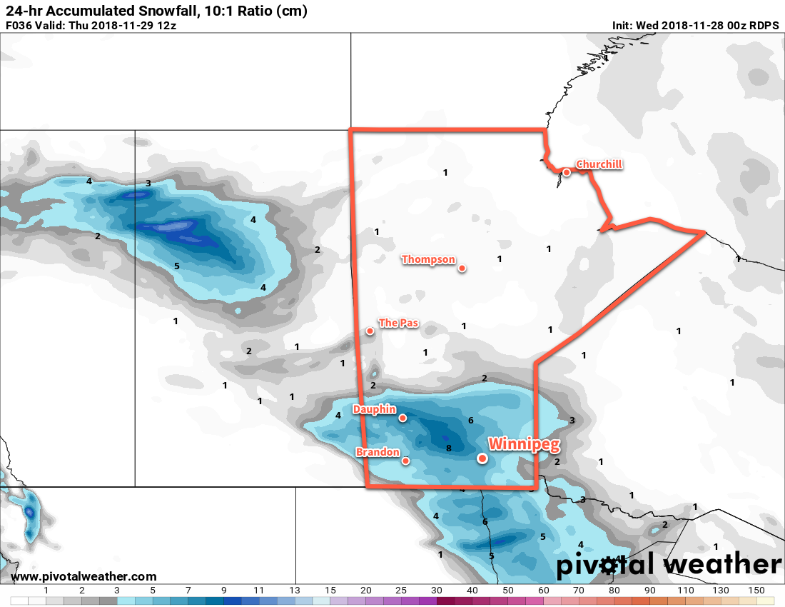
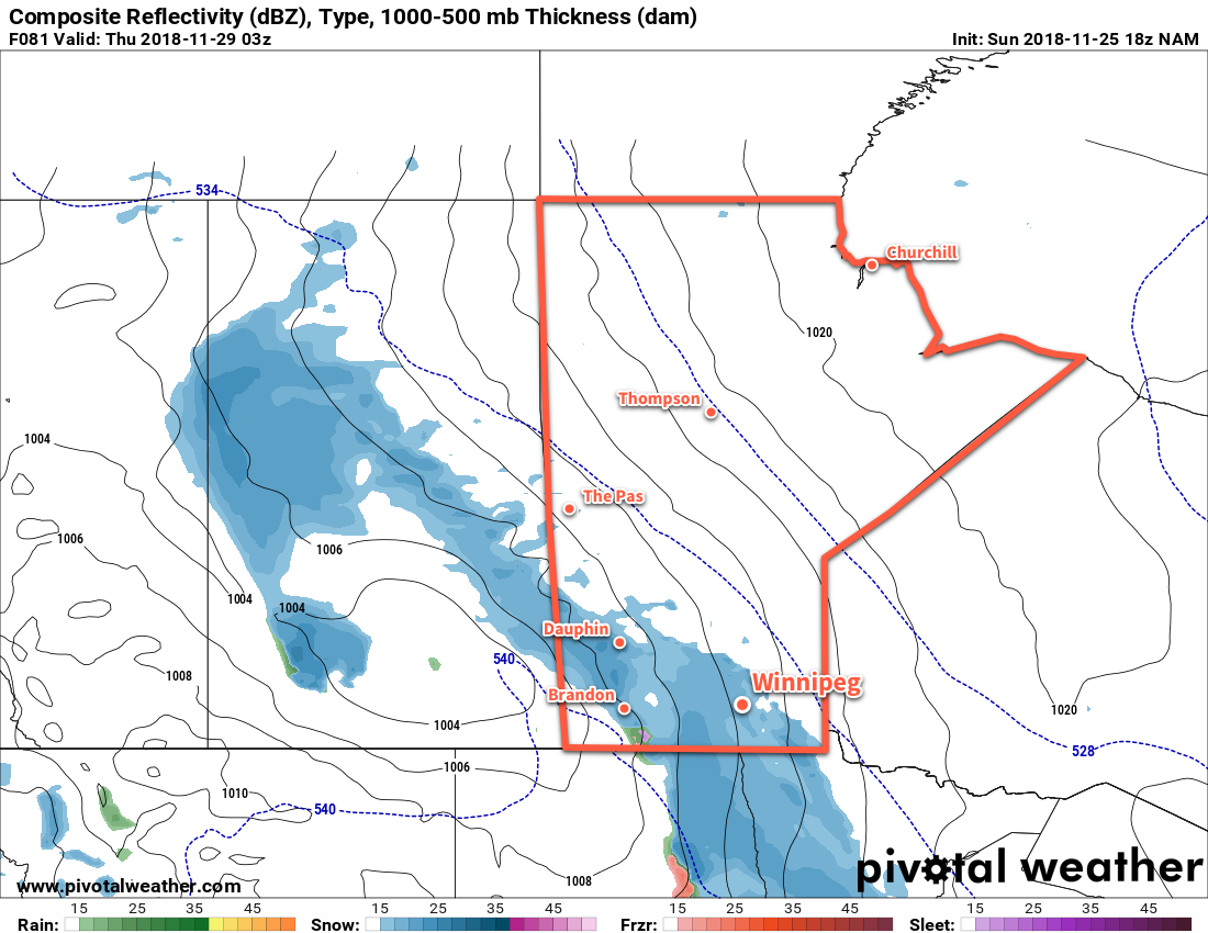
An advancing cold front will bring cloudy skies with periods of light snow to Winnipeg today. Accumulations will be minimal but don’t let that fool you: this system will pack a punch. Temperatures will reach a high near -9°C this morning, but midday the cold front will slide through and shift the winds northwesterly. Winds will strengthen through the afternoon to around 30 gusting 50 km/h, ushering in a markedly colder air mass. Temperatures will fall to around -11°C by the evening, and then continue to a low near -25 or -26°C. While this is unseasonably cold, it won’t be anywhere near the record low which sits in the -30s. Skies will clear out in the evening alongside diminishing winds.

Fortunately, the cold will be short-lived. Thursday will see a daytime high colder than the seasonal overnight low as temperatures climb back to around -17°C. Winds will remain light and gradually shift to southerly as an Arctic high passes through the region into the Dakotas. The core of the cold air will already be to our east by Thursday night, with warmer air quickly moving in behind it. As a result, the city will see some cloudiness on Thursday night with temperatures remaining fairly steady near -17 or -18°C.

This forecast of temperature departures from seasonal show the core of the coldest air over southern Manitoba midday Thursday. Note, however, the flood of warmer temperatures quickly spreading back into the Northern Prairies in its wake.

Friday will bring more sunshine as temperatures continue to climb back towards seasonal. Winnipeg will see a high near -11°C with light southerly winds continuing. Temperatures will dip to a low near -15°C on Friday night with a few clouds.

Long Range Outlook

The city should see near-seasonal temperatures through the weekend with a fair amount of sunshine. Seasonal to above-seasonal temperatures look likely to start next week, but cloud and the chance for more flurries or light snow may return midweek into the weekend.

Winnipeg’s seasonal daytime high is currently -8°C while the seasonal overnight low is -17°C.

More of The Same Until Mid-Week Cold Blast

Mostly cloudy conditions will persist in Winnipeg until an Arctic cold front surges southwards mid-week and brings clearing skies along with a blast of cold weather.

Winnipeg will see near-seasonal temperatures today and tomorrow as the region remains in a relatively stagnant pattern. The vast expanse of stratus cloud that has been in place over the past several days remains. A few patches of clearing may develop through the day, but it’s practically impossible to predict where exactly that will occur before it happens. While skies should remain mainly cloudy today and tomorrow, a peek of sun is possible. Daytime highs both today and Tuesday will be a near-seasonal -7 or -8°C. Cloud cover in the region will keep overnight lows slightly warmer in the -10 to -12°C range or so.

A major pattern shift will take place on Wednesday as an Arctic cold front plows southwards though the province. The city will see cloudy skies and 2 to 4 cm of light snow as the front moves through. Northerly winds of 30 gusting 50 km/h will move in behind the front as skies clear, ushering in a markedly colder air mass. Temperatures will plummet Wednesday night to a low near -24°C with wind chill values dipping towards the mid-minus 30s.

Long Range Outlook

The remainder of the work week will bring seasonably cold temperatures with daytime highs in the minus teens.

This forecast map of temperature anomalies for Thursday shows the wide swath of temperatures well below seasonal values across the southern Prairies.

The coldest temperatures will be short-lived, though, with signs that temperatures will moderate through the weekend back towards seasonal values to start next week. On the bright side, the colder air mass will likely mean the city finally sees some consistent sunshine!

Winnipeg’s seasonal daytime high is currently -7°C while the seasonal overnight low is -16°C.

Snow Ushers In A Return To Seasonal Temperatures

Winnipeg will see its first notable snowfall of the season today as warmer temperatures move into the region.

Light snow will spread eastwards across the Red River Valley today, arriving in Winnipeg sometime mid-morning. While it won’t snow too heavily, it should stick around well into the evening before easing overnight into Thursday morning. As a result, the steady snowfall will likely pile up to around 5 cm here in Winnipeg by the time it tapers off, but areas west of the city will see a bit more at 5 to 10 cm. Temperatures will be seasonable with a high near -5°C. Winds will be a bit breezy out of the southeast at 30 gusting 50 km/h. That said, the mild temperatures should limit any blowing snow that might want to occur across the valley.

As mentioned before, periods of light snow will continue into the night with temperatures remaining steady near -5°C. Winds will ease into Thursday morning.

Thursday will be a relatively pleasant day in Winnipeg as temperatures remain seasonably mild with a high near -3°C. Skies will remain overcast with a chance of flurries and winds will remain light. Skies remain cloudy for Thursday night with a low near -8°C.

More cloudy weather will be on the way for Friday with highs near -6°C. Winds will gradually pick up out of the southeast once again to around 20 km/h. Skies will remain cloudy on Friday night with lows dipping to around -8°C.

Long Range Outlook

There’s currently a bit of disagreement on exactly how the weekend will go. Forecast models generally agree on the development of a Colorado Low that will move through the American Plains this weekend, however they disagree on how far north its impact will extend. Some models have snow and strong northerly winds in place over southern Manitoba this weekend. Others, though, keep it all to our south and leave us with cool but comparatively pleasant conditions. We’ll have more on what to expect in our next post on Friday.

Winnipeg’s seasonal daytime high is currently -6°C while the seasonal overnight low is -14°C.

Week’s Cool Start Eases Mid-Week With Chance of Snow

Below-seasonal temperatures continue in Winnipeg as a slow-moving Arctic ridge moves across the region. Milder temperatures are forecast to return mid-week, bringing cloud and, likely, widespread snow.

Today and tomorrow will be similar days in Winnipeg. Temperatures will remain below seasonal values with daytime highs a degree or two on the colder side of -10°C. Winds will remain out of the northwest around 20 km/h for both days. A mix of sun and cloud will develop today alongside a chance for some light flurries. Slightly more cloud will be in place on Tuesday, but flurries look less likely. Temperatures both nights will fall into the mid- to low minus teens.

On Wednesday, a low pressure system will work its way across southern Saskatchewan into North Dakota. As it progresses eastwards, it will support an area of snow along its northern flank, slowly spreading across southwestern Manitoba into the Red River Valley. Along with breezy east-southeasterly winds, milder temperatures will push into the region. Winnipeg should see a high temperature near -6°C.

A band of snow will push across portions of Southern Manitoba on Wednesday afternoon and evening.

The one uncertainty associated with this system will be its track. Early indications are that it will produce a swath of 5 to 10 cm of snow across southwestern Manitoba with amounts diminishing quickly into the 2 to 4 cm range north of the Trans-Canada highway. If the low ends up taking a track just a bit further south, much of the snow could end up in North Dakota. We’ll be keeping an eye on this system and have more details in Wednesday’s forecast. At this point, it seems likely that the heaviest snow will remain southwest of Winnipeg with around 5 cm possible in the SW Red River Valley. Winnipeg itself may see a couple cm of new snow on Wednesday evening into the night.

Long Range Outlook

The remainder of the work week will continue to bring plenty of cloud alongside mild temperatures. Daytime highs should sit around -3°C both Thursday and Friday with overnight lows in the low minus single digits. Winds will also ease through Thursday and remain light on Friday. Near-seasonal temperatures will be in place for the weekend, and then a cold front slumps southwards on Sunday night. This will bring another chance for organized snow and the return of slightly below-seasonal temperatures.

Winnipeg’s seasonal daytime high is currently -5°C while the seasonal overnight low is -14°C.