Cloudy and Cooling with Occasional Light Snow

Winnipeg will see several batches of light snow over the coming few days as temperatures slowly slide towards seasonal values.

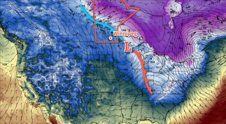
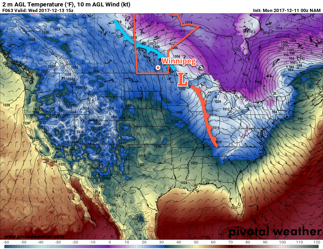
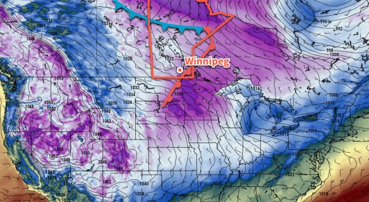
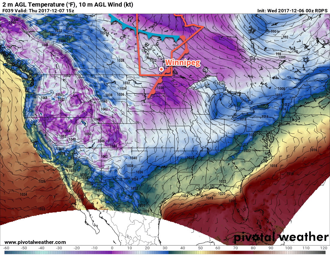
Today will bring falling temperatures to Winnipeg as a cold front slumps south and brings another shot of light snow through the region. Not much snow will fall, perhaps 1 to 2 cm, and it should taper off by the afternoon. Winnipeg will see breezy northwesterly winds around 30 gusting to 50 km/h, but over the western Red River Valley they’ll be a bit stronger and closer to 40 gusting 60 km/h. The winds will taper off through the afternoon across the region as temperatures fall to around -9°C. Skies will remain mostly cloudy tonight as temperatures remain steady near -10°C.

Thursday will bring more cloud to the region with a chance of some more light snow as another weak upper-level disturbance slides across the region. Temperatures will climb to a high near -7°C with light winds. Some clearing will work into the region on Thursday night as temperatures dip to a low near -16°C.

GDPS Forecast Precipitation Type and Rate valid 12Z Saturday December 16, 2017
Some accumulating light snow is expected to move through Winnipeg on Friday night into Saturday morning

Friday will bring mixed skies to Winnipeg, but the cloud will push back into the region in the afternoon as another Mackenzie clipper begins dropping southeastwards out of the Northwest Territories. Temperatures will reach a high near -11°C before the cloud thickens up in the afternoon.

Models are wavering a bit on the location, but snow will likely push into southwestern Manitoba in the afternoon and then eastwards into the Red River Valley on Friday evening. Temperatures will hover around the -10°C mark on Friday night. Total snowfall amounts are a bit in the air at this point, but around 2 to 5 cm looks probable for Winnipeg.

Long Range Outlook

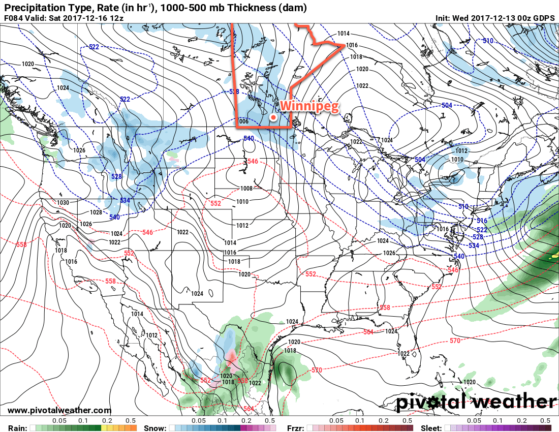
The weekend looks mild as warmer air pushes eastwards into the province, bringing daytime highs back to around -4°C. Saturday will still bring plenty of cloud, but the sun may make a return on Sunday. At this point, it looks like Monday may be the warmest day with temperatures possibly climbing above freezing before cooler air begins working back into the region with seasonal temperatures returning mid-week.

Winnipeg’s seasonal daytime high is currently -10°C while the seasonal overnight low is -19°C.

NAM Forecast 2m Temperature valid 15Z Wednesday December 13, 2017 – Featured

Seasonably Mild Weather With Bouts of Unpleasantness

Temperatures will continue to be generally mild for mid-December over the coming days…but that’s not to say that it will be pleasant all the time.

Despite the general mild trend that will be in place for Winnipeg over the coming days, today will be distinctly unpleasant as moderate northwesterly winds of 30 to 40 km/h usher in a cooler Arctic air mass. Temperatures will fall through the day to around -11°C by early this evening as the cloud cover clears out. Winds should taper off in the latter half of the afternoon. Temperatures will dip to a low near -16°C tonight but cloud cover will begin working back into the region overnight and help temperatures moderate back towards -12 or -11°C by Tuesday morning.

Tuesday will bring mostly cloudy skies to Winnipeg as a warm front slowly pushes eastwards ahead of the next low pressure system dropping into the Prairies from the Northwest Territories. Temperatures will reach a high near -8°C with light winds. The cloudy skies will continue on Tuesday night as winds pick up a bit out of the south-southeast and temperatures rise to around -4°C by Wednesday morning.

NAM Forecast 2m Temperature valid 15Z Wednesday December 13, 2017 – Featured
A cold front will slump southwards through Winnipeg on Wednesday morning

Wednesday will bring mild conditions as highs climb to around -2°C in Winnipeg under cloudy skies as a low pressure system slumps southeastwards through the province. Winds will pick up out of the northwest in the afternoon to around 30 to 40 km/h behind a cold front that will slump southwards through the region midday. There will be a chance for some light snow throughout much of the day but at this point amounts look like they would be minimal. Expect breezy conditions on Wednesday night as temperatures head to a low near -10°C.

Long Range Outlook

The remainder of the week will continue to bring seasonal to above-seasonal temperatures, particularly with respect to overnight lows which look to remain 5-10°C above normal for much of the week. The chances for snow look low until Friday into Saturday, when a low pressure moving across the region will bring a chance for some accumulating snow.

Winnipeg’s seasonal daytime high is currently -9°C while the seasonal overnight low is -19°C.

Cloudy and Mild Weekend Ahead

Above-seasonal temperatures return to Winnipeg for the weekend at the cost of sunshine with mostly cloudy skies on the way. The prolonged period of cloudy skies will be supported by a convoy of low pressure systems over the next few days that will bring multiple bouts of light snow to the region.

Mild air is rebounding eastwards across the Prairies, however Winnipeg and the Red River Valley won’t quite get into the warm sector, remaining just to its east and under the storm track. While no major systems are on the horizon, Winnipeg will still see plenty of cloud and bouts of non-accumulating light snow.

The first system sliding southeastwards along the storm track will swing through early this morning, sweeping a cold front through the region and ushering in breezy northerly winds of 30 to 40 km/h. The cooler air won’t affect daytime highs too much; Winnipeg should still see temperatures climb to around -4°C midday. Slightly cooler air will push into the region through the afternoon, likely dropping the temperature to around -6°C or so by evening. The passage of the front and slightly cooler air moving in will combine to produce some light snow across the Red River Valley, but we don’t expect it to have much of an impact. No accumulation is expected from it, nor will it adversely impact travel conditions. Heading into Friday night, the Red River Valley will see some clearing, allowing temperatures to plummet in the cold air mass down to a low near -18°C.

Light snow will spread across southern Manitoba on Friday behind a cold front sweeping through the province.

Temperatures will rebound fairly quickly on Saturday morning as more cloud cover moves into the region as a warm front pushes eastwards into southern Manitoba. Temperatures will climb back up to a high near -4°C once again under cloudy skies. Winds will pick up out of the south to around 20 km/h in the afternoon, but diminish to 10 to 15 km/h fairly early in the evening. Once again, some non-accumulating light snow is likely in the afternoon as a weak low pressure system slides through the region. Skies will remain mainly cloudy overnight with temperatures remaining steady near -5°C.

On Sunday, Winnipeg will find itself under a stalled frontal boundary under a northwest flow aloft. It looks likely that the city will remain on the warmer side of the front, with cooler air to the northeast and warmer air to the southwest. Winnipeg should see a high near -3°C, but the far southwestern Red River Valley may reach as high as 0°C, while areas colder to the south basin of Lake Winnipeg see highs near -5 or -6°C. A couple very weak disturbances will slide southeastwards over the stalled front through the day, bringing another chance for some non-accumulating light snow through the day.

A low pressure system will bring 2 to 4 cm of snow along a swath of the Prairies as it moves through Sunday into Sunday night.

By late Sunday afternoon into the evening, a more organized low is expected to move into the region, bringing 2 to 4 cm of snow through the evening with temperatures slowly dipping to a low near -11°C.

Long Range Outlook

Next week will begin with a surge of colder air moving into southern Manitoba, but a return to well above-normal temperatures will push back into the region for Wednesday, bringing some light snow with it. The temperature roller coaster looks poised to continue, with colder temperatures then pushing back into the region for the end of the week into the weekend.

Winnipeg’s seasonal daytime high is currently -9°C while the seasonal overnight low is -18°C.

Cool Temperatures Short-Lived With Seasonal Conditions Set To Return

The unseasonably cold temperatures and downright unpleasant winds that have characterized the conditions behind a Colorado Low moving through Ontario will be short-lived as seasonal temperatures push eastwards into Manitoba for the second half of the week.

It will be a cold day in Winnipeg today as an Arctic ridge pushes into southern Manitoba. Those nasty northwesterly winds will persist through this morning, but finally begin to diminish through the afternoon. Temperatures will reach a high of only -11°C or so, well below the seasonal -8°C. There will be some cloud about in the morning, but by the afternoon skies should clear out leaving Winnipeg with plenty of sunshine. Winds will taper off tonight as the Arctic ridge moves over the region and temperatures dip to a very chilly low near -18°C. Cloud cover will begin working into the region late overnight from the north as weak upper-level disturbance slumps southwards into Manitoba.

Thursday will bring mainly cloudy skies to Winnipeg and the Red River Valley with temperatures climbing to a more seasonal high near -7°C. No organized snow is expected with this system, but temperature profiles seem close enough to just right that patches of non-accumulating light snow may be possible. Winds will be light through the day as well, making for a relatively pleasant early-December day. Cloudy skies will remain over the area on Thursday night as temperatures head to a low near -11°C.

A warm front will push through Winnipeg early Thursday morning, bringing seasonal temperatures back to the region.

Friday will bring more cloud to Winnipeg as yet another upper-level disturbance dives southwards over the Prairies. It will nudge the warmer air slightly further east, pushing daytime highs in the Red River Valley up to around -5°C. As it moves through, there will be a good chance for some light snow, but it isn’t expected to accumulate much at this point. Winds will remain relatively light until a cold front swings through in the evening, after which they’ll pick up out of the north-northwest to around 30 gusting 50 km/h. Temperatures will dip to a low near -13°C on Friday night.

Long Range Outlook

Temperatures will continue above-seasonal through the weekend, with a chance of a potent push of warm air on Sunday that may bring near-freezing temperatures and some light snow, then the cold air collapses southwards once again, temperatures back to seasonal to below-seasonal for the start of next week. Light snow is possible on Sunday and several days next week, but no significant storms or accumulations are on the horizon.

Enjoy the return to more seasonal temperatures; they should – combined with calmer winds – make it much easier to get out and enjoy the winter weather!

Winnipeg’s seasonal daytime high is currently -8°C while the seasonal overnight low is -17°C.