Mild Snow Day Ushers In Cold Weather

The work week will start off with some snow over southern Manitoba, followed by significantly colder temperatures than have been seen over the last couple weeks.

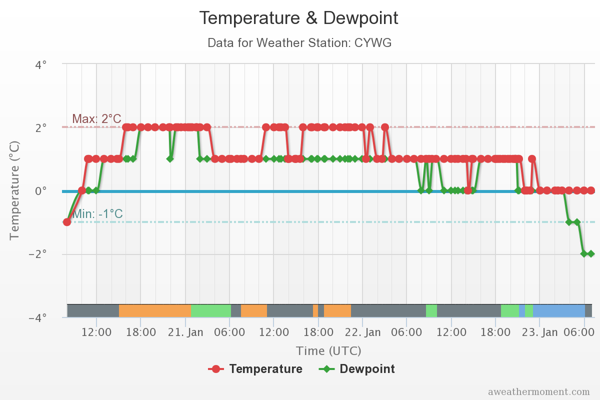
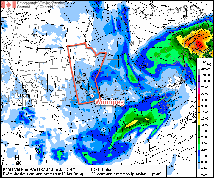
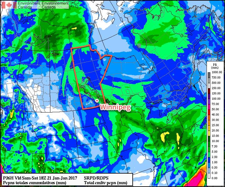
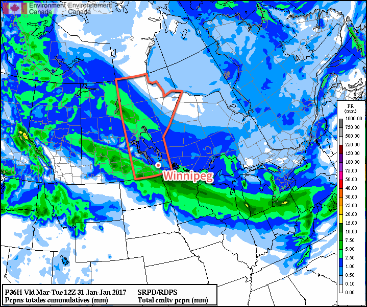
Today will bring snow to southern Manitoba, however what once looked like a solid 5-10 cm for Winnipeg will end up as just some [periods of] light snow as the bulk of the system passes to the southwest. While some areas across SW Manitoba will see up to 5-10 cm of new snow, the Red River Valley will see just a dusting to 4-8 cm over the far southwestern corner. Temperatures will be quite mild with daytime highs near the -1°C mark, but the winds will pick up for the afternoon out of the northeast to around 30 km/h with a bit of gustiness on top.

A majority of the snow associated with Monday’s snowfall is now expected to fall just southwest of Winnipeg.

Skies remain cloudy tonight with a continued chance for some flurries and a risk of freezing drizzle. Temperatures will drop to a low near -5°C.

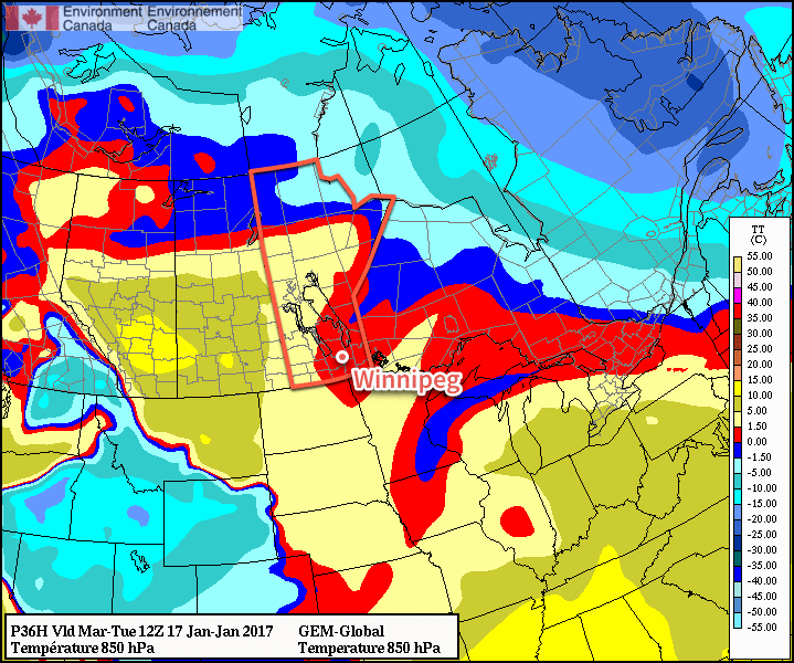
Tuesday will bring a second, weaker disturbance across the province, this time dragging a more pronounced cold front southwards. There will be some light snow/flurries associated with this system that will persist until the passage of the cold front in the late afternoon/early evening. Temperatures will drop quite abruptly once the front moves through as skies clear out with breezy northwesterlies. Temperatures will continue to drop to a low near -20°C on Tuesday night.

Wednesday looks quiet as an area of high pressure moves through the region. Winds will be fairly light, and temperatures will reach a slightly below-seasonal high near -13°C under mainly sunny skies. It will be colder again on Wednesday night as temperatures dip to a low near -23°C.

Long Range

The remainder of the week will be fairly sunny with seasonal to slightly below-seasonal temperatures. A weak disturbance will move through on Saturday that may bring a dusting of snow, but temperatures will continue at near-seasonal values. It appears the large-scale weather pattern may shift early next week and bring milder, but snowier, weather back to southern Manitoba, so we’ll be keeping an eye on how that develops!

Winnipeg’s seasonal daytime high is currently -11°C while the seasonal overnight low is -22°C.

Cloudy & Mild Weather Continues

There’s no end to the mild weather in sight thanks to a stagnant weather pattern that will persist through the remainder of the week. For those that love the sun, it will be a hard week as cloudy conditions persist with a continued chance of light flurry or freezing drizzle activity.

This weekend was a notable one when it came to warmth in Winnipeg as temperatures remained above 0°C for a record-breaking 66 hours, breaking the old record of 44 hours set on January 8/9, 2002. Temperatures first climbed above 0°C at 3PM on Friday January 20th and remained there all the way through 11PM on January 22.

Temperatures hovered between 0 and +2°C in Winnipeg for 66 hours between January 20th and 22nd, 2017.

This record mild spell broke no record high temperatures, but did result in a couple of rainfalls that brought January 2017 to the 2nd rainiest on record with 3.6 mm so far. The rainiest January on record is 1944 when 3.7 mm fell.

So, all that said, the forecast for the next few days is simple.

Cloudy. Today and tomorrow will both bring a continued chance for some light flurry or freezing drizzle activity across the Red River Valley with temperatures topping out near -1°C and light winds. Lows will be near -5°C both tonight and tomorrow night.

Flurries are expected across southern Manitoba on Wednesday.

The area of low pressure that’s entrenched over the region will begin moving out on Tuesday night, allowing some more organized northwesterly winds to develop across the Red River Valley. Winds will strengthen to 20-30 km/h by Wednesday morning and continue throughout the remainder of the day. Temperatures will be cooler with that northwest flow; highs will top out around -3°C and flurries will be widespread across southern Manitoba. Temperatures will dip to a low near -8°C under more cloudy skies on Wednesday night.

Long Range

Relatively mild temperatures will continue through the second half of the week with daytime highs hovering near -5°C. Sun may begin poking out on Thursday, but at this point it looks like Friday will be the first day of the week the sun makes a full comeback. No significant precipitation is expected in the second half of the week.

Mild, Sloppy Weekend Ahead

Winnipeg will see a mild weekend with temperatures continuing well above-normal, but a developing trough of low pressure will bring unsettled weather to the region.

Today will mark the beginning of a soggy weekend as temperatures hovering just above the freezing mark persist over the next several days.

Temperature-wise, expect temperatures to be within a degree of +1°C all the way until Monday morning, when it will dip just below the freezing mark. Alongside those mild temperatures will be overcast skies through the entire weekend.

We’ll an almost-continuous chance of precipitation of some sort. Today will bring dissipating fog patches this morning and a chance of drizzle through much of the rest of the day. A impulse heading northwest out of Minnesota will move across the region this evening, bringing an area of rain showers through the Red River Valley with amounts of 2-5 mm expected. After it passes tonight, fog patches will likely redevelop. Saturday will see a chance of showers or drizzle throughout the day and night.

An area of rain and snow will move through the province tonight, starting near Sprague and heading northwest towards Flin Flon.

That chance for light precipitation will continue through Sunday, but slightly cooler temperatures moving in mean that some flurries may mix into things.

Long Range

Not much will change through the first half of next week; cloudy conditions with temperatures near the freezing mark will continue with chances for light precipitation continuing.

Temperatures Soar For The Week Ahead

Very mild temperatures will spread into Southern Manitoba this week sending daytime highs soaring to over 10°C above normal for mid-January.

The week will start with one more day with seasonal temperatures in Winnipeg & the Red River Valley as mainly sunny skies combine with light winds as temperatures climb to a high near -6°C. Temperatures will dip to around -11°C tonight as winds begin to pick up from the south in advance of an incoming warm front.

Tuesday and Wednesday will bring the arrival of warmer weather to the region as a warm front sweeps eastwards across the province. Tuesday will see winds increasing out of the south to around 30-40 km/h while temperatures climb to a high near -3°C late in the day. The winds will diminish in the evening and temperatures will dip to a low near -5 or -6°C. On Wednesday, the warm air will push even further east, sending daytime highs to the 0°C mark in the Red River Valley with fairly light winds. Expect temperatures to dip down to around -2 or -3°C on Wednesday night.

The forecast 850mb temperatures show clearly the push of mild air across the Prairies through mid-week.

Both Tuesday and Wednesday have some uncertainty as to how much cloud will move in. At best, we could expect mixed skies, however I think it will lean towards the cloudier side than the sunnier side. Having fairly cloudy conditions as we warm up to the freezing mark in January would not exactly be uncommon for this area.

Long Range

The second half of the week will continue to bring mild temperatures with daytime highs near the freezing mark and variable cloudiness. Heading into the weekend, it begins to appear that the weather will begin to get a bit busier as the storm track shifts towards our region. It looks like, at this point, Saturday may bring a chance of rain or freezing rain, but amounts would be fairly light. The remainder of the weekend looks cloudy and mild.

Heading into the start of next week, models are beginning to converge on the development of another Colorado Low that would impact our region. It’s still very early, so as usual plenty can change between now and then, but at the moment it appears that this system could bring snow into Winnipeg & the Red River Valley sometime Monday and persist through Tuesday. Forecast storm total amounts are generally in the 10-20 cm right now. We’ll be keeping an eye on this system as we get closer and things begin to shape up more.

Winnipeg’s seasonal daytime high is currently -13°C while the seasonal overnight low is -24°C.