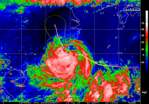
Strong Typhoon Makes Landfall in Taiwan
A strong typhoon, Typhoon Soulik, has made landfall in northern Taiwan last night bringing heavy rainfall and strong winds in the order of around 160km/h – considered category two. Soulik, once a category four typhoon, encountered cooler waters before making landfall and Taiwan’s rugged terrain continues to tear it apart. It’s expected to cross the South China Sea and make a second landfall on China’s southeast coast as a tropical storm. Most models show it heading into China’s mainland weakening into a tropical depression and further on, a low pressure system. Although only a tropical depression, Soulik will bring copious amounts of rain into the mainland, prompting fears of possible flooding later this weekend.
As of Friday night, electricity disruptions, 1 death and two dozen injuries had been reported. Around 8,500 people had been evacuated prior to Soulik making landfall because they lived in landslide-prone terrain.