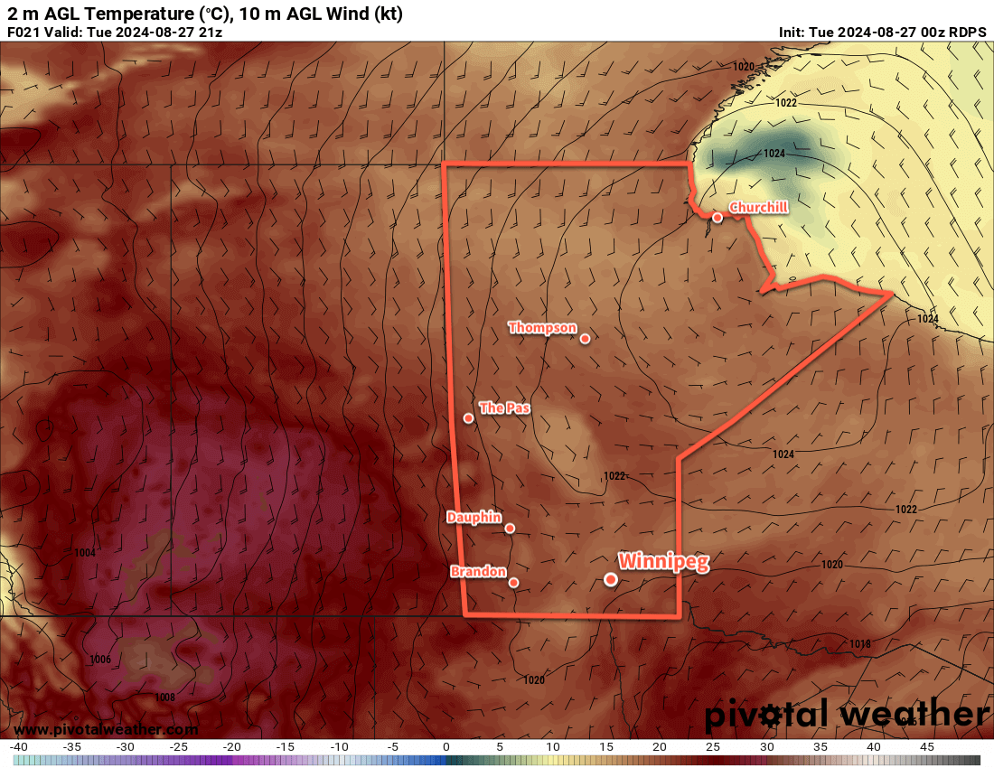
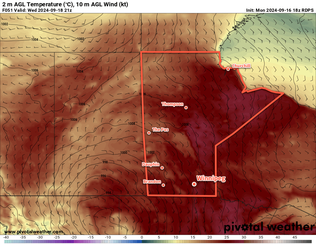
A persistent southerly flow over southern Manitoba will keep the seasonably warm and humid conditions in place for a for a few more days.
A quick note to start: the lack of forecasts last week was due to the fact that I’m dealing with a long-lasting bout of COVID–19 that’s sidelined me for a while now. I’m on a [gradual] up and up now, with symptoms finally receding after testing positive on rapid tests for a whopping 11 days in a row. Not a fun time, looking forward to getting back at life.
Daytime highs in the mid-20s will continue into mid-week for the Winnipeg area as a persistent low pressure complex to the west supports a southerly flow across the region. Daytime highs for Tuesday and Wednesday will likely sit around 25 °C; it could be a touch cooler if a bit of a stronger cold pool is left behind from overnight convection, or a tad warmer if we clear out early and a stronger southerly flow can develop earlier in the day.
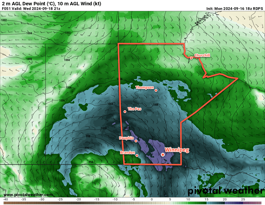
The humidity will also be notable for mid-September, with dew point values in the mid- to upper-teens, potentially reaching around 20 °C on Wednesday. This is more humid that the region often sees at this time of year, but the lower daytime highs in the 20s should keep the worst of the heat effects at bay. In the sun, the heat and humidity could combine to feel like it’s in the low 30s rather than mid-20s.
Overnight lows both tonight and tomorrow night will sit in the mid-teens.
Weather-wise, today should bring clearing skies as the disturbance that brought rain and thunderstorms to the region yesterday pushes off to the east. A few clouds will begin to build back in tonight, leading to mixed skies on Wednesday as a cold front approaches the region from the west.
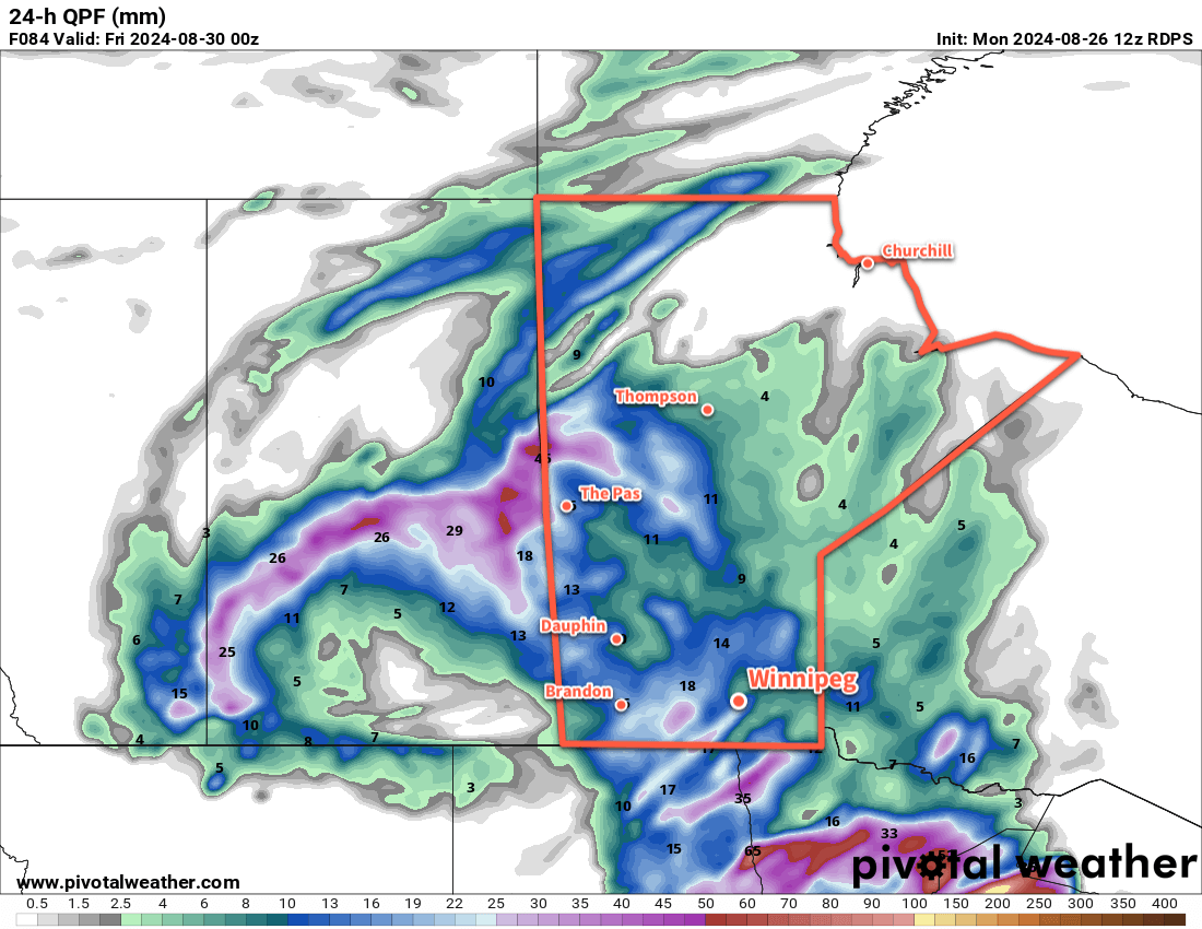
A few showers are possible on Wednesday; it looks like they should be weak, though the slow-moving nature of the cold front and broad forcing could result in a narrow band of slow-moving showers that could produce some locally higher amounts in the 15 to 25 mm range. I’m doubtful Wednesday will be a “wet” day, more likely a cloudier one with the chance of passing showers.
The cloudiness and chance of showers will continue into Wednesday night.
Unsettled End to the Work Week
The low that’s been sitting to the west all week will finally get moving on Thursday, moving into southwest Manitoba on Thursday and sliding into northern Manitoba on Friday.
This will bring a notable change in the weather to southern Manitoba. To start, both Thursday and Friday could bring wet conditions to the Red River Valley. On Thursday, showers and thunderstorms will begin possible through much of south-central and southeast Manitoba as the forcing along the cold front picks up with the advance of the low. This activity will likely continue into the night as it pushes northeast.
Winds will finally shift on Thursday from the persistent southerly at 20 to 30 gusting 50 km/h seen much of this week to westerly winds of 15 to 30 km/h.
On Friday, showers in the instability on the back-side of this system may clip through southern Manitoba as cooler air moves into the region. Daytime highs will cool into the low 20s by the end of the work week.
Long Range Outlook
Heading into the weekend, more settled conditions will develop over the region as near-seasonal temperatures return. Winnipeg will see partly cloudy conditions over the weekend with daytime highs in the upper teens and overnight lows near the 10 °C mark.
This trend looks to continue into the start of next week.
Today’s seasonal daytime high in Winnipeg is 18 °C while the seasonal overnight low is 6 °C.