Temperatures will soar this weekend in Winnipeg as a hot and humid air mass moves in from the south.
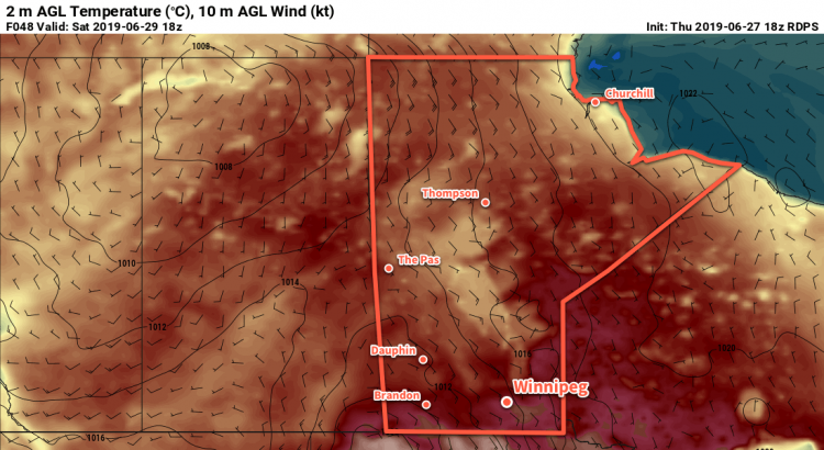
A building upper ridge will push increasingly hot and humid conditions into southern Manitoba this weekend. The first push of heat will arrive today with the temperature climbing to around 30°C in Winnipeg. Skies will stay mostly sunny through the day with light winds. Tonight will be warm with a low near 18°C.
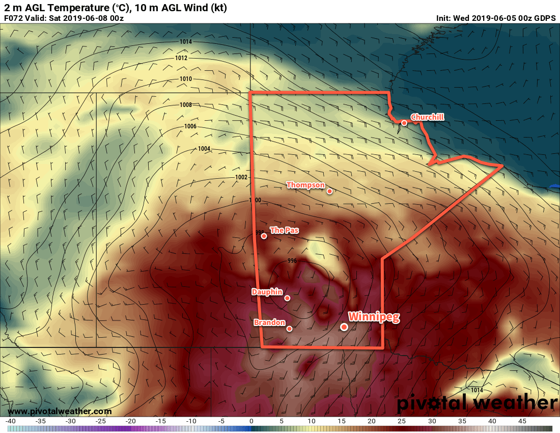
Saturday will be another hot day with increasing humidity. The city will see variable cloudiness through the day depending on (a) how much blow-off from overnight thunderstorms in Saskatchewan and western Manitoba moves through in the first half of the day, and (b) how much thunderstorm activity develops in the afternoon. Winnipeg should see a high near 31°C, but may be warmer or cooler depending on how much sunshine there is. Dew points will gradually climb through the day, reaching the mid- to upper-teens by the end of the afternoon. Combined with the warm temperatures, this will result in humidex values in the upper 30s.
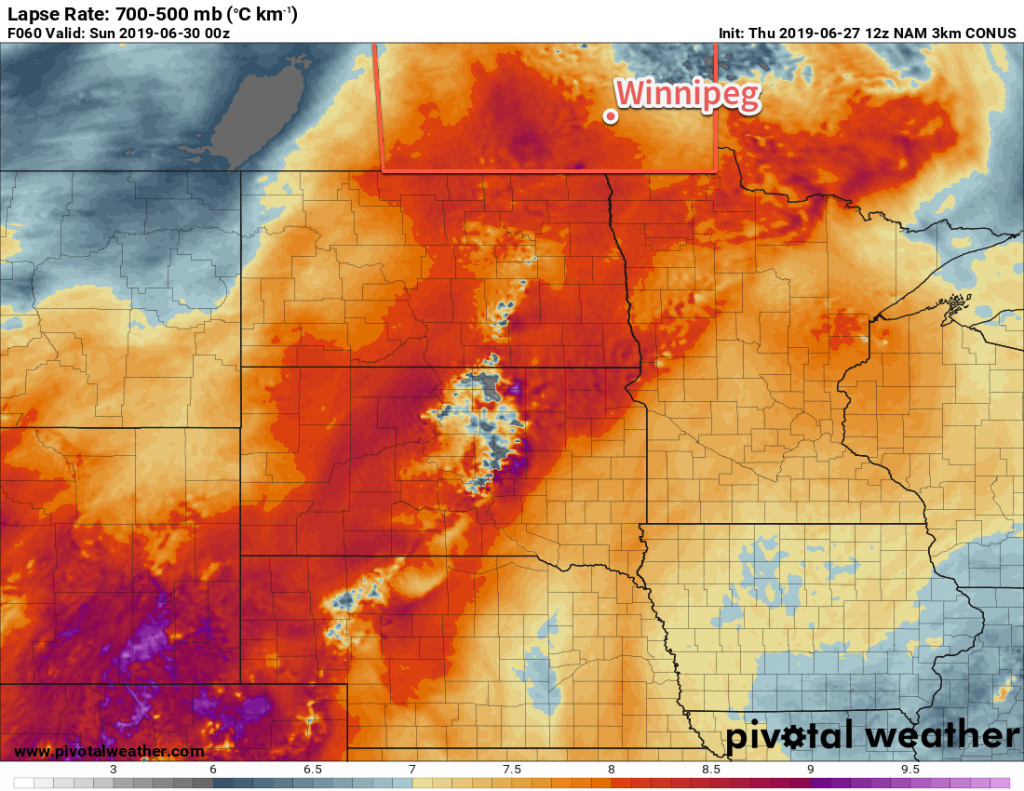
Significant mid-level instability will develop over southern Manitoba on Saturday afternoon, shown by 700-500mb lapse rates ≥ 8°C/km. 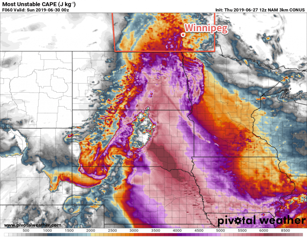
While surface-based convection will struggle against a capping inversion, significant instability for elevated convection will be in place Saturday afternoon across southern Manitoba.
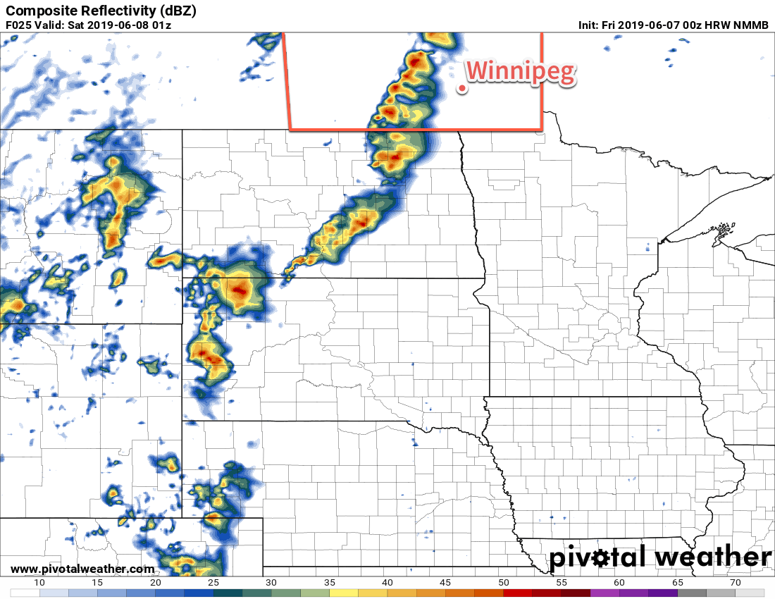
The thunderstorm threat for the day is largely conditional; a strong capping inversion will likely preclude any surface-based convection through the afternoon. There will be steep mid-level lapse rates coupled with strong dynamics that may support elevated convection, though. The first organized threat will be midday if any convection from Friday night manages to survive through the morning. Conditions should be more settled for the afternoon, then a risk for thunderstorms will redevelop late in the day. We recommend you view ECCC’s Thunderstorm Outlook on Saturday morning for the authoritative look at the day’s convective potential. You’ll be able to view it in our Bulletin Viewer.
The warm conditions continue on Saturday night as winds ease off and then turn northwesterly by Sunday morning. Winnipeg will see a low near 19°C.
Sunday will usher in drier conditions as breezy westerly winds up to 30 gusting 50 km/h develop. Temperatures will again climb to around 30°C, but dew points will drop back into the single-digits, making for more comfortable conditions. Any leftover cloud in the morning will quickly clear out, leaving behind partly cloudy skies for the rest of the day. Temperatures will dip to a mild low near 17°C on Sunday night with winds easing.
Long Range Outlook
Next week will bring a fair amount of sunshine to the region with daytime highs generally in the 25 to 30°C range. No major precipitation events are forecast, however there may be one or two chances for thunderstorms through the week.
Today’s seasonal daytime high in Winnipeg is 25°C while the seasonal overnight low is 12°C.