A Return to Seasonal Temperatures

Winnipeg will see calm weather through the first half of the week filled with plenty of sunshine as temperatures return to more seasonal values.

It’s another short and sweet forecast today with little weather in store for Winnipeg over the next couple days.

Today & tomorrow will both be sunny days, however temperatures will remain below normal. Today will see a high near -10°C, and there will be another chilly night ahead with a low near -20°C. Tuesday will be milder, with highs climbing to around the -5°C mark with southerly winds to 15-20 km/h. Expect a low near -12°C on Tuesday night.

Warmer air will be pushing eastwards over the coming few days.

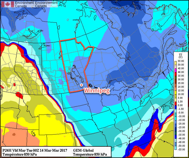
Wednesday will see cloud cover move into the region, creating mixed to cloudy skies, as even milder air pushes eastwards. Highs will climb to around -2°C with strengthening southerly winds to around 30 km/h. Lows will be mild on Wednesday night near the -4 or -5°C mark.

Long Range

NAEFS 8-14 Day Temperature Anomaly Forecast — Valid March 20-27, 2017

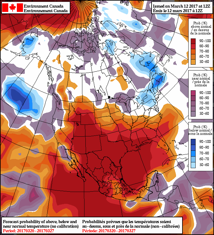
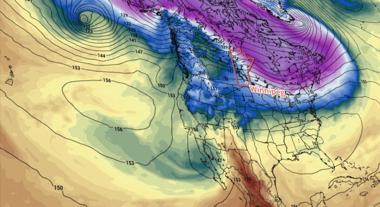
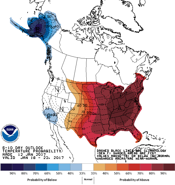
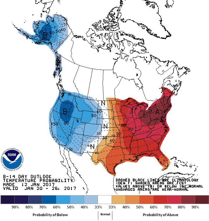
Temperatures will moderate towards seasonal values for the long-range, however in the second half of this week temperatures will likely climb above-normal for a few days before returning to seasonal values for next week.

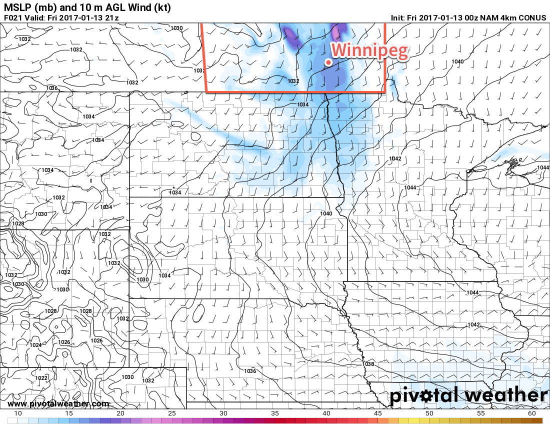
Precipitation wise, it looks like there will be a chance for some rain or snow this Thursday into Friday, and then the threat for a more potent storm system for the start of next week.

Winnipeg’s seasonal daytime high is currently -2°C while the seasonal overnight low is -12°C.

Massive Warm-Up On The Way

Today will mark a bitterly cold end to the week, but significantly warmer weather is on the way as the jet stream pushes northwards and allows mild Pacific air to spill across the Prairies.

Unfortunately, before we get to the warmer weather, we have to make it through today which will be, generally speaking, miserable.

We’re off to a cold start with an extreme cold warning as temperatures sit below -30°C with wind chill values dipping below -40. Warmer weather will attempt to push into the region today, but cold air will be pumped northwards up the Red River Valley out of the Arctic high that is now to our southeast. This combination will make today particularly uncomfortable as our freezing, but relatively calm, morning turns into a cold and uncomfortably windy afternoon.

Temperatures will climb to a high near -19°C today but winds strengthen midday out of the south to 30-40 km/h, maintaining wind chill values near -30. These strong southerly winds will likely produce areas of poor visibility in blowing snow throughout the rural regions of the Red River Valley.

Winds will taper off tonight as the warm front finally pushes through the region, allowing warmer air to finally push into the Red River Valley.

The 4km NAM picks up on the stronger southerly winds of 30-40 *km/h* expected through the Red River Valley today.

Temperatures will dip just a few degrees to -22°C tonight.

Saturday will be much nicer with winds of 10-20 km/h out of the south-southwest, just a few clouds and a high near -12°C. We’ll see a few clouds overnight as temperatures drop to -15°C or so.

Sunday will be another nice day with mixed skies, winds of 15-25 km/h, and a high near -7°C. Skies will be clear on Sunday night with a low near -13°C.

Long Range

The good news is that even warmer air is on the way next week and it doesn’t look like it’s going to go anywhere any time soon.

There is fairly good agreement across multiple models and agencies that the upcoming pattern change will be prolonged and produce generally above-normal temperatures for the next 2-3 weeks. At the moment, next week looks warm with daytime highs climbing to the freezing mark with little precipitation expected.

A Couple More Cool Days Before We Heat Up

We’ll have a couple days of cool weather before an upper ridge builds in, bringing hot & humid weather to southern Manitoba in the second half of the week. The arrival of the heat and humidity is also expected to bring our first significant risk of severe thunderstorms this year.

A cool northerly flow will be in place over southern Manitoba on Monday

This Week

Today will remain on the cool side as a surface high to our north-west pumps cool air into southern Manitoba. Some cloud cover is expected in southern Manitoba during the morning as an upper disturbance moves through, but skies should clear by the afternoon. Daytime highs will be in the upper teens with gusty north winds at 40 km/h gusting to 60 km/h.

Tuesday will remain cool as we remain under the influence of that surface high. Temperatures will once again be in the upper teens, although some areas in western Manitoba may reach the low twenties. Skies are expected to be mainly sunny and winds will be breezy from the north.

Warmer weather will begin to move into southern Manitoba on Wednesday as the surface high moves off to the east. A southerly flow will be in place over southern Manitoba, helping to bring warmer air into the region and push daytime highs into the mid twenties over the Red River Valley and the upper twenties over western Manitoba. There will likely be a risk of severe thunderstorms in eastern Saskatchewan on Wednesday and that may spill over into western Manitoba. Depending on how conditions develop, the thunderstorm risk may extend across all of southern Manitoba on Wednesday night as storms from Wednesday evening move east with time. A westerly steering flow and a strong southerly low-level jet would tend to favour easterly or south-easterly storm motions, which would help steer storms toward the Red River Valley during the overnight period. More details on Wednesday’s potential thunderstorm risk will be available as the week progresses.

Long Range

The long range forecast suggests a hot, but unsettled pattern, will be in place for southern Manitoba from late this week into the weekend. An upper ridge will be centred over southern Manitoba during this time period, but we are expected to remain at the top of this ridge, putting us along the storm track. The influx of warm, humid air due to the southerly flow in this ridge combined with the moderate to strong flow with the jet stream aloft should favour numerous thunderstorm chances during the Wednesday-Monday period. The nature of the thunderstorm threat remains quite unclear, but at least one or two severe events seems probable at this time. An upper trough is expected to approach either late this weekend or next week, which will push out this hot/humid air mass.

Sunny Skies and Warm Temperatures this Week

This week will feature a return sunny skies and warm temperatures, weather that we haven’t seen a lot of over the last week.

A surface high over Manitoba will bring sunny skies and mild temperatures

This Week

Today will be one of the cooler days this because we’ll still be in the coolish air mass leftover from the surge of arctic air late last week. However, high temperatures will still be in the upper teens under mainly sunny skies. Winds will be from the north as we’ll still be on the western edge of an upper trough, but the wind should shift to a southerly component on Monday night.

Tuesday will see even warmer conditions as temperatures climb into the low twenties. An upper ridge will begin building over southern Manitoba, which means Tuesday will be the first of many seasonably warm days. Winds will be light on Tuesday and skies are expected to remain sunny.

The forecast for Wednesday is a bit more uncertain than Monday and Tuesday because a shortwave trough is expected to push through southern Manitoba. It doesn’t appear this trough will bring any rain to southern Manitoba, but it may bring additional cloud cover to the region. Assuming the cloud cover isn’t too extensive, temperatures should climb into the mid-twenties with breezy south winds.

Long Range

The long range forecast suggests that the remainder of May will generally remain warmer than normal. One interesting feature of the long range forecast that bears watching is the potential for our first notable thunderstorm event of the year. Models have been consistent in bringing a large upper trough into western North America by next weekend, which is expected to draw a warm, moist air mass into southern Manitoba. The exact nature of the thunderstorm threat for southern Manitoba remains quite uncertain, but it appears possible we may see our first thunderstorm event of the year at some point on the long weekend.