Light Snow Lingers Into the Weekend

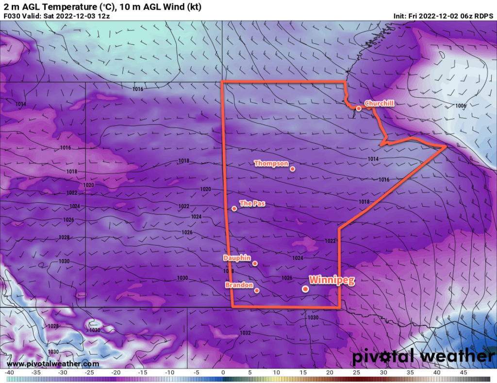
Temperatures will cool through the weekend as light snow lingers on the back-side of the departing Colorado Low.

RDPS 24hr. Snowfall Accumulation Forecast valid 00Z Sunday December 18, 2022
Light snow will continue to fall over the next couple days in southern Manitoba. Accumulations will be relatively light, though, with only 2 to 5 cm likely by Saturday evening.

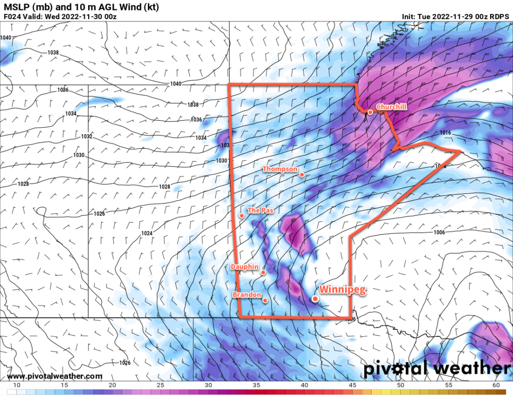
The Colorado Low that brought accumulating snow to the region over the past few days is gradually trundling eastwards, but its slow departure will mean both gradual cooling and lingering snow. In Winnipeg, this means cloudy conditions with periods of light snow over the next few days.

Accumulations will be relatively light over the next few days at just a couple centimetres or so each day. But with cooling temperatures, the persistent north wind and drier snow will result in plenty of blowing and drifting snow.

Temperatures will slide to around -10 °C this afternoon, then continue to drop over the next day. Expect lows around -12 °C tonight, then temperatures continue to slide into the mid-minus teens on Saturday.

Temperatures will stabilize for Sunday into Monday at seasonably cool values, but there will continue to be a chance of light snow.

Long Range Outlook

Heading into next week, a major pattern change is underway across the Prairies. A lobe of the Polar Vortex will detach and slump into the Prairies, bringing with it much colder temperatures. Beginning early next week, temperatures in southern Manitoba will begin to plummet. Daytime highs will fall into the -20s with overnight lows dipping close to -30 °C.

That stretch of colder weather will likely last much of the week, but some moderation back towards seasonal temperatures looks to be in store by the weekend.

At least we should see the sun more next week!

Today’s seasonal daytime high in Winnipeg is -10 °C while the seasonal overnight low is -20 °C.

Unpleasant Blast of Winter Weather Arrives

Strong northwest winds will send temperatures plummeting in Winnipeg today.

RDPS 2m Temperature Forecast valid 12Z Saturday December 3, 2022
A very cold air mass will move over the entire Prairies today with temperatures ranging from -20 to -35 °C across the region by Saturday morning.

A disturbance that brought snow to parts of western Manitoba will bring about quite a pattern chance for Winnipeg today. As the system tracks off to the east, moderate to strong northwest winds will develop and draw colder Arctic air into the region.

In Winnipeg, winds will increase to around 40 gusting 60 km/h midday, while to the west and south of the city the winds will be stronger, reaching as high as 50 gusting 70 km/h. These winds will send temperatures falling from around -11 °C this morning to around -18 °C by the evening. Wind chill values will become an issue later in the day, falling into the -30s by late afternoon.

The winds will also produce blowing snow through the Red River Valley, but the worst hit area will likely be the Trans-Canada Highway corridor between Elie and Portage la Prairie. If travelling through that area today, be prepared for the potential for road closures due to poor driving conditions this afternoon.

The wind will ease this evening with clearing skies. Temperatures will dip to a low around -23 °C.

A ridge of high pressure will move across the region on Saturday, keeping skies clear and temperatures cold. Winnipeg will see temperatures climb to a high near -15 °C with a southwest wind near 20 km/h. Temperatures will dip to a low near -20 °C tonight with increasing cloud towards Sunday morning.

On Sunday, a low pressure system will move through the region, dropping from northern Saskatchewan into the Interlake. It will bring warmer temperatures back to the region with highs into the -5 to -10 °C range along with some light snow. The north winds will return on Sunday night, sending temperatures downwards through the day on Monday.

Long Range Outlook

Arctic air returns early next week, bringing some of the coldest temperatures Winnipeg’s seen so far this winter. Temperatures will likely drop towards the -20 °C mark on Monday, then continue into the mid-minus twenties on Monday night. Tuesday could be the first day of the season with a daytime high colder than -20 °C, but temperatures then look to gradually moderate through the remainder of the week.

Today’s seasonal daytime high in Winnipeg is -6 °C while the seasonal overnight low is -13 °C.

#awm #forecast_post #awm_windy #awm_blowing_snow

A Few Flurries Usher in Cooler Weather

The Winnipeg area will see mixed skies with some occasional light snow over the coming days as cooler weather slumps into the region.

RDPS 10m Wind Forecast valid 00Z Wednesday November 30, 2022
Moderate to strong northwesterly winds will begin to usher in a colder air mass later today.

Cooler temperatures will filter southwards into Manitoba this week behind a departing low pressure system. This low will track from the Interlake eastwards into Ontario today with strengthening northerly winds developing in its wake. In Winnipeg, northwest winds will strengthen up to 40 gusting 60 km/h by the evening as skies cloud over. Once the cloud moves in, flurries will be likely across the region, and there may be some localized blowing snow in the area by evening. Temperatures will reach a high near -3 °C today, then dip down below -10 °C overnight tonight.

On Wednesday, the wind and flurries will taper off through the day, but the clouds might not break up until later in the afternoon. Temperatures will be much cooler with a high near -9 °C. With some clear breaks overnight, temperatures will fall into the mid-minus teens for a low overnight.

On Thursday, another low pressure system will begin approaching from the west, spreading more cloud cover into the region. Winds will pick up out of the south to around 30 km/h with highs a tad warmer, closer to -7 °C or so. With the thickening cloud cover, temperatures will stay a bit warmer on Thursday night, only dipping to around -10 °C. This approaching low will spread snow into southern Manitoba with the first flakes likely falling by early Friday morning.

Long Range Outlook

Snow will taper off later Friday with northerly winds picking up through the day. The region could see anywhere from 2–5 cm of snow, and temperatures will fall into the minus teens by the end of the day.

The cloud cover will break up on Friday night as a colder air mass moves into the region. Beginning on the weekend, daytime highs will dip below -10 °C while overnight lows head toward the -20s, bringing the first real shot of winter cold to southern Manitoba. While there will be some ups and downs, temperatures look like they’ll continue to drop next week with daytime highs possibly falling into the low minus teens by midweek.

Today’s seasonal daytime high in Winnipeg is -6 °C while the seasonal overnight low is -15 °C.

Cooler Weather Ahead With A Chance of Snow

Winnipeg’s temperatures will continue to slide over the next week as multiple disturbances move through the region.

RDPS 2m Temperature Forecast valid 00Z Wednesday November 9, 2022
Tuesday afternoon will likely be the last time Winnipeg sees above-freezing temperatures for…a while.

More snow is on the way today, but it will fall to the west and north of Winnipeg. Although Winnipeg got a bit of snow overnight, the main bulk of the snow pushed into western Manitoba overnight. It will continue to the northeast today, while here in the Red River Valley temperatures warm slightly under cloudy skies.

Winnipeg will see a high up to around the 5 °C mark this afternoon with easing southeasterly winds. Skies will stay cloudy through the day. A trough will move through this afternoon, followed by a cold front in the evening. The trough will bring a chance of showers as it moves through this afternoon. Cloudy skies will continue this evening with the passage of the cold front. It doesn’t look like any snow will fall with that frontal passage.

Heading into the rest of the week, Winnipeg will find itself on the edges of passing systems. Disturbances will push past the area on Wednesday afternoon and later on Thursday, but both will mainly affect areas southeast of Winnipeg. Wednesday’s system will bring a chance for some afternoon flurries, but Thursday’s could bring more notable snowfall. Right now, it appears that Winnipeg will only be grazed by the system with 2—5 cm accumulation by Friday morning. Amounts will increase southeast of the city, with 15 to 25 cm likely over the southeast corner of the province. Coupled with strengthening north winds, travel conditions to the south and east will likely deteriorate Thursday night into Friday with accumulating snow and blowing snow.

Snowfall accumulations will be sensitive to the track of this system. Should it push northwest a little bit, Winnipeg may be seeing a more significant snowfall event to end the week.

Through this whole time, cooler and cooler temperatures will be pushing into Winnipeg. Today’s above-freezing high will give way to a high near 0 °C on Wednesday that then drops towards -5 °C for the rest of the week. Overnight lows will also drop below -10 °C by the end of the week.

Long Range Outlook

Heading into next week, a strong northwesterly flow will develop aloft, allowing Arctic air to spill southwards across the Prairies. This will lead to a prolonged period of below-normal temperatures with highs likely in the mid-minus single digits and overnight lows near or below -10 °C. The region should see a bit of sun through the weekend, but cloudier conditions will return next week. Multiple disturbances will slump southwards in the flow, bringing several chances for snow next week. In addition, the colder air moving into the region will combine with the organizing northwest winds and will likely produce some lake-effect snow in the lee of the Manitoba Lakes next week.

It’s been a nice run, but it does indeed look like the region is finally on its decent out of fall into winter. Get those long johns and snow pants ready!

Today’s seasonal daytime high in Winnipeg is +1 °C while the seasonal overnight low is -7 °C.