More Cloudy, Cool Weather Ahead

The battle between Arctic and Pacific air will continue over southern Manitoba this week, bringing more cool and cloudy weather.

With a series of Arctic high pressure systems moving through southern Manitoba and a persistent west-southwest flow aloft, Winnipeg will continue to see below-seasonal temperatures and plenty of cloud cover.

Today Winnipeg will see temperatures reach a high near 8 or 9°C with a southeasterly wind near 20 km/h. Skies will remain mostly cloudy, but the day should stay dry. The city may see a light rain shower or two overnight as temperatures head to a low near +4°C.

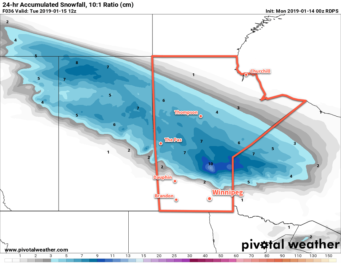
Tuesday will bring another day of cloudy skies to Winnipeg. A warm front lifting northwards into the region will bring warmer temperatures than much of the last week with a high near 11°C. An area of rain will move across the province north of the front, likely remaining north of Winnipeg as it tracks across the Parkland and Interlake. Keep an eye on this one, though; if the warm front ends up a tad further south, it could end up being a rainy day for Winnipeg.

A band of rain will spread through the Parkland and Interlake regions on Tuesday, remaining north of Winnipeg...probably.
A band of rain will spread through the Parkland and Interlake regions on Tuesday, remaining north of Winnipeg…probably.

Temperatures will dip to a mild low near 8°C on Tuesday night. The chance for rain will steadily increase overnight as a low pressure system strengthens over South Dakota.

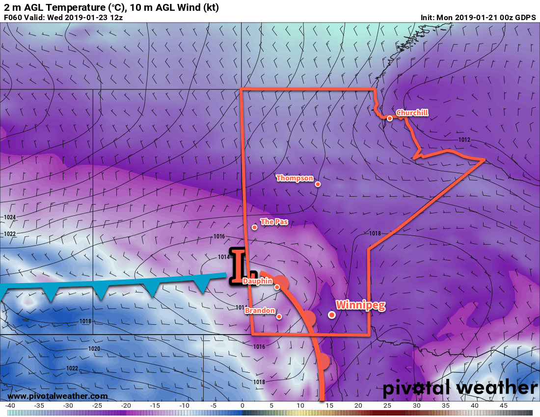
Wednesday will bring period of rain to the region as the South Dakota low lifts northwards towards Lake of the Woods. The Red River Valley will likely see 5 to 15 mm of rain through the day. Most notable will be the winds that develop behind a cold front that will sweep through in the afternoon. Behind the front, northwesterly winds up to 40 gusting 60 km/h will usher Arctic air back into the region. The rain will taper off in the evening, but a chance of snow will persist overnight as a lake-effect snow band likely develops off of Lake Manitoba. Temperatures will dip to a low near -2°C by Thursday morning.

Long Range Outlook

Absolutely no improvement is in sight in the long-range outlook. Winnipeg will likely see sunshine on Thursday with a cool high near 5°C, but then the cloud moves back in and will likely remain in place all the way through much of the weekend. More rain is possible on Friday followed by the potential for rain or snow to start next week.

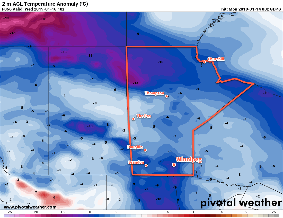
NAEFS 8-14 Day Temperature Anomaly Forecast — Valid October 8-15, 2018

It looks like October will be kicking off in much the same way September ended: with remarkably cool weather running several weeks ahead of schedule.

Winnipeg’s seasonal daytime high is currently 15°C while the seasonal overnight low is +3°C.

Warm, Unsettled Weather on the Way

Winnipeg will see a mild but unsettled weekend as a slow-moving low pressure system works through the region.

Mixed skies will be in place over the Red River Valley today as a warm front approaches from the southwest. Winnipeg will see a seasonal high near 22°C with dry conditions. Areas over the southern RRV, though, may see scattered showers develop later this afternoon into the evening. Winds will increase from 10 to 20 km/h in Winnipeg to closer to 30 km/h near the US border. Temperatures will remain seasonably mild tonight with a low in Winnipeg near 14°C. An approaching warm front will sustain southeasterly winds at 20 to 30 km/h as well as bring increasing cloud cover. By early Saturday morning, showers and/or thundershowers will be in place across much of the Red River Valley.

The showers will stick around through the first half of Saturday morning, then push off to the east. In their wake, Winnipeg will continue to see mixed to mainly cloudy skies with moderate southerly winds increasing to 40 gusting 60 km/h. Despite the cloud, temperatures should climb to a high near 25°C in Winnipeg. Heading into Saturday night, the remainder of the warm front will push through, bringing more cloud and another chance of [thunder]showers to the Red River Valley. Temperatures will dip to a low near 16°C with breezy winds persisting right into early Sunday morning.

A band of [thunder]showers will spread eastwards acoss southern Manitoba on Friday night into Saturday morning.
After those showers clear out early Sunday morning, Winnipeg will see a relatively pleasant day. Mixed skies will continue, but winds will ease into the 20 to 30 km/h range as temperatures climb to a high near 27°C. A cold front will push through on Sunday evening, bringing with it a good chance of showers or thunderstorms. There may even be a low chance of scattered strong to severe thunderstorms along the front as it moves through. The region will finally see some marked clearing on Sunday night as winds ease and temperatures head to a low near 13°C.

Long Range Outlook

Winnipeg will see a return to seasonal temperatures and settled conditions on Monday. It will be short-lived though; most long-range forecasts show the return of unsettled conditions by Wednesday. Winnipeg looks to see several chances for rain through the second half of next week. While a stretch of cloudy weather won’t be what most people would like, numerous chances for some rain sounds quite nice to my increasingly parched lawn!

Winnipeg’s seasonal daytime high is currently 20°C while the seasonal overnight low is 8°C.

Warmer Weather Makes A Windy Return

Sunshine returns to Winnipeg today as warmer air beings moving back into the province. Conditions will be relatively pleasant – albeit windy on Thursday – with the only chance for rain expected overnight Thursday as a cold front moves through.

The upper trough which brought more cloud and showers to the province yesterday will move out of the region this morning, bringing an end to the showers as skies clear. Temperatures will remain slightly cool today, though, with Winnipeg’s high expected to reach 21°C. Winds will be light out of the west through the day. Skies should remain mostly clear tonight as the low dips to around 12°C with 20 to 30 km/h winds developing out of the south.

Thursday will bring warm temperatures back to Winnipeg as the high climbs to an above-seasonal 28°C. Unfortunately, the warmth will come with moderate southerly winds strengthening to 40 gusting 60 km/h. The Red River Valley will see a few clouds through the afternoon.

Moderate southerly winds will develop across the Red River Valley on Thursday afternoon

Heading into Thursday night, Winnipeg will see a slight chance of thunderstorms along a cold front moving through. It’s one of those situations where the best support for thunderstorms appears to be both north and south of Winnipeg, so we’ll just have to see if any manage to develop near us. If thunderstorms develop, there will be a slight risk of severe thunderstorms with the main threat of large hail and damaging winds.

Thursday Night Thunderstorm Potential

Going over the MIST ingredients:

  • Moisture: A strengthening southerly flow will develop over southern Manitoba on Wednesday night, sourced from the central Plains. This flow will result in significant moisture transport northwards, evidenced by surface dewpoints increasing from the high single digits on Wednesday night into the mid-teens on Thursday afternoon. Moisture should be rather deep given the general large-scale transport expected to occur.
  • Instability: Instability will be moderate with MLCAPE values of 1000-1500 J/kg expected to develop Thursday afternoon. The cold front will sustain the instabilities it pushes eastwards overnight with most models maintaining 1000-1500 J/kg of MUCAPE.
  • Shear: Moderate shear will be in place with 30-40 kt of effective shear. Profiles show favourable directional shear within the effective layer with south-southeasterly winds near the storm base veering to southwesterly aloft.
  • Trigger: The cold front pushing east-southeast should provide the focus for thunderstorm development.

These parameters favour strong to marginally severe thunderstorms that could persist along the cold front for much of the night. Due to the favourable shear profiles, discrete thunderstorms may develop early in the event lifecycle upscale growth transitions the storms into a multicellular line. Marginally severe hail of 2-3 cm appears possible with these thunderstorms, along with wind gusts of 80-100 km/h.

Behind the cold front, winds will diminish as skies clear and temperatures drop to a low near 13°C.

Friday will bring settled, pleasant weather to Winnipeg. The high should climb to around 23°C with west northwest winds of 20 to 30 km/h. Temperatures will dip to a cooler low near 10°C as a weak ridge of high pressure moves in overnight.

Long Range Outlook

Winnipeg’s weekend is looking fantastic with sunny to partly cloudy skies and temperatures in the mid-20s. Winds don’t appear that they’ll be much of an issue, either. All in all a great way to start September!

Winnipeg’s seasonal daytime high is currently 23°C while the seasonal overnight low is 10°C.

Hot Start Followed By Big Cool Down

After a hot start to the week today in Winnipeg, a cold front passing on Tuesday will usher in much cooler conditions.

Temperatures will soar above 30°C today in Winnipeg as a broad area of low pressure moves through the region. A west-southwest flow will send highs up to around 31°C with comfortable humidity levels. Skies will remain mainly sunny, and those aforementioned winds will only be around 20 km/h. Temperatures will remain mild tonight with a low near 18°C.

Tuesday will bring more cloud to the region and near-seasonal temperatures. Temperatures will climb to around 27°C before a cold front drops through the region. The front will bring increasing cloud and begin cooling off temperatures. There will be a chance for some showers or isolated thunderstorms in the afternoon, but low moisture and dynamic support will limit the rainfall potential. Winds will be notable with northerlies up to 30 to 40 km/h moving in for the afternoon.

A sharp cold front will sweep southwards through the Red River Valley on Tuesday afternoon.

A high pressure system moving into the region will bring significantly cooler temperatures on Tuesday night wth lows heading back towards 10°C. Winds will gradually diminish to around 10 to 15 km/h on Tuesday night.

Wednesday will see mixed skies gradually clear, but temperatures will be markedly cooler with a high near 21°C. Winds will be light out of the north-northeast as the high moves through. Expect another cool night on Wednesday night with a low near 11°C and light winds.

Long Range Outlook

Temperatures will return back towards seasonal values for the remainder of the week, but forecasts are indicating that unsettled conditions will return to the region. A few disturbances moving through will bring the chance of showers or thunderstorms back to the region Thursday night through Friday.

Winnipeg’s seasonal daytime high is currently 26°C while the seasonal overnight low is 13°C.