Increasing cloudiness and breezy conditions will usher milder temperatures into Winnipeg for the end of the work week.
A warmer air mass will begin pushing into Manitoba today, bringing increasingly southerly winds to the Red River Valley. With mixed skies leaning towards the cloudier side, Winnipeg will see winds pick up out of the southeast to 20 to 30 km/h. Temperatures will still be on the cool side today with a high near -8°C. There will be a chance of some flurries today as the warm front approaches, but no accumulations are likely. Tonight, winds will continue out of the south near 30 km/h with mostly cloudy skies continuing. The arrival of warmer air will be easily noticed with temperatures remaining steady near -8°C through the night.
Thursday will bring mostly cloudy skies to Winnipeg with winds out of the south at 30 gusting 50 km/h. Warmer air will continue to push into the region, sending the high to an above-seasonal -1°C. Mostly cloudy skies will continue on Thursday night with easing winds and a low near -4°C.
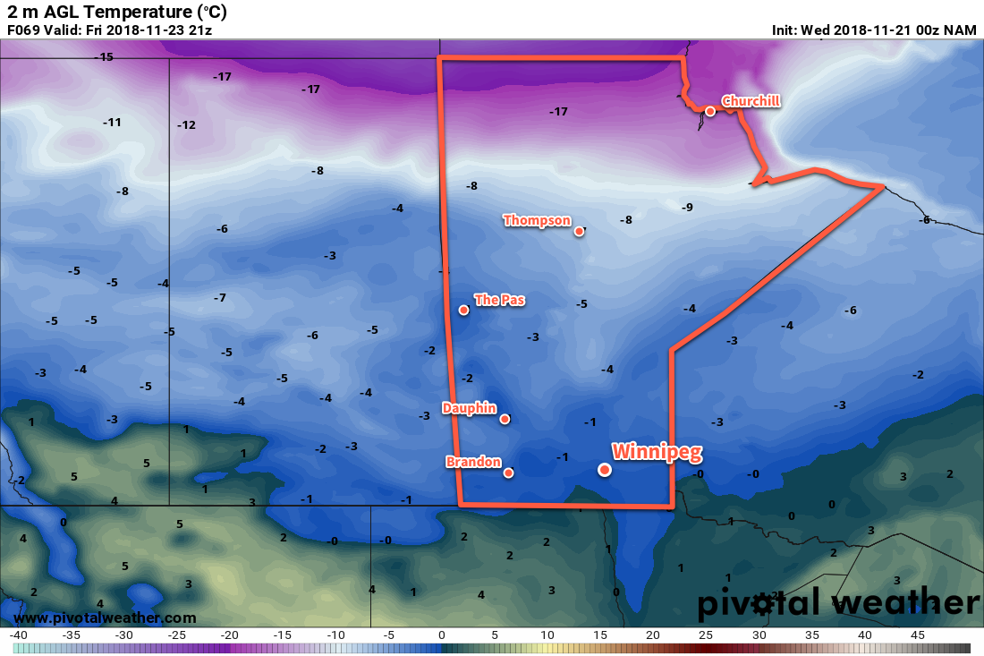
On Friday, the warmest temperatures associated with this system will be in place. Under mostly cloudy skies, high will reach 0°C with light southerly winds. Winds will shift to the north behind a trough that moves through in the evening, then strengthen overnight as a cold front slumps southwards. This cold front will also bring with it a chance for some light snow overnight. Temperatures will dip to a low near -5°C as those northerly winds pick up to around 30 km/h.
Long Range Outlook
Heading into the weekend, temperatures will slide back to well below-seasonal values. Along with the colder weather, Winnipeg will see variable cloudiness with the chance for some flurries. By the start of next week, temperatures will be back to around 5°C below normal for late-November. Those cool conditions will stick around for much of next week.
Winnipeg’s seasonal daytime high is currently -4°C while the seasonal overnight low is -12°C.