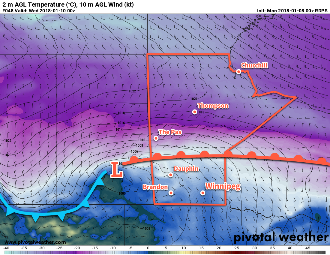
A potent low pressure system moving through Manitoba on Tuesday will send temperatures in Winnipeg soaring, only to crash back down just as quickly. Alongside the warmth, Winnipeg will see something that has been relatively elusive this winter: snow.
A ridge of high pressure over the region today will bring cold and calm conditions to Winnipeg. Under variable cloudiness, temperatures will climb to a well below seasonal high near -17°C. Winds will remain light.
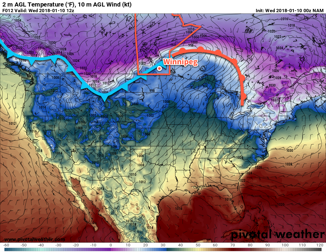
Conditions will begin deteriorating tonight as a potent low pressure system begins pushing eastwards across the Prairies. Temperatures will dip a few degrees in the evening, then climb towards -15°C by Tuesday morning as skies cloud over and winds pick up out of the southeast to around 40 km/h.
Snow will move into Winnipeg early Tuesday morning ahead of an advancing warm front. The heaviest snow will likely fall during the morning rush hour, then gradually taper off into the afternoon. Winnipeg will likely see around 5 cm or so of snow during the day, with amounts increasing into the 15 to 25 cm range across central Manitoba.
Update on Winds
Winds will be quite strong out of the southeast throughout much of the day, with winds of 40 gusting 60 km/h strengthening to 50 km/h with gusts of 70-80 km/h throughout the remainder of the day. These strong winds combined with falling snow will produce very poor visibilities in blowing snow with the potential for white-out conditions on area highways.
Temperatures will climb quite substantially on Tuesday as the warm front passes and temperatures reach the daytime high around -1 or 0°C. Winds will ease to around 20 km/h as the low passes through the Interlake, then strengthen to 30-40 km/h out of the west-northwest on Tuesday night as the low exits the region.
Skies will remain mostly cloudy with a slight chance of flurries on Tuesday night as temperatures head to a low near -15°C. Northwest winds near 30 km/h may produce some patches of blowing snow on area highways, so be sure to give yourself extra time if you need to travel.
An Arctic high will build into the Prairies behind this system on Wednesday, ushering a colder air mass into the region. Temperatures will continue to fall through Wednesday, reaching -20°C by the evening. Winds will be moderate out of the northwest at around 30 to 40 km/h, likely producing areas of blowing snow with poor visibility on area highways. Skies will see increasing cloudiness with a chance of flurries dropping southwards out of the Interlake. Expect a low near -25°C on Wednesday night.
Long Range Outlook
Unfortunately, the passage of Tuesday’s low marks a transition into a prolonged period of cooler temperatures.

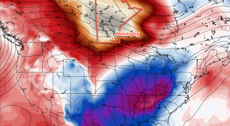
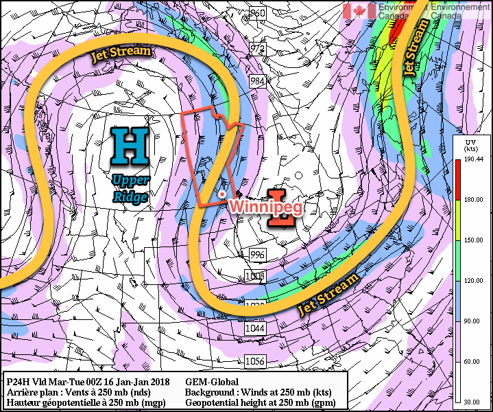
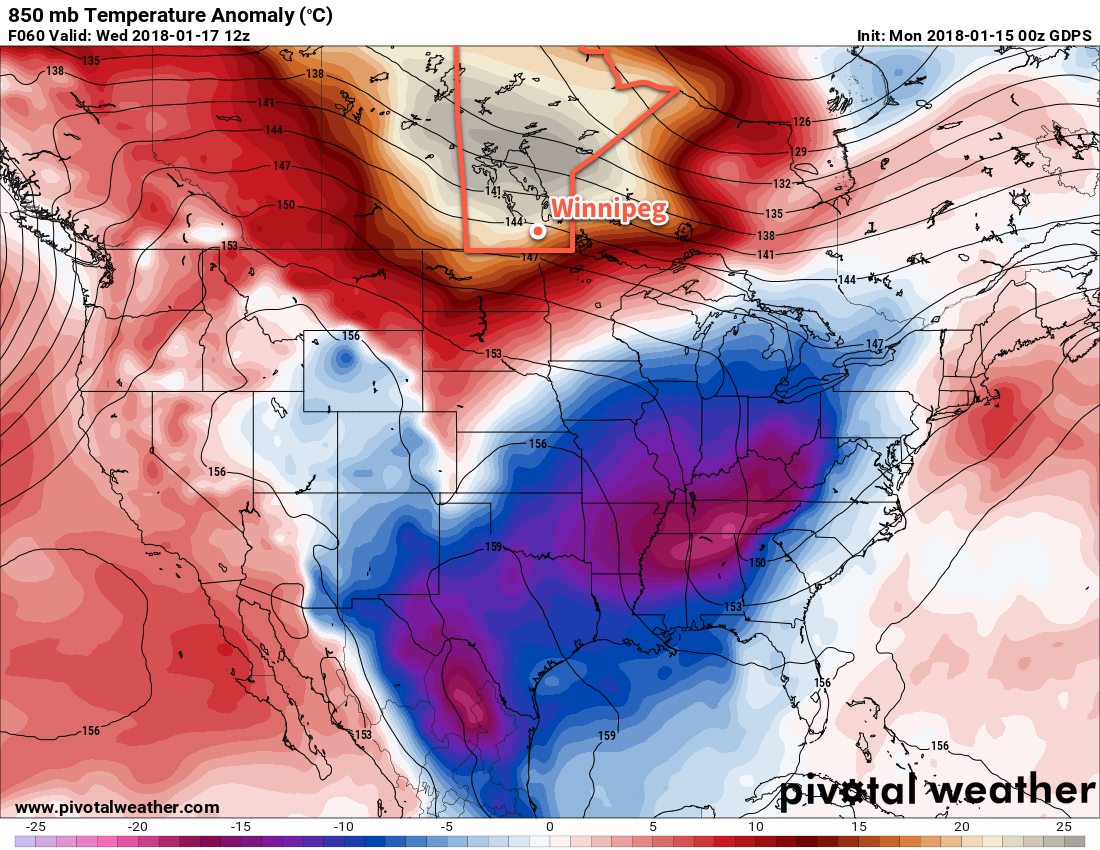
In the wake of this storm, the polar vortex is expected to intensify slightly and drop southwards into Hudson Bay, establishing a large-scale north-northwest flow that will pipe Arctic air southwards into the eastern Prairies. Winnipeg will move into a cold pattern for the remainder of the week with daytime highs near -20°C – or colder – and overnight lows near -30°C.1
This period of colder temperatures is persist for much of next week too, with hints of a brief warm-up as a low passes by mid-week immediately followed by a return to colder conditions. So if you had optimistically put away the deep freeze gear, it’s time to get it back out!
Winnipeg’s seasonal daytime high is currently -11°C while the seasonal overnight low is -22°C.
- While temperatures will be below normal, it won’t be unseasonably cold: most record lows are below -40°C for this time period! ↩