A Brief Early-Week Cooldown

A cold front passing through the region this evening will bring the chance for some flurries this evening and return temperatures well below seasonal…for one day. Milder weather quickly returns for the remainder of the week on Wednesday.

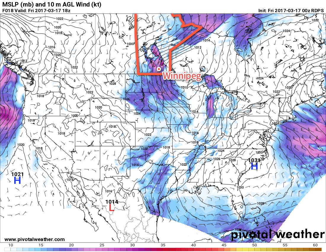
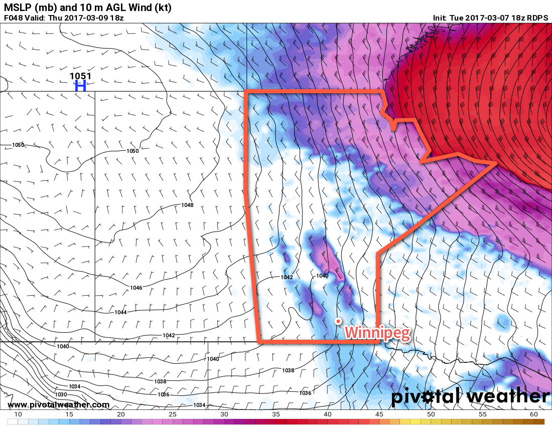
Today will be a fairly sunny day with the Red River Valley still in the warm-sector of a major low pressure system bringing blizzard conditions to portions of northern Manitoba. Temperatures will be mild with daytime highs generally around the 4-6°C, bolstered by westerly winds at 20-30 km/h.

Things will change this evening when a cold front sweeps through the Red River Valley, bringing a chance of flurries and gusty northwesterly winds to 30-40 km/h. Temperatures will drop to around -5°C within a few hours, and then continue on to an overnight low near -13°C. Winds should taper off to around 20 km/h by midnight and remain there for the rest of the night. Skies will clear out fairly quickly behind the front.

Tuesday will see a large ridge of high pressure build into the region, bringing mainly sunny skies and winds that gradually taper off. Temperatures will be cool with daytime highs near -7°C. The northerly winds will taper off in the afternoon and then temperatures will head down to a low near -14°C overnight.

An Arctic ridge will be in place over Manitoba on Tuesday, bringing below-seasonal temperatures.

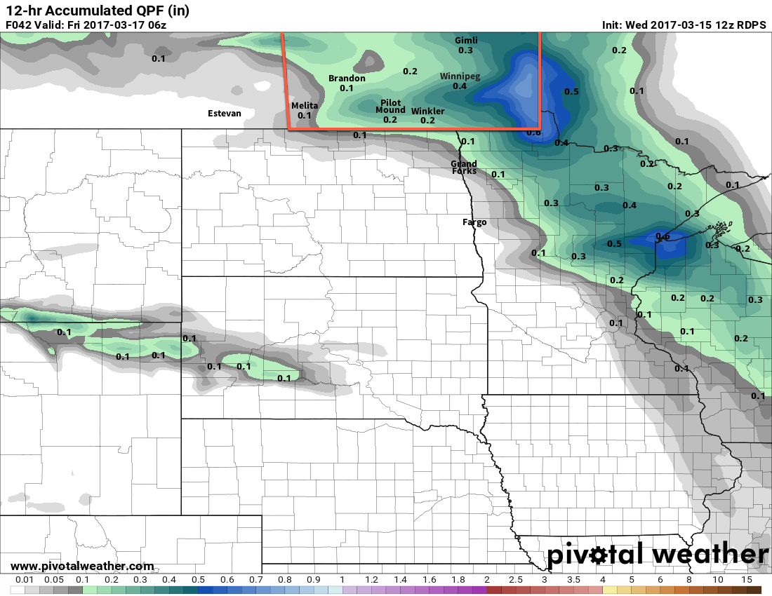
Wednesday will start off cool, but warm up through the day as a southerly wind to 30-40 km/h develops ahead of an approaching low pressure system. Daytime highs across the Red River Valley will be near 0°C as cloudy skies develop later in the afternoon. With windy conditions and warm air continuing to push eastwards overnight, temperatures will remain mild with lows near -2 to -4°C on Wednesday night. As the warm front moves through, there will be a chance for some precipitation, which could end up as anything from rain to snow or freezing rain.

Long Range

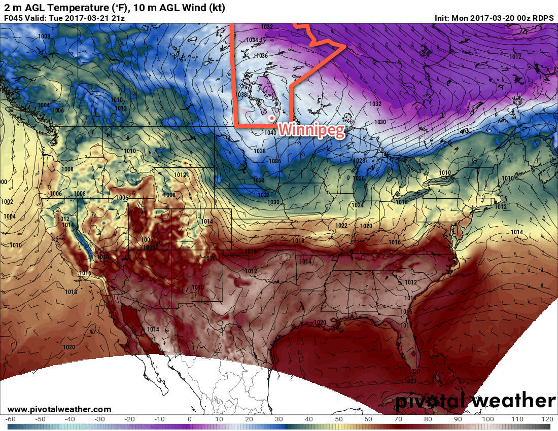
The remainder of the week looks mild with daytime highs above 0°C and generally settled conditions.

Winnipeg’s seasonal daytime high is currently 1°C while the seasonal overnight low is -10°C.

An Unpleasant Friday Followed Up By A Warm Weekend

Today will be categorically unpleasant as a brisk northwesterly wind ushers colder air into Winnipeg & the Red River Valley behind a cold front that passed through earlier this morning. It will be relatively short-lived, though, as temperatures begin rebounding immediately on Saturday and climb back above-normal for Sunday.

A cold northwesterly wind will be in place over Winnipeg & the Red River Valley today, starting out at around 30km/h but strengthening to 50 gusting 70 km/h midday. This will be accompanied by light snow, with anywhere from 1-3 cm looking like the most likely accumulation. The combination of yesterday’s rain, freezing overnight, and the gusty winds with snow will likely make highways in the Red River Valley slippery, so you should be sure to give yourself extra time and take caution if you have to travel today. Additionally, if any slightly heavier snow bands develop, visibilities will likely be very reduced as the strong winds blow the snow around underneath them. Temperatures will slowly drop through the day to around -4°C by this evening.

Winds will ease off through the night with clearing skies as temperatures dip to a low near -13°C.

Moderate northwesterly winds (pink) will be in place over the Red River Valley today.
Saturday will be cool with a high of just -3 or -2°C and increasing cloud. Winds will increase to around 15-20km/h by the end of the day, and then continue to strengthen overnight to 30-40 km/h. Temperatures will remain steady near -2°C overnight under cloudy skies. There’s a very slight chance of some light flurries early Sunday morning.

Sunday will be a pleasant day with temperatures climbing to a high near +3°C under mixed skies. Winds will shift from southerly at 15-20 km/h to westerly at around 30 km/h late in the afternoon. Expect a low near -2°C under partly cloudy skies on Sunday night.

Long Range

Looking ahead into next week, it appears a cool-down is on the way Monday as northwesterly winds usher in an Arctic ridge behind the low pressure system tracking across the northern Prairies. This will send daytime highs back down to the freezing mark or just below for the first half of the week. Warmer weather returns in a windy southerly flow in the second half of the week, but along with it comes a couple potential disturbances that could bring precipitation to the Red River Valley.

Winnipeg’s seasonal daytime high is currently 0°C while the seasonal overnight low is -11°C.

Spring Warmth Brings Showers

Springtime warmth will arrive in Winnipeg as temperatures climb above the freezing mark, but the warmer weather will be accompanied by some rain and snow as a low pressure system moves through the region.

Today will be a very pleasant day in Winnipeg with sunny skies in the morning giving way to mixed skies with temperatures climbing to a high near -2°C.1 Winds will pick up out of the south to around 30 km/h this afternoon. Tonight will bring increasing cloudiness overnight as temperatures drop to a low near -5°C with southerly winds continuing at 20-30 km/h.

Tomorrow will be the mildest day of the next few as an approaching low pressure system moves through the region. Skies will be mainly cloudy to start the day and continue to be cloudy for the remainder of the day. A warm front will move across the Red River Valley through the afternoon, bringing milder temperatures as highs climb to around the +3°C mark. Along with the warmer weather, rain will spread across the Red River Valley in the afternoon with the warm front.2 It appears at this point that the Red River Valley will likely receive 2-4 mm of rain, so nothing too dramatic, although there are some models indicating the potential for 10-15 mm.

The RDPS model is a bit more enthusiastic than the other models, producing around 10mm of rain in the Red River Valley.

The light rain will end in the evening, followed quickly by the winds diminishing. The cloudy skies and warm air over the Red River Valley will keep overnight lows fairly warm, with Winnipeg dropping to around 0°C for a low. Towards early Friday morning, winds will then pick back up out of the northwest as the cold front swings through, which will bring cooler temperatures back into the region.

Friday will continue with mainly cloudy skies and fairly strong northwesterly winds to 40-50 km/h. Temperatures will remain steady near 0°C as any diurnal warming will be offset by the cooler air mass moving into the region. Throughout much of the day there will a decent chance for light snow, but no accumulations are expected at this point.

Friday night will bring diminishing winds, clearing skies, and cooler temperatures with overnight lows dropping to around -14°C.

Long Range

The weekend is looking quite pleasant with partly cloudy skies both Saturday and Sunday and high temperatures climbing back to above normal. At this point, Sunday is looking like it could be quite warm with highs in the 4-8°C range, although those warmer temperatures would likely come with a decent southerly wind. The hope at this point is that any precipitation associated with this warm-up will move across the central and northern Prairies, leaving us dry.

Into next week it looks like a return to near-seasonal temperatures and dry conditions.

Winnipeg’s seasonal daytime high is currently -1°C while the seasonal overnight low is -11°C.

  1. While our high is forecast for the airport location, it's quite likely several sites across Winnipeg see high temperatures closer to +1 or +2°C.
  2. There's a chance that the early stages of the precipitation fall as snow if temperatures haven't warmed quite enough yet, but the transition to rain would follow quickly.

Wild Winter Storm Winds Down

Residents of southern Manitoba can breathe a sigh of relief as conditions begin to improve as the major winter storm that has been hammering the province begins to move off into the Arctic.

Today will bring relief to southern Manitoba as the strong westerly to northwesterly winds in place over the region begin to subside. These winds have created havoc over southwestern Manitoba where some of the worst blizzard conditions in recent memory developed on Monday and persisted throughout the day and into the night on Tuesday. Brandon saw blizzard conditions begin around 5PM on Monday evening and persist all through Tuesday. Numerous motorists had to be rescued from area highways, despite significant notice of extremely poor conditions being given in advance of this storm by Environment Canada.1

This winter storm was driven by a powerful low pressure system that stretched all the way from Western Saskatchewan to Labrador on Tuesday evening.

Winds will subside through the day from around 50 gusting 70 km/h this morning to 30 gusting 50 km/h around midday as the low pushes off to the northeast, allowing the pressure gradient to begin to slacken over the southern portion of the province. While the winds will still be a bit gusty, they should be low enough for visibilities to improve. Temperatures will be cool, however, with a high temperature of just -10°C. Skies will start the day cloudy but break up to more of a mix in the morning.

Skies will be partly cloudy tonight as temperatures drop to a chilly -20°C.

A ridge of high pressure will push into Manitoba from the northwest, ushering colder temperatures into the province.

Thursday will see much colder air pushing into the province as a ridge of high pressure builds into the region. Temperatures will struggle to recover much through the day with highs expected to climb only to around the -17°C mark. This is nearly 15°C below normal for this time of year. Winds will be out of the northwest at around 20-30 km/h under partly cloudy skies. Temperatures will drop even further below normal on Thursday night with lows dipping down to around -27°C under clear skies with light winds.

Friday will be a cool and sunny day with little wind. Highs will be around -17 or -16°C with a low on Friday night near -21°C.

Long Range

The below-normal temperatures will continue through the weekend and into the beginning of next week, although there will be a gradual climb towards near-seasonal conditions. No significant snowfall is expected for Winnipeg the next 7 days.

Winnipeg’s seasonal daytime high is currently -3°C while the seasonal overnight low is -13°C.


  1. Environment Canada issued several special weather statements regarding the storm as well as blizzard warnings well in advance of the storm’s onset.