Winnipeg will see another cool day before seasonal temperatures return on Saturday and stick around through the weekend and beyond. Overall the upcoming weather forecast could be described as "fairly boring" with no significant weather events expected in the next 5-7 days.
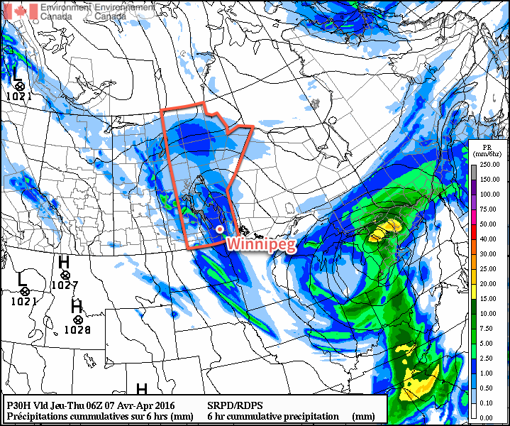
Winnipeg will see mainly cloudy skies today as a weak upper-level disturbance moves across the province. With all the cloud and a weak northerly wind, below-normal temperatures will persist with a high temperature of just 7°C. The afternoon will bring a slight chance of some shower activity, but it is overall expected to be quite light and may remain north of the Winnipeg. Temperatures will be chilly tonight as temperatures dip to +2°C under cloudy skies.
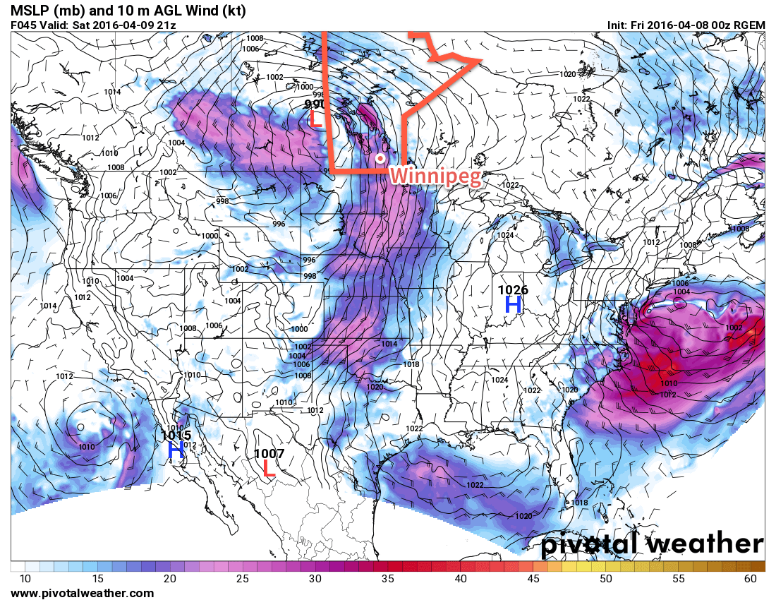
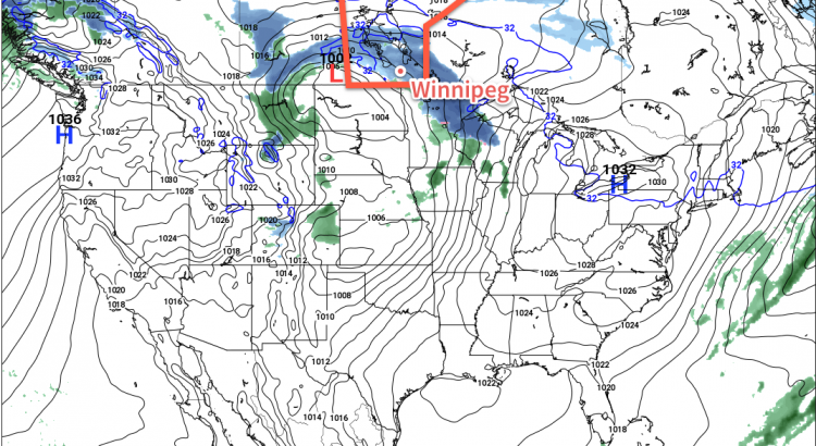
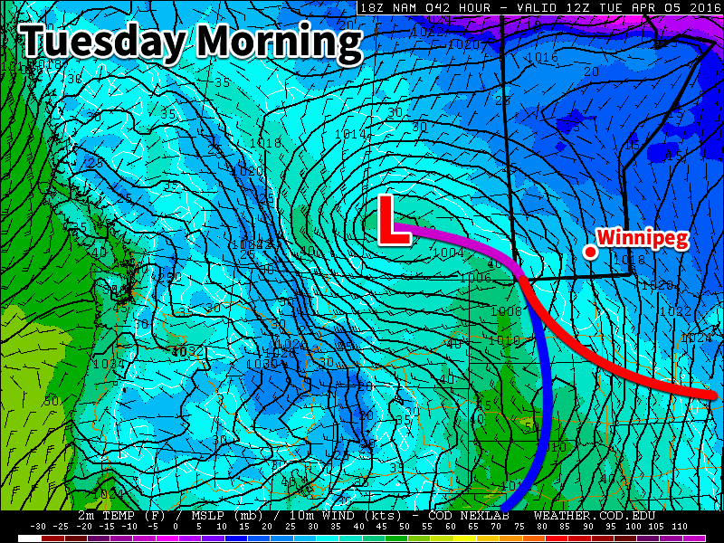
Saturday will be another cloudy day in Winnipeg and mark the start of the next weather system that, while not directly impacting us, will set the stage for the weather over the region for the next few days. A fairly potent low pressure system will begin building out of Montana into South Dakota, spreading cloud and rain through North Dakota towards the Canadian border. A strong deformation zone should set up just south of the border, keeping the precipitation States-side. In Manitoba, this system will produce primarily cloud and wind. As mentioned, we expect mainly cloudy skies for Winnipeg, and much of the remainder of Southern Manitoba, on Saturday. The wind will pick up out of the northeast, strengthening to about 30km/h here in Winnipeg, with values closer to 40 gusting 60 km/h over southwestern Manitoba.
Some of the cloud will begin to slump to the south on Saturday night as temperatures drop to the -1°C mark.
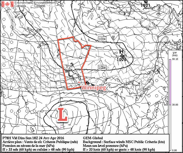
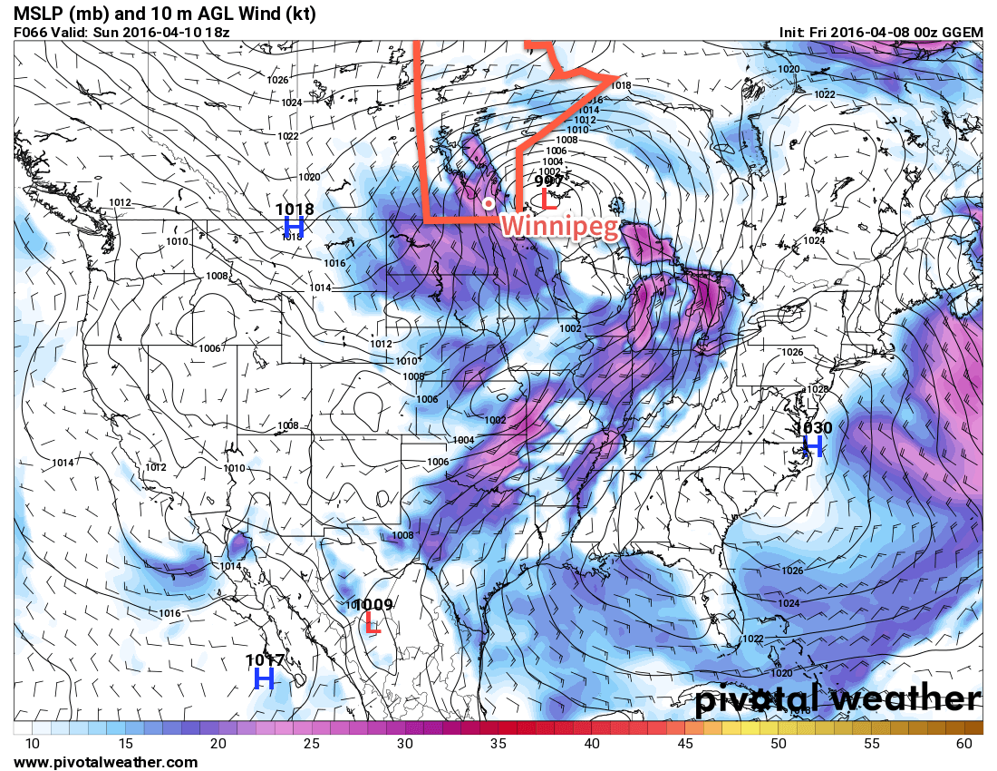
Sunday will bring partly cloudy skies for Winnipeg as the main cloud shield slumps to the international border.[1] Temperatures will continue near seasonal values with a high of 10°C. Unfortunately, it will feel quite chilly as a brisk northeasterly wind approaching 40km/h develops over the Red River Valley. Temperatures will dip down to the freezing mark on Sunday night once again with winds tapering off.
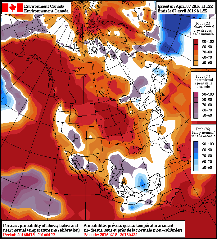
A quick glance ahead into next week shows pretty much more of the same; some sun, some cloud, and temperatures at or just below seasonal. Not much is expected precipitation wise until a system comes through in the second half of the week and brings the potential for some rain to the region.
Winnipeg’s seasonal daytime high is currently 13°C while the seasonal overnight low is 0°C.
- This means that for areas in the southern Red River Valley, skies will likely be more mixed-to-cloudy. ↩