Mid-January Storm To Bring All Manner of Nasty Weather

A powerful storm system is pushing into Southern Manitoba this morning and will become the first major storm of the year. This storm will impact the entirety of Manitoba and bring very strong winds, heavy snow, near-blizzard conditions and a good chance of some freezing rain. Read on to find out where will see what as we break this thing down.

  • Significant weather expected: strong winds (and blowing snow), freezing rain and heavy snowfall.

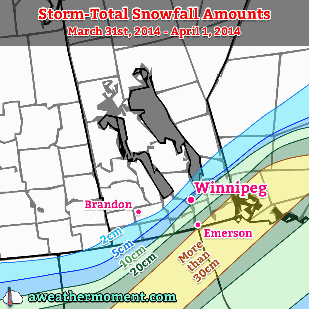
  • Expected storm-total snowfall amounts from this system.

Disclaimer: I could write many more words than I have time to write about this system. As such, I’m going to just explicitly state right now that while I may mention areas outside the Red River Valley, the focus of this post will be for the weather expected in Winnipeg & the Red River Valley.

We’ll start out with the good news: temperatures are expected to stay near or above normal[1] through the remainder of the week; no horribly cold Arctic air is expected to slam southwards into the Prairies with this system. That’s about where the good news ends, though.

As we progress through this morning, an area of snow will move into the Red River Valley, pushing in from the west ahead of the incoming warm front. The low pressure centre is currently in northeastern Saskatchewan and will begin to dive southeast into Central Manitoba later this morning. Winds will strengthen out of the south this morning up to around 40-50km/h with gusts as high as 70km/h. Despite the relatively mild temperatures – we’re sitting at around -10°C – extensive blowing snow will likely be an issue in areas to the south of Winnipeg[2] thanks to the strength of the winds.

Wednesday

3°C / -11°C
Snow beginning this morning. Very windy. Risk of freezing rain this afternoon. Flurries overnight with blizzard conditions in the Red River Valley.

The heaviest snowfall will pass to the north and east of the city where a heavy snowfall warning is in effect for 10-15cm of snow. Here in the Red River Valley we’ll see a fair gradient in snowfall amounts from the southwest corner to the northeast corner thanks to how the precipitation spreads in from northwest to southeast. Through the day today, areas in the southwest corner can expect the lighter end of the snowfall with only around 2-5cm accumulation by the evening. Here in Winnipeg we’ll see from 5-10cm of snow while closer to 10cm of snow will fall to our north and east.

Our winds, as mentioned before, will become quite strong out of the south. They’ll lighten a little bit for the early afternoon as they swing to the west as the low pressure system moves through the Interlake and the warm front pushes east of the Red River Valley. Our temperature will jump up to around +2 or +3°C and we’ll see a break in any blowing snow that’s happening. By mid-to-late afternoon, though, a cold front will be approaching. Winds will shift a little more to the northwest and we’ll see a risk for some freezing rain just ahead of and along the cold front as it pushes through. In addition, there is the potential for some fairly heavy bursts of snow along the cold front with some models hinting that there may be a fair amount of convective activity associated with it[3]. Winds will shift straight out of the northwest by the evening and strengthen considerably to 50km/h with gusts potentially as high as 80km/h overnight here in Winnipeg.

This wind will readily whip up the freshly fallen snow in the RRV and produce near-zero or white-out conditions on area highways. Despite the fact that temperatures will not drop too quickly – only to around -10°C overnight – it will still be a brutal night. Continued flurry activity will likely continue through the night, compounding the visibility problems presented by the winds alone.

Thursday


⇒ -10°C / -20°C
Windy with blowing snow. Mainly cloudy.

The snow will taper off early on Thursday, but poor visibilities will continue through much of the day as the strong northwest winds persist at 40-50km/h at least into the early afternoon. Temperatures will remain fairly steady at around -10°C.

By evening the wind will taper off as a ridge of high pressure moves into the province, bringing an end to any blowing snow left in the Red River Valley. The clouds will also scatter out and we’ll drop to a chilly -21°C for our overnight low.

Friday & The Weekend


-10°C / -14°C
Cloudy periods with a chance of afternoon flurries.

Friday will start off sunny but some cloudy periods will develop as a warm front pushes into the Red River Valley. We’ll become overcast in the mid-to-late afternoon and see a chance for a few flurries as the warm front pushes eastwards. This front will usher in warmer air for the weekend with highs near the 0°C mark and overnight lows dropping just shy of around -10°C.


  1. Normal daytime highs are around -13°C for mid-January.  ↩
  2. As usual, with a southerly wind the highways that will be affected most are those that run west/east.  ↩
  3. As evidenced by lightning in Northern Alberta last night.  ↩

Mild Weekend Welcome, But A Mixed Bag Otherwise

Temperatures over the next few days will be positively balmy for early January in Winnipeg as daytime highs near -5°C over the next few days keep us well over the normal high of around -13°C for this time of year. The warm temperatures are a welcome reprieve from the bitter cold that has gripped the province over the last month, but the other aspects of the weather will be a bit of a mixed bag over the next few days as multiple low pressure systems move through the region.

Friday
-5°C / -15°C
Cloudy with flurries beginning midday. Clearing overnight.
Saturday
-7°C / -12°C
Mixed skies and a bit cooler.
Sunday
-3°C / -15°C
Mixed skies with a chance of flurries in the morning and evening.

Today will be a pleasant day with fairly light winds and a high of around -5°C. Skies will remain cloudy through the day and we’ll likely see some scattered flurries develop through the Red River Valley midday as a very weak low pressure system pushes through. This evening will see any remaining flurries push off to our east with clouds scattering out overnight as we drop to a low of around -15°C.

Saturday will be a slightly cooler, thanks to a weak ridge passing over the Red River Valley, but nice day with a mixed sky and a high near -7°. We’ll drop only to around -12°C Saturday night as a warm front moves through the area associated with an incoming clipper system from Alberta. A band of light snow should push through the Red River Valley overnight into early Sunday morning with no real significant accumulations other than perhaps a couple centimetres here or there; the bulk of the snowfall will remain in the Interlake where around 2-5cm of snow is expected. Perhaps the bigger impact of the system will be the strong winds that move into the region on Saturday night; we’ll see them increase out of the south to 40 gusting 60km/h which will likely produce some blowing snow on highways throughout the Red River Valley.

After things clear out on Sunday morning we’ll actually be in for quite a nice day with a high near -3°C. Skies will be mixed for much of the day before more cloud moves into the area in the evening hours as a cold front slumps southwards towards the Red River Valley. The chance for some light flurry activity will re-emerge on Sunday evening with the passage of the cold front but as with the rest of the features this weekend, no significant amounts are expected.

Warmer weather is expected to continue through much of next week. A storm system is currently forecast to move through on Wednesday night, which could bring blizzard conditions to the Red River Valley thanks to very strong northwesterly winds, will likely bring cooler weather for the week’s end. We’re no longer in a relatively static upper-level pattern, though, so the cold air will continue trundling off to the east fairly quickly instead of sitting around here for a prolonged period.

Mild, Snowy Christmas Eve Gives Way to Another Cold Snap

This week will see cold weather continue — not exactly the Christmas present that many were hoping for.

The Wind Will Pick Up on Monday Night

The Wind Will Pick Up on Monday Night

Monday

Monday

Sunny
-23°C / -25°C

After a frigid morning, temperatures won’t recover a whole lot today, but at least it will be sunny! Afternoon temperatures will be in the low to mid minus twenties, with increasing winds. Wind speeds during the morning and afternoon won’t be particularly high, but winds will increase through the evening and into the overnight period. Some blowing and drifting snow is likely in open areas on Monday night as winds increase to 30-40km/h gusting to 50-60km/h out of the south. To add insult to injury, snow is expected on Monday night into Tuesday. The snow will begin in Western Manitoba on Monday night, and push into the rest of Southern Manitoba by Tuesday morning.

Christmas Eve

Tuesday

Mainly cloudy. Snow.
-12°C / -20°C

Tuesday will be warmer than Monday as those stiff southerly winds overnight bring in some milder air, but this reprieve from the cold will be accompanied by snow. A total of 4-8cm of snow is expected in Southern Manitoba by the time the snow ends on Tuesday afternoon. Temperatures on Tuesday morning will be in the minus twenties, but by afternoon we should climb into the minus single digits over Western Manitoba and the mid minus teens over Eastern Manitoba. The Red River Valley will likely remain stuck in a southerly flow through the day, causing temperatures to remain a bit below -10C.

Christmas Day

Wednesday

Mainly cloudy. Chance of flurries.
-18°C / -28°C

Another cold front will pass through Southern Manitoba on Christmas morning, allowing cold weather to return for the big day. The wind will also pick up behind this front, generating chilly wind chill values. High temperatures for Christmas will be in the upper minus teens, with a chance of flurries through the day.

Long Range

The long range forecast looks cold, cold, cold. We may see one warmer day towards the end of the week, but other than that there is no moderation in the forecast.

$("").attr({
    "rel": "stylesheet",
    "href": "http://fonts.googleapis.com/css?family=Mountains+of+Christmas:700"
}).appendTo("head");
$("h1, h2, h3, h4, h5").css("font-family", "Mountains of Christmas");

Alberta Clipper Brings Back the Deep Freeze

After enjoying a well above-normal –2°C daytime high on Monday, things are set to plunge back into the deep freeze as an Alberta Clipper low pressure system tracks into Ontario and allows a new supply of very cold Arctic air to surge southwards across the Prairies.

The Clipper

Wednesday

-9°C / -26°C
Mostly cloudy; flurries likely. Windy.

A potent Alberta Clipper will move through Manitoba today with the bulk of it’s snow falling along a line from Flin Flon through Norway House and Beren’s River where anywhere from 4–10cm can be expected. Further south, we’ll see light snow through the Parkland and Interlake through much of the day, but the snow won’t start in earnest until the afternoon along and south of the Trans-Canada Highway when the cold front associated with this system moves through.

And what a cold front it is! Yesterday saw genuine flash-freezes in the high plains of the Rockies; Dawson Creek, BC had it’s temperature fall from +5°C to –16°C in just 3 hours. In Grand Prairie, AB temperatures plummeted similarly, with temperatures falling from +5°C to –15°C in just 3 hours as well. It’s this intense blast of arctic air which will help this system produce snow despite the fact it is lacking considerable moisture.

While temperatures won’t be set to plummet quite so dramatically further east in Manitoba, we’ll certainly see the cold air return with a blast. We’ll be dealing with snow, wind, blowing snow and bitterly cold temperatures/wind chill by the end of the day today. Here’s what you can expect:

Snow: We’ll likely see scattered light flurries through the morning and early afternoon. Marginally more organized snow will try to push in through the afternoon along the cold front, but the system will have difficulty producing much snowfall anywhere other than along the northern edge of the track of the low pressure system. By the time things taper off this evening, anywhere from just a trace of snow to 2–3cm will likely have fallen in Winnipeg & the Red River Valley.

Wind & Blowing Snow: Winds will remain fairly light through the day until the passage of the cold front early this afternoon. Behind the front the winds will flip to the northwest and pick up strength to 30–40km/h with gusts as high as 60km/h. This wind will couple with the loose snow on the ground and the falling snow to produce widespread blowing snow through much of the Red River Valley. The worst areas for blowing snow will be the western and central RRV on any west-east running roads, including the Trans-Canada Highway between Winnipeg & Portage la Prairie. If you have plans to travel west on the Trans-Canada Highway today, be prepared for slippery roads with snow and blowing snow producing very poor visibilities.

Falling Temperatures/Wind Chill: Temperatures will fall quite aggressively behind the cold front with temperatures dropping from our daytime high of around –9°C to an overnight low of around –26°C. The cold temperatures coupled with the wind will produce wind chill values near –35 through the overnight hours.

The Remainder of the Week

Thursday

-21°C / -28°C
Sunny & cold.

The remainder of the week through the beginning of next week will be marked by the presence of yet another significant Arctic air mass entrenched over the Prairies. We’ll see mainly sunny skies on Thursday with light winds but temperatures will be very cold. Our high will only climb to around –22 or –21°C before plummeting back down to –28 or –29°C for our overnight low on Thursday night.

Friday

-17°C / -25°C
Some afternoon cloud.

Temperatures will climb a little higher on Friday as a very weak disturbance ripples down the northwest flow, spilling a little bit of cloud across Southern Manitoba by the afternoon hours. The temperature will climb up to around –17°C and we’ll see the temperature drop to around –25°C on Friday night.

Things look clear and cold for the weekend. Another shot of Arctic air will push into the Red River Valley bringing another batch of bitterly cold temperatures and overnight lows near –30°C.