Summer Warmth Continues With Chance of Mid-Week Showers

 Beautiful summer weather will continue in Winnipeg, though a disturbance passing mid-week could bring showers to the region.

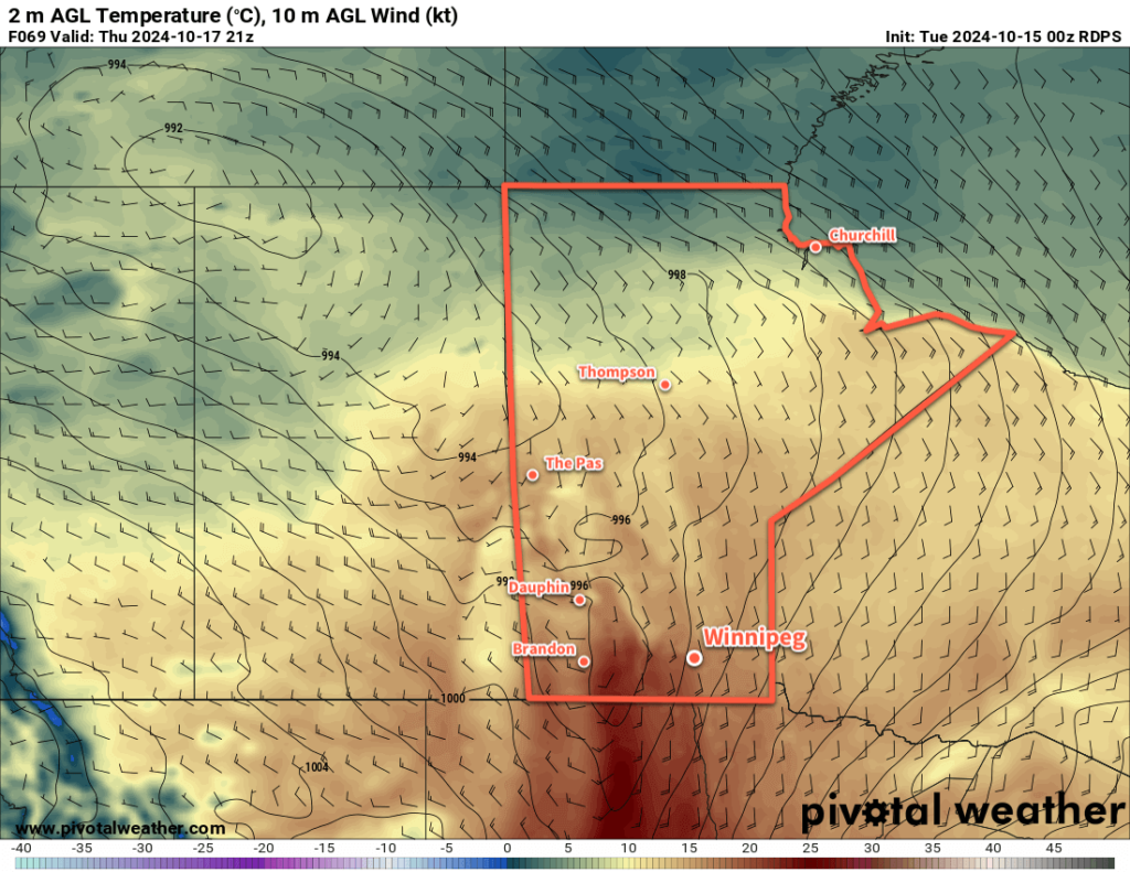
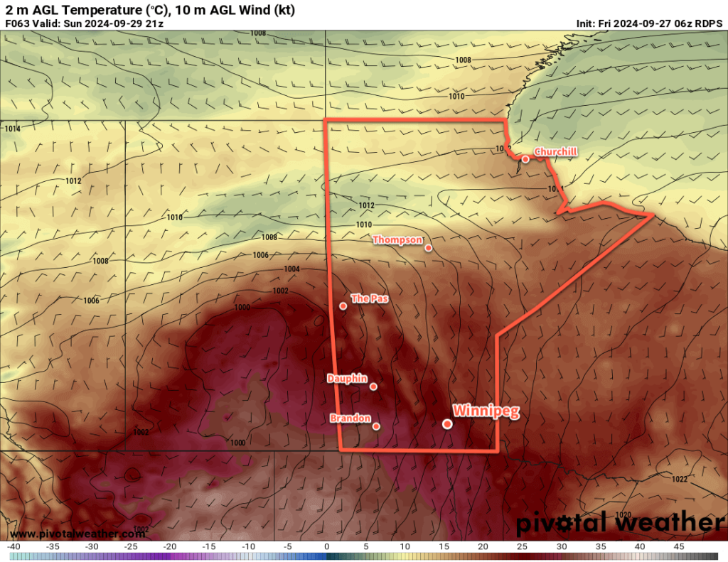
RDPS 2m Temperature Forecast valid 21Z Tuesday August 20, 2024
It will be a hot day in the Red River Valley on Tuesday with highs near 30 °C.

Warm and sunny weather will continue in Winnipeg thanks to an upper ridge that remains in place over the region. This will leave Winnipeg today in a southerly flow between an area of high pressure over NW Ontario and a developing area of low pressure in southern Alberta.

As a result, it will be another hot day in Winnipeg as temperatures climb to the 30 °C mark with southerlies up to around 20 km/h. Skies will become mixed today as cloud cover left over from a disturbance in Saskatchewan drifts through the region. Temperatures will dip into the mid-teens tonight with light winds and a few clouds.

Wednesday will be another pleasant day with temperatures climbing up into the upper 20s and southerlies up into the 20–30 km/h range. A mainly sunny start to the day will give way to a few clouds in the afternoon. All in all, a beautiful day.

Wednesday night will bring a change in the weather as a low pressure system begins to track east across the Prairies. It will spread cloud into Winnipeg on Wednesday night with lows down to around 20 °C.

Thunderstorms will likely develop along this system’s warm-sector trough on Wednesday night, beginning over Montana and southern Saskatchewan and pushing into Manitoba in the early morning hours.

This will bring a chance of showers or thunderstorms to the Winnipeg area on Thursday morning. The chance will steadily s drop from mid-day onwards with sunny breaks developing in the afternoon. Southerly winds up to around 20 km/h will shift southwesterly by the end of the day. The cloud cover will keep temperatures cooler with a high in the mid-20s.

Long Range Outlook

Summer heat will return to end the week with daytime highs near 30 °C on Friday through Sunday. Dew point values will persist in the upper teens, making for slightly muggy conditions that feel closer to the mid-30s. And to top it off, Winnipeg should see plenty of sunshine throughout the weekend!

Enjoy that summer warmth while it’s here!

Today’s seasonal daytime high in Winnipeg is 24 °C while the seasonal overnight low is 11 °C.

#awm_rain #awm_thunderstorms #mbstorm #Winnipeg

Settled but Smokey Weather Ahead

A broad area of high pressure moving through the northern Prairies will bring seasonal conditions to the Winnipeg area this weekend. Unfortunately, northerly winds will also bring several plumes of wildfire smoke through the region over the coming days.

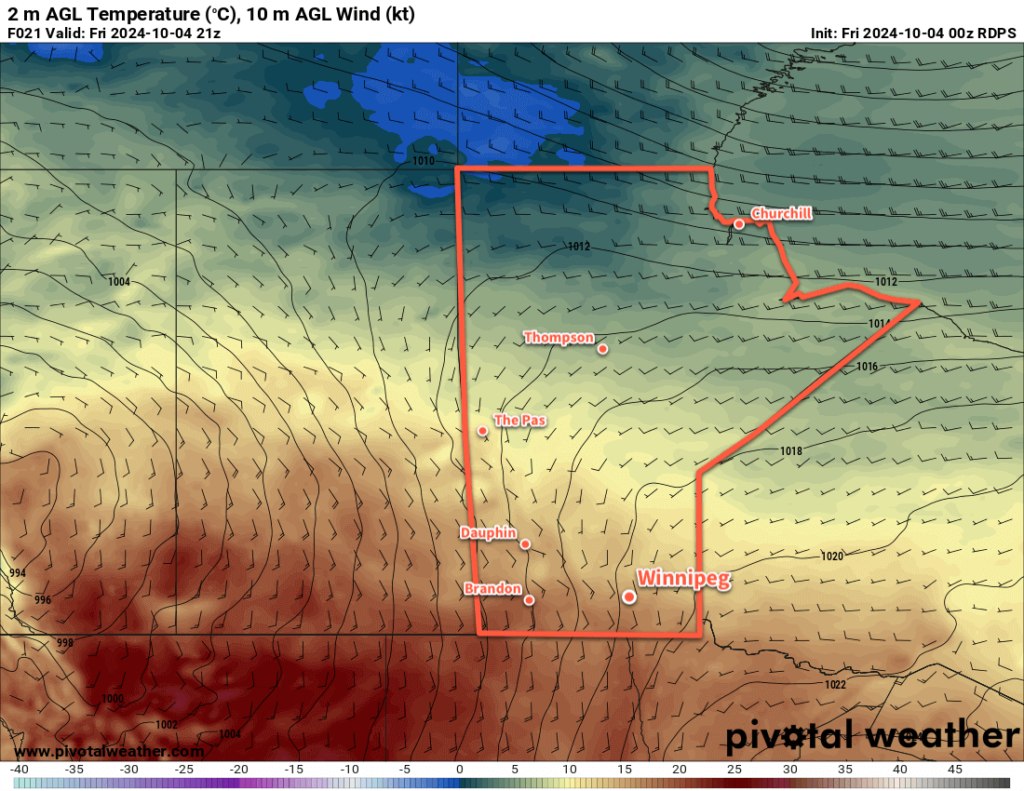
RDPS 2m Temperature Forecast valid 21Z Saturday August 17, 2024
This weekend will bring light winds and seasonal temperatures to much of the southern Prairies.

The Winnipeg area will get a chance to dry out after yesterday’s soaking as the slow-moving system responsible for it trundles towards the Great Lakes. Behind it, a ridge of high pressure will build in from the north as an area of high pressure moves into northern Manitoba this weekend.

This pattern change will bring partly cloudy to mixed skies to the area over the next few days with daytime highs in the mid-20s and overnight lows in the mid- to upper-teens. Winds will stay northerly over the next few days, up to around 30 km/h today then easing to 20 km/h or less for the weekend.

There is a low chance of a brief rain shower this afternoon due to lingering instability, then it will stay dry through the weekend.

The bigger issue in the days ahead will be plumes of wildfire smoke that descend through the region in the northerly winds.

CAMS PM2.5 forecast valid 17Z Friday August 16, 2024
The CAMS air quality model shows a broad plume of elevated PM2.5 values from wildfire smoke through much of Saskatchewan and western Manitoba today.

Today, dense plumes of smoke will move through portions of western Manitoba and Saskatchewan, sourced from wildfires over west-central Manitoba and northern Saskatchewan. Additionally, a secondary plume from wildfires in the Island Lake region in northeast Manitoba will drift southwest across the southern Interlake into the southwest corner of the province.

For Winnipeg, smoke models are trending towards keeping the smoke west and north of the city, but there is a chance that the city is caught by the edge of the plume this afternoon. If that happens, AQHI values will likely climb into the 6 to 8 range for the afternoon with improvement on Friday evening across the Red River Valley and western Manitoba.

CAMS PM2.5 forecast valid 23Z Saturday August 17, 2024
On Saturday, a potentially dense plume of wildfire smoke will drift towards the Red River Valley from the fires near Island Lake in NE Manitoba.

Heading into Saturday, a dense plume of smoke is forecast to drift from the Island Lake fires southwest into the Red River Valley. Unfortunately, if this happens the plume will end up stalling out under the ridge of high pressure over the Red River. This plume is forecast to arrive by Saturday afternoon and persist through midday Sunday before clearing. AQHI values with this plume could be as high as 10+.

AQHI values of 4 to 7 suggest that people with sensitivities to air quality should consider reducing their exposure. When values reach 7 to 10, all should consider reducing their exposure. AQHI values of 10 or higher are unhealthy and everybody should minimize their exposure.

Long Range Outlook

The ridge of high pressure will shift to the east on Monday, bringing southerly winds back to the region. Temperatures will climb back into the upper-20s with mainly sunny skies. The southerly winds will push wildfire smoke back northwards, bringing cleaner air to the southern Prairies and worse air quality to the northern Prairies.

Today’s seasonal daytime high in Winnipeg is 25 °C while the seasonal overnight low is 12 °C.

Mild, Unsettled Conditions Moving In

Seasonably warm weather will continue in Winnipeg as a slow-moving disturbance brings unsettled conditions to the region mid-week.

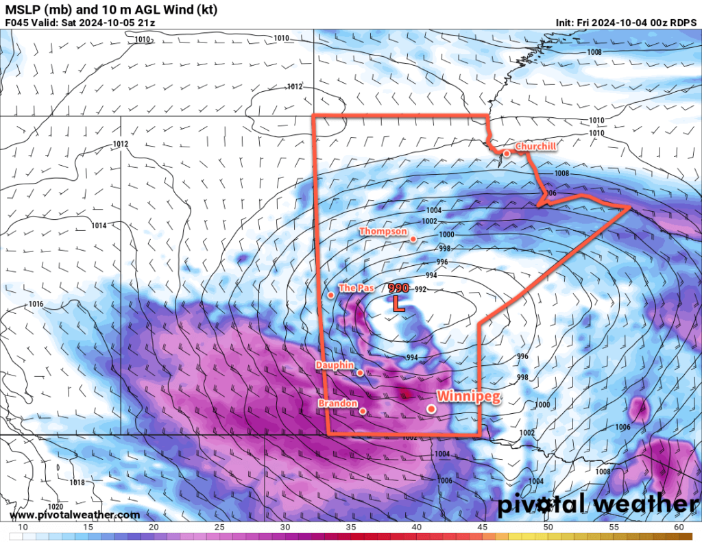
RDPS 10m Wind and MLSP Forecast valid 03Z Thursday August 15, 2024
A slow-moving disturbance that extends from the southern Arctic to the United States will move through Manitoba this week.

For today, though, the Winnipeg area will have a beautiful day. A ridge of high pressure over the region will keep skies mainly sunny as temperatures climb to highs in the upper 20s. Humidity levels will stay comfortable with light southeast winds.

A change in the weather will begin tonight. A broad and slow-moving disturbance that stretches from the southern Arctic all the way south to the United States will begin pushing a more humid and unsettled air mass into the province. This system will begin as a low pressure system in Saskatchewan today that will support the development of showers and thunderstorms that tracks towards western Manitoba overnight.

Further east in the Red River Valley, a chance of showers or thunderstorms will develop overnight as a strengthening low-level flow is lifted over a warm front. Elevated showers or thunderstorms could be possible through the second half of the night into Wednesday morning. Temperatures will drop to a low in the upper teens with southeast winds picking up into the 20 to 30 km/h range.

The forecast gets…fuzzier heading into Wednesday. This system will separate into a low centre that tracks into northern Manitoba and a second low center that consolidates further south in the Dakotas. Both of these systems will support their own area of showers and/or thunderstorms, but what happens between the two is unclear.

As this system will begin slow-moving, it’s likely that both Wednesday and Thursday will bring mainly cloudy skies to the Winnipeg area with southeast winds of 20 to 30 km/h on Wednesday becoming light for Thursday. There will be a chance of showers this whole period, though the highest chance looks to be Wednesday night into Thursday morning. Temperatures will be mild with seasonal highs in the mid-20s and lows in the mid- to upper-teens.

At this point it’s unclear if there’s much of a severe weather threat or not for the region. If there’s enough lift from this system, then widespread showers or more likely, and if there’s not enough, there could be little precipitation at all. There is a sweet spot, though, that a few high-resolution weather models pick up on, that could produce rounds of more intense thunderstorms. There’s nothing to do but wait and watch for now, though, and see how this system evolves. Make sure that you stay aware of any weather alerts issued by the Storm Prediction Centre in Winnipeg over the next couple days.

Long Range Outlook

This system will exit the region on Friday, brining sunnier skies back to the region with light to moderate northerly winds. A ridge of high pressure will build into the region through the weekend, bringing light winds, highs in the mid- to upper-20s, and lows in the mid-teens. After a couple unsettled days, it looks like a strong finish to the work week and a wonderful summer weekend ahead.

Today’s seasonal daytime high in Winnipeg is 25 °C while the seasonal overnight low is 12 °C.

Temperatures Warming Back up Over the Weekend

An Arctic high will bring one more day of cool weather to Winnipeg, but warmer temperatures will build back in through the weekend.

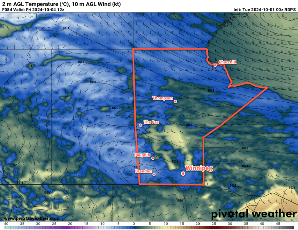
RDPS 10m Wind Forecast valid 21Z Friday August 9, 2024
A sprawling Arctic high will be the dominant weather feature over the eastern Prairies this weekend.

An Arctic high will sit entrenched over the eastern Prairies over the next few days, gradually weakening as the cool air over the region gradually warms. This will result in a simple forecast for Winnipeg: gradually increasing sunniness with warming temperatures.

Skies will improve from mixed skies today to partly cloudy skies on Saturday to mainly sunny skies on Sunday. Northerly winds in the 20–30 km/h range today will ease tonight; heading into the weekend the winds will be light out of the northwest on Saturday and the west on Sunday.

Temperatures will be cool today as the region is under the remains of the cold air core from the low that passed into the region earlier this week. Temperatures will climb to around 20 °C today in Winnipeg, return to seasonal values on Saturday in the low to mid-20s, then climb into the mid- to upper-20s on Sunday.

Overnight lows will slowly climb through the weekend into the mid-teens as more seasonal levels of humidity build back in.

Long Range Outlook

The start of next week will continue to bring warm and settled weather to the region as the area of high pressure over the region continues to weaken and gradually drift to the southeast. The chance of showers or thunderstorms may return mid-week, but settled conditions will likely return quickly with near-seasonal temperatures.

Today’s seasonal daytime high in Winnipeg is 26 °C while the seasonal overnight low is 13 °C.